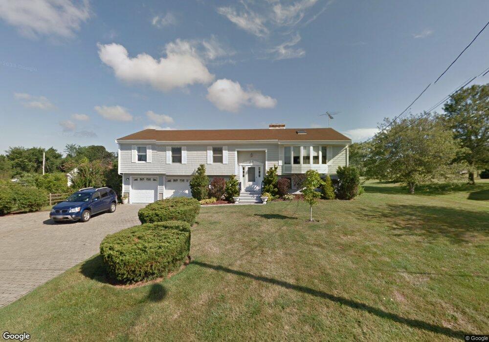
44 Wayside Ave Middletown, RI 02842
Estimated Value: $826,000 - $1,296,000
3
Beds
3
Baths
3,308
Sq Ft
$347/Sq Ft
Est. Value
About This Home
This home is located at 44 Wayside Ave, Middletown, RI 02842 and is currently estimated at $1,146,865, approximately $346 per square foot. 44 Wayside Ave is a home located in Newport County with nearby schools including Middletown High School, St Michael's Country Day School, and St George's School.
Ownership History
Date
Name
Owned For
Owner Type
Purchase Details
Closed on
Sep 30, 2014
Sold by
Spillane Francis P
Bought by
Schieefelin John S and Schieffelin Linda W
Current Estimated Value
Purchase Details
Closed on
Jun 22, 2012
Sold by
Spillane Francis P and Spillane Eileen M
Bought by
Spillane Francis P
Purchase Details
Closed on
Jul 27, 1994
Sold by
James Michael and James Deborah
Bought by
Spillane Francis P
Purchase Details
Closed on
May 9, 1989
Sold by
Ashe Flora W
Bought by
Spillane Francis P
Create a Home Valuation Report for This Property
The Home Valuation Report is an in-depth analysis detailing your home's value as well as a comparison with similar homes in the area
Home Values in the Area
Average Home Value in this Area
Purchase History
| Date | Buyer | Sale Price | Title Company |
|---|---|---|---|
| Schieefelin John S | $285,000 | -- | |
| Spillane Francis P | -- | -- | |
| Spillane Francis P | $45,000 | -- | |
| Spillane Francis P | $65,000 | -- |
Source: Public Records
Mortgage History
| Date | Status | Borrower | Loan Amount |
|---|---|---|---|
| Previous Owner | Spillane Francis P | $160,000 | |
| Previous Owner | Spillane Francis P | $150,000 | |
| Previous Owner | Spillane Francis P | $100,000 |
Source: Public Records
Tax History Compared to Growth
Tax History
| Year | Tax Paid | Tax Assessment Tax Assessment Total Assessment is a certain percentage of the fair market value that is determined by local assessors to be the total taxable value of land and additions on the property. | Land | Improvement |
|---|---|---|---|---|
| 2025 | $8,996 | $763,000 | $403,800 | $359,200 |
| 2024 | $8,591 | $763,000 | $403,800 | $359,200 |
| 2023 | $7,152 | $568,100 | $296,800 | $271,300 |
| 2022 | $6,829 | $568,100 | $296,800 | $271,300 |
| 2021 | $6,829 | $568,100 | $296,800 | $271,300 |
| 2020 | $6,976 | $507,000 | $229,000 | $278,000 |
| 2018 | $6,971 | $507,000 | $229,000 | $278,000 |
| 2016 | $6,649 | $431,200 | $208,400 | $222,800 |
| 2015 | $6,485 | $431,200 | $208,400 | $222,800 |
| 2014 | $6,420 | $399,500 | $190,000 | $209,500 |
| 2013 | $6,276 | $399,500 | $190,000 | $209,500 |
Source: Public Records
Map
Nearby Homes
- 0 Wolcott Ave
- 118 Wolcott Ave
- 162 Center Ave
- 65 Seascape Ave
- 84 Allston Ave
- 55 John Clarke Rd Unit 8
- 55 John Clarke Rd Unit 3
- 0 Honeyman Ave
- 476 Green End Ave
- 141 Gray Craig Rd
- 4 James St
- 140 Tuckerman Ave
- 16 Sachuest Dr
- 318 Corey Ln
- 0 Saltwood Dr
- 310 Corey Ln
- 129 Bliss Mine Rd
- 138 Green End Ave
- 36 Kay Blvd
- 119 Corey Ln