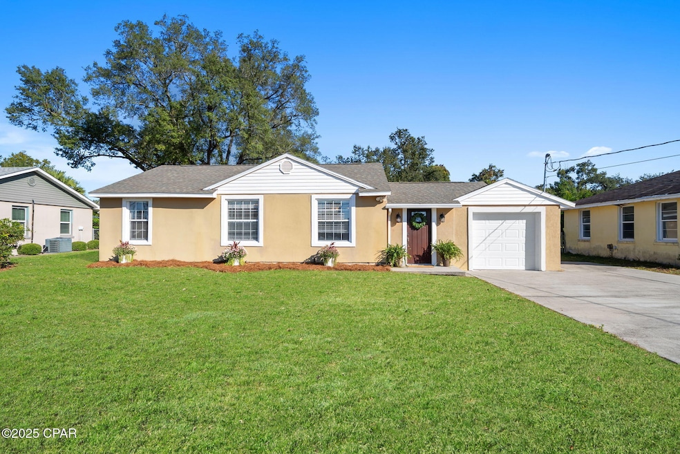


440 S Macarthur Ave Panama City, FL 32401
South Panama City NeighborhoodEstimated payment $1,560/month
Highlights
- Popular Property
- Bungalow
- 1 Car Garage
- No HOA
- Central Heating and Cooling System
- Fenced
About This Home
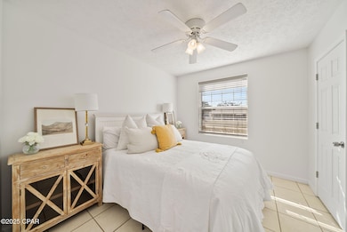
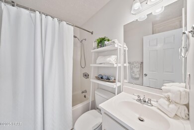
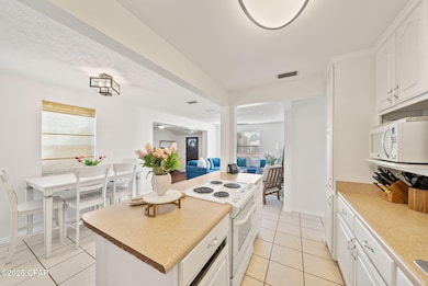
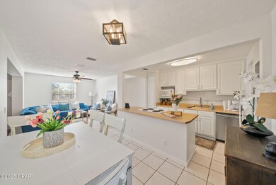
Welcome to your new home in the highly sought-after Cove neighborhood in historic downtown, Panama City! This delightful 3-bedroom, 1-bathroom residence, originally built in the 1940s, combines timeless charm with modern updates. Step inside to discover a beautifully maintained interior that showcases the character of an older era while offering contemporary comforts. Recent updates include a roof after Hurricane Michael, a new HVAC system, ensuring durability and energy efficiency for years to come. The spacious layout features inviting living areas, perfect for family gatherings and entertaining friends. The property also boasts a convenient one-car garage, along with a newly paved driveway and alleyway access at the back of the home. Situated just steps away from St. Andrews Bay Yacht Club and the water and mere minutes from downtown Panama City, this home's location is unparalleled. Enjoy easy access to the yacht club, picturesque Beach Drive, and all the amenities downtown has to offer, from trendy shops and delectable dining to vibrant nightlife. Don't miss the chance to own a piece of history in one of Panama City's most desirable neighborhoods. Schedule your viewing today and fall in love with this charming cove home!

Home Details
Home Type
- Single Family
Est. Annual Taxes
- $1,044
Year Built
- Built in 1947
Lot Details
- 10,498 Sq Ft Lot
- Lot Dimensions are 140 x 77
- Fenced
- Zoning described as City
Parking
- 1 Car Garage
- Additional Parking
Home Design
- Bungalow
Bedrooms and Bathrooms
- 3 Bedrooms
- 1 Full Bathroom
Schools
- Cherry Street Elementary School
- Jinks Middle School
- Bay High School
Utilities
- Central Heating and Cooling System
Community Details
- No Home Owners Association
- Bunkers Cove Subdivision
Map
Home Values in the Area
Average Home Value in this Area
Tax History
| Year | Tax Paid | Tax Assessment Tax Assessment Total Assessment is a certain percentage of the fair market value that is determined by local assessors to be the total taxable value of land and additions on the property. | Land | Improvement |
|---|---|---|---|---|
| 2024 | $1,069 | $98,274 | -- | -- |
| 2023 | $1,069 | $95,412 | $0 | $0 |
| 2022 | $1,073 | $92,633 | $0 | $0 |
| 2021 | $1,040 | $89,935 | $0 | $0 |
| 2020 | $1,013 | $88,693 | $39,322 | $49,371 |
| 2019 | $556 | $75,224 | $37,852 | $37,372 |
| 2018 | $711 | $86,825 | $0 | $0 |
| 2017 | $705 | $86,475 | $0 | $0 |
| 2016 | $1,117 | $72,814 | $0 | $0 |
| 2015 | $1,118 | $70,902 | $0 | $0 |
| 2014 | $1,104 | $70,608 | $0 | $0 |
Property History
| Date | Event | Price | List to Sale | Price per Sq Ft |
|---|---|---|---|---|
| 12/02/2025 12/02/25 | For Sale | $280,000 | -- | $250 / Sq Ft |
Purchase History
| Date | Type | Sale Price | Title Company |
|---|---|---|---|
| Warranty Deed | $100,000 | Diamond Title Agency Inc | |
| Interfamily Deed Transfer | $225,000 | None Available |
Mortgage History
| Date | Status | Loan Amount | Loan Type |
|---|---|---|---|
| Open | $95,000 | New Conventional |
Source: Central Panhandle Association of REALTORS®
MLS Number: 782228
APN: 21522-000-000
Disclaimer: Certain information contained herein is derived from information provided by parties other than Homes.com. All information provided is deemed reliable, but is not guaranteed to be accurate and should be independently verified.
![]() IDX information is provided exclusively for consumers’ personal, non-commercial use, that it may not be used for any purpose other than to identify prospective properties consumers may be interested in purchasing. Data is deemed reliable but is not guaranteed accurate by the MLS.
IDX information is provided exclusively for consumers’ personal, non-commercial use, that it may not be used for any purpose other than to identify prospective properties consumers may be interested in purchasing. Data is deemed reliable but is not guaranteed accurate by the MLS.
- 451 S Palo Alto Ave
- 334 S Macarthur Ave
- 343 S Palo Alto Ave
- 328 S Palo Alto Ave
- 324 S Palo Alto Ave
- 212 S Cove Terrace Dr
- 301 Bunkers Cove Rd
- 214 S Cove Ln
- 1613 Dewitt St
- 105 N Cove Terrace Dr
- 105 N Marie Dr
- 111 N Marie Dr
- 109 N Cove Ln
- 109 N Palo Alto Ave
- 900 E 2nd Place
- 3616 E 2nd Ct
- 1002 E 2nd Ct
- 1000 E 2nd Ct
- 208 N Macarthur Ave
- 1202 Tyndall Dr
- 427 S Macarthur Ave
- 807 Cherry St Unit 3
- 212 N Cove Blvd
- 105 Allen 65 Ave Unit 65
- 108 N Gray Ave Unit C
- 108 N Gray Ave Unit B
- 300 Penny Ct
- 349 Mercedes Ave
- 240 Harmon Ave Unit 211
- 240 Harmon Ave Unit 212
- 240 Harmon Ave Unit 110
- 240 Harmon Ave Unit 217
- 240 Harmon Ave Unit 107
- 240 Harmon Ave
- 401 E Beach Dr Unit A3
- 3014 E 1st Ct
- 1320 E Hwy 98 Bus 307 Hwy Unit 307
- 509 Maine Ave
- 2806 E 3rd St
- 102 E 4th St Unit A