Estimated Value: $7,862,000 - $10,125,208
5
Beds
5
Baths
5,212
Sq Ft
$1,726/Sq Ft
Est. Value
About This Home
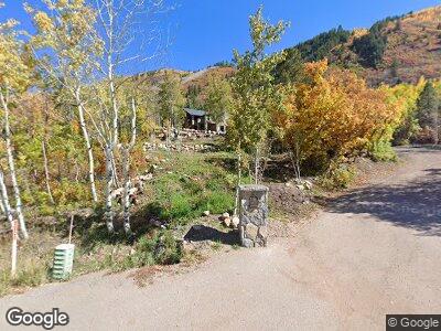
This home is located at 44155 Highway 82, Aspen, CO 81611 and is currently estimated at $8,993,604, approximately $1,725 per square foot. 44155 Highway 82 is a home located in Pitkin County with nearby schools including Aspen Elementary School, Aspen Middle School, and Aspen High School.
Ownership History
Date
Name
Owned For
Owner Type
Purchase Details
Closed on
Aug 27, 2012
Sold by
Silverstein Barry L and Siverstein Joyce L
Bought by
Barry L Siverstein Aspen Trust
Current Estimated Value
Purchase Details
Closed on
Sep 2, 2011
Sold by
Dumeresque Rebecca and Dumeresque Michael J
Bought by
Silverstein Barry L and Silverstein Joyce L
Purchase Details
Closed on
Aug 22, 2007
Sold by
Kellner Michele
Bought by
Dumeresque Michael J and Dumeresque Rebecca
Home Financials for this Owner
Home Financials are based on the most recent Mortgage that was taken out on this home.
Original Mortgage
$2,875,000
Interest Rate
6.69%
Mortgage Type
Seller Take Back
Purchase Details
Closed on
Jul 24, 2001
Sold by
Kellner Mark R
Bought by
Kellner Michele
Create a Home Valuation Report for This Property
The Home Valuation Report is an in-depth analysis detailing your home's value as well as a comparison with similar homes in the area
Home Values in the Area
Average Home Value in this Area
Purchase History
| Date | Buyer | Sale Price | Title Company |
|---|---|---|---|
| Barry L Siverstein Aspen Trust | -- | None Available | |
| Silverstein Barry L | $4,475,000 | -- | |
| Dumeresque Michael J | $5,750,000 | Pct | |
| Kellner Michele | -- | -- |
Source: Public Records
Mortgage History
| Date | Status | Borrower | Loan Amount |
|---|---|---|---|
| Previous Owner | Dumeresque Michael J | $650,000 | |
| Previous Owner | Dumeresque Michael J | $250,000 | |
| Previous Owner | Dumeresque Michael J | $550,000 | |
| Previous Owner | Dumeresque Michael J | $2,875,000 |
Source: Public Records
Tax History Compared to Growth
Tax History
| Year | Tax Paid | Tax Assessment Tax Assessment Total Assessment is a certain percentage of the fair market value that is determined by local assessors to be the total taxable value of land and additions on the property. | Land | Improvement |
|---|---|---|---|---|
| 2024 | $25,080 | $863,570 | $280,210 | $583,360 |
| 2023 | $25,080 | $874,650 | $283,800 | $590,850 |
| 2022 | $23,636 | $738,150 | $243,250 | $494,900 |
| 2021 | $15,111 | $486,740 | $250,250 | $236,490 |
| 2020 | $10,455 | $335,730 | $221,650 | $114,080 |
| 2019 | $8,367 | $268,680 | $221,650 | $47,030 |
| 2018 | $10,397 | $270,560 | $223,200 | $47,360 |
| 2017 | $10,485 | $386,890 | $216,000 | $170,890 |
| 2016 | $10,819 | $391,500 | $238,800 | $152,700 |
| 2015 | $10,753 | $391,500 | $238,800 | $152,700 |
| 2014 | $10,062 | $357,640 | $238,800 | $118,840 |
Source: Public Records
Map
Nearby Homes
- 44481 Colorado 82
- 41 Popcorn Ln
- 9 & 17 Ullr Way
- 184 Mountain Laurel Dr
- 250 Mountain Laurel Dr Unit B
- 51 Roaring Fork Dr
- 602 Mountain Laurel Dr
- 42 Northway Dr
- 552 Mountain Laurel Dr
- 258 Roaring Fork Dr
- 137 Westview Dr
- 96 McSkimming Rd
- 1265 Riverside Dr
- 1011 Ute Ave
- 71 & 73 Smuggler Grove
- 1039 E Cooper Ave Unit 21A
- 1039 E Cooper Ave Unit 1A
- 610 S West End St Unit D-303
- 610 S West End St Unit K201
- 610 S West End St Unit E103
- 44155 Highway 82
- 44155 Highway 82
- 44155 Highway 82
- 44255 Highway 82
- 42701 Hwy 82 Unit A
- 44125 Highway 82
- 44255 Highway 82
- 44481 Hwy 82
- 44481 Highway 82
- 44255 E Highway 82
- 43991 Highway 82
- 44190 Highway 82
- 43991 Hwy 82
- 50 Warren Creek Ln
- 44010 Highway 82
- 44142 Highway 82
- 43995 Highway 82
- 43995 Hwy 82
- 44530 Highway 82
- 43777 Highway 82