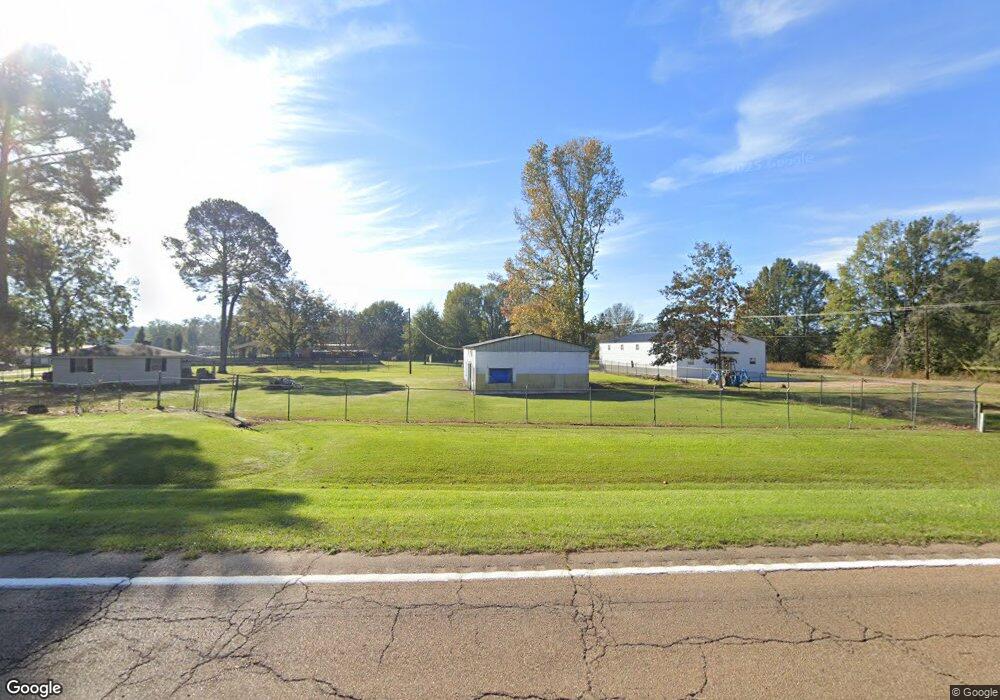
44166 Highway 28 Georgetown, MS 39078
Estimated Value: $136,031
3
Beds
1
Bath
1,049
Sq Ft
$130/Sq Ft
Est. Value
About This Home
This home is located at 44166 Highway 28, Georgetown, MS 39078 and is currently priced at $136,031, approximately $129 per square foot. 44166 Highway 28 is a home located in Copiah County with nearby schools including Crystal Springs Elementary School, Crystal Springs Middle School, and Crystal Springs High School.
Ownership History
Date
Name
Owned For
Owner Type
Purchase Details
Closed on
Aug 31, 2023
Sold by
Daughtry R V
Bought by
Johnson Tearria L
Current Estimated Value
Purchase Details
Closed on
Aug 22, 2022
Sold by
Ray Smith Oscar
Bought by
Johnson Tearria L
Purchase Details
Closed on
Sep 10, 2021
Sold by
Lowery Delois W
Bought by
Moreau William M and Moreau Alicia L
Purchase Details
Closed on
May 20, 2009
Sold by
Daughtry R. V
Bought by
Smith Oscar Ray and Daughtry R. V
Create a Home Valuation Report for This Property
The Home Valuation Report is an in-depth analysis detailing your home's value as well as a comparison with similar homes in the area
Purchase History
| Date | Buyer | Sale Price | Title Company |
|---|---|---|---|
| Johnson Tearria L | -- | None Listed On Document | |
| Johnson Tearria L | -- | None Listed On Document | |
| Moreau William M | -- | None Listed On Document | |
| Smith Oscar Ray | -- | -- |
Source: Public Records
Tax History
| Year | Tax Paid | Tax Assessment Tax Assessment Total Assessment is a certain percentage of the fair market value that is determined by local assessors to be the total taxable value of land and additions on the property. | Land | Improvement |
|---|---|---|---|---|
| 2025 | $78 | $19,133 | $0 | $0 |
| 2024 | $1 | $525 | $0 | $0 |
| 2023 | $78 | $525 | $0 | $0 |
| 2022 | $204 | $1,356 | $0 | $0 |
| 2021 | $200 | $1,356 | $0 | $0 |
| 2020 | $194 | $1,293 | $0 | $0 |
| 2019 | $196 | $1,293 | $0 | $0 |
| 2018 | $194 | $1,293 | $0 | $0 |
| 2017 | $273 | $1,293 | $0 | $0 |
| 2016 | $273 | $1,871 | $0 | $0 |
| 2015 | $453 | $3,060 | $0 | $0 |
| 2014 | $453 | $3,060 | $0 | $0 |
Source: Public Records
Map
Nearby Homes
- 9307a Mississippi 28
- 866 Old River Rd
- 0 Steel Creek Rd
- 133 Beaman Dr
- 11040 Highway 472
- 589 Simpson Highway 28 W
- 108 Guy Barron Dr
- 0 Lee Bass Rd Unit 4139875
- 543 Lee Bass Rd
- 135 472 Hwy
- 502 Buckley Rd
- 0 Lower Rockport Rd
- 1012 Dogtown Ln
- 1002 Poplar Springs Rd
- 2165 S Harmony Rd
- 0 Poplar Springs Rd
- 0 Whitetown Ln
- 0 Hwy 27 Unit 23890335
- 1 Mississippi 478
- 2 Mississippi 478
- 1040 Jackson St
- 44159 Highway 28
- 1050 Madison Ave
- 1007 Country Loop Rd
- 1011 Mary St
- 1004 Mary St
- 1029 Jackson Ave
- 11177 Highway 27
- 1025 Jackson Ave
- 10173 Mississippi 27
- 1005 Sallie Ln
- 10173 Hwy 27
- 38020 Highway 28
- 1189 Railroad Ave
- 1024 Madison Ave
- 44120 Highway 28
- 1191 Railroad Ave
- 45013 Highway 28
- 1014 Sallie Ln
- 44129 Highway 28
Your Personal Tour Guide
Ask me questions while you tour the home.
