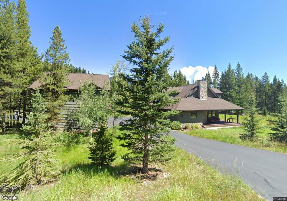
4417 Andesite Rd Big Sky, MT 59716
Big Sky NeighborhoodEstimated Value: $2,805,000 - $3,015,780
5
Beds
5
Baths
3,472
Sq Ft
$839/Sq Ft
Est. Value
About This Home
This home is located at 4417 Andesite Rd, Big Sky, MT 59716 and is currently estimated at $2,911,945, approximately $838 per square foot. 4417 Andesite Rd is a home located in Gallatin County with nearby schools including Ophir Elementary School, Ophir Junior High School, and Lone Peak High School.
Ownership History
Date
Name
Owned For
Owner Type
Purchase Details
Closed on
Apr 30, 2010
Sold by
Prieto Julio J and Prieto Deanne B
Bought by
Summers Frank A and Kraus Rene A
Current Estimated Value
Home Financials for this Owner
Home Financials are based on the most recent Mortgage that was taken out on this home.
Original Mortgage
$412,100
Outstanding Balance
$187,426
Interest Rate
2.5%
Mortgage Type
New Conventional
Estimated Equity
$2,724,519
Purchase Details
Closed on
May 15, 2006
Sold by
Prieto Julio J and Prieto Deanne B
Bought by
Herran Cindy
Create a Home Valuation Report for This Property
The Home Valuation Report is an in-depth analysis detailing your home's value as well as a comparison with similar homes in the area
Home Values in the Area
Average Home Value in this Area
Purchase History
| Date | Buyer | Sale Price | Title Company |
|---|---|---|---|
| Summers Frank A | -- | Security Title Company | |
| Herran Cindy | -- | None Available |
Source: Public Records
Mortgage History
| Date | Status | Borrower | Loan Amount |
|---|---|---|---|
| Open | Summers Frank A | $412,100 |
Source: Public Records
Tax History Compared to Growth
Tax History
| Year | Tax Paid | Tax Assessment Tax Assessment Total Assessment is a certain percentage of the fair market value that is determined by local assessors to be the total taxable value of land and additions on the property. | Land | Improvement |
|---|---|---|---|---|
| 2025 | $11,075 | $2,346,883 | $0 | $0 |
| 2024 | $12,709 | $2,815,475 | $0 | $0 |
| 2023 | $12,982 | $2,815,475 | $0 | $0 |
| 2022 | $7,720 | $1,181,397 | $0 | $0 |
| 2021 | $7,530 | $1,181,397 | $0 | $0 |
| 2020 | $7,855 | $975,165 | $0 | $0 |
| 2019 | $7,350 | $975,165 | $0 | $0 |
| 2018 | $7,008 | $849,489 | $0 | $0 |
| 2017 | $6,816 | $849,489 | $0 | $0 |
| 2016 | $6,302 | $635,674 | $0 | $0 |
| 2015 | $6,267 | $635,674 | $0 | $0 |
| 2014 | $6,931 | $531,001 | $0 | $0 |
Source: Public Records
Map
Nearby Homes
- 105 Nordic Ln
- 167 Nordic Ln
- 525 Fourpoint Rd
- 214 W Pine Cone Terrace
- TBD Silverado Trail
- TBD Gray Owl Ln
- 178 Pine Cone Terrace
- 45 Turkey Leg Rd
- 45 Turkey Leg Rd Unit 1049
- 765 Antler Ridge Rd
- TBD Sleeping Bear Rd
- 32 Rose Hip Unit N-3
- 35 N Fork Rd
- 725 Sand Hill Rd
- 852 Outlook Trail
- Lot 44 Amber Lily Dr
- 208 Outlook Trail
- 580 Outlook Trail Unit 42
- TBD Little Coyote Rd
- TBD Bitterbrush Trail Lot 42
- 1255 Andesite Rd
- Lot 7 Autumn Trail
- TBD Andesite Rd
- 1280 Andesite Rd
- 4349 Andesite Rd
- 336 Autumn Trail
- 1185 Andesite Rd
- lot 7C Andesite
- 65 Nordic Ln
- 1151 Andesite Rd
- 4325 Andesite Rd
- 0 Silverado Trail Unit 216472
- 0 Silverado Trail Unit 212134
- 0 Silverado Trail Unit 187020
- 0 Silverado Trail Unit 189796
- 0 Silverado Trail Unit 185215
- 0 Silverado Trail Unit 192839
- 0 Silverado Trail Unit 217606
- 526 Autumn Trail
- 123 Nordic Ln