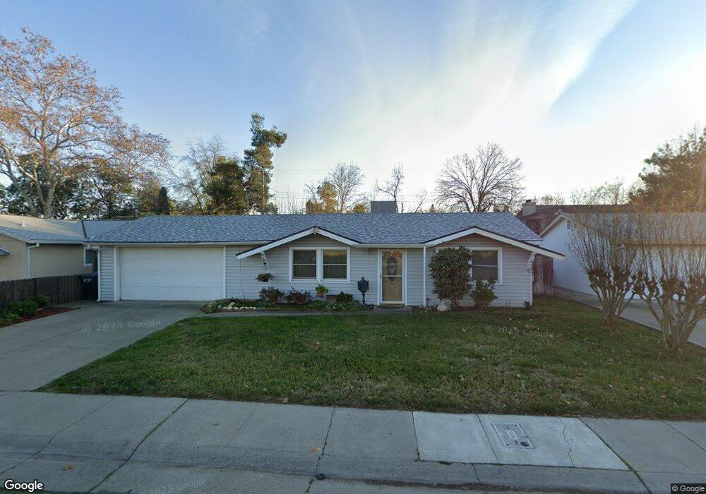
442 Berthoud St Sacramento, CA 95838
Robla NeighborhoodEstimated Value: $351,067 - $398,000
3
Beds
2
Baths
1,112
Sq Ft
$333/Sq Ft
Est. Value
About This Home
This home is located at 442 Berthoud St, Sacramento, CA 95838 and is currently estimated at $370,517, approximately $333 per square foot. 442 Berthoud St is a home located in Sacramento County with nearby schools including Taylor Street Elementary School, Rio Linda Preparatory Academy, and Norwood Junior High School.
Ownership History
Date
Name
Owned For
Owner Type
Purchase Details
Closed on
Jan 28, 1998
Sold by
Boykin Wylie E
Bought by
Boykin Callie E
Current Estimated Value
Home Financials for this Owner
Home Financials are based on the most recent Mortgage that was taken out on this home.
Original Mortgage
$52,500
Interest Rate
7.05%
Purchase Details
Closed on
Jan 7, 1998
Sold by
Hunt Ronald L and Hunt Kenneth R
Bought by
Hunt Kenneth R and Hunt Sylvia A
Home Financials for this Owner
Home Financials are based on the most recent Mortgage that was taken out on this home.
Original Mortgage
$52,500
Interest Rate
7.05%
Create a Home Valuation Report for This Property
The Home Valuation Report is an in-depth analysis detailing your home's value as well as a comparison with similar homes in the area
Home Values in the Area
Average Home Value in this Area
Purchase History
| Date | Buyer | Sale Price | Title Company |
|---|---|---|---|
| Boykin Callie E | -- | Placer Title Company | |
| Hunt Kenneth R | $52,500 | Placer Title Company |
Source: Public Records
Mortgage History
| Date | Status | Borrower | Loan Amount |
|---|---|---|---|
| Closed | Hunt Kenneth R | $52,500 |
Source: Public Records
Tax History
| Year | Tax Paid | Tax Assessment Tax Assessment Total Assessment is a certain percentage of the fair market value that is determined by local assessors to be the total taxable value of land and additions on the property. | Land | Improvement |
|---|---|---|---|---|
| 2025 | $1,101 | $76,239 | $26,901 | $49,338 |
| 2024 | $1,101 | $74,745 | $26,374 | $48,371 |
| 2023 | $1,126 | $73,280 | $25,857 | $47,423 |
| 2022 | $1,069 | $71,844 | $25,350 | $46,494 |
| 2021 | $1,063 | $70,436 | $24,853 | $45,583 |
| 2020 | $1,042 | $69,715 | $24,599 | $45,116 |
| 2019 | $1,035 | $68,349 | $24,117 | $44,232 |
| 2018 | $967 | $67,010 | $23,645 | $43,365 |
| 2017 | $1,210 | $72,212 | $27,508 | $44,704 |
| 2016 | $1,014 | $70,797 | $26,969 | $43,828 |
| 2015 | $945 | $69,734 | $26,564 | $43,170 |
| 2014 | $955 | $68,369 | $26,044 | $42,325 |
Source: Public Records
Map
Nearby Homes
- 4391 Burgess Dr
- 541 Samuel Way
- 525 Samuel Way
- 4261 Taylor St
- 782 Crosswind Dr
- 4528 Austin St
- 4640 Seanpatrick Dr
- 31 Butterwick Ct
- 581 Main Ave
- 4650 Debralee Way
- 4824 Taylor St
- 4279 Englewood St
- 4851 Warren Ave
- 1 Pinache Ct
- 741 Ephesus Ave
- 4159 Englewood St
- 114 Pinedale Ave
- 410 Marlin Spike Way
- 4 Coso Ct
- 213 Arbor Crest Way
- 448 Berthoud St
- 436 Berthoud St
- 430 Berthoud St
- 443 Berthoud St
- 449 Berthoud St
- 437 Berthoud St
- 431 Berthoud St
- 424 Berthoud St
- 455 Berthoud St
- 425 Berthoud St
- 418 Berthoud St
- 4559 Windcloud Ave
- 419 Berthoud St
- 39 Bluewind Ct
- 4555 Windcloud Ave
- 412 Berthoud St
- 4551 Windcloud Ave
- 4563 Windcloud Ave
- 35 Bluewind Ct
- 57 Poinsettia Ct
Your Personal Tour Guide
Ask me questions while you tour the home.