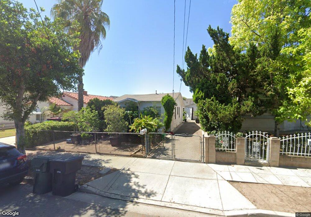
442 W Ralph St San Gabriel, CA 91776
Marshall NeighborhoodEstimated Value: $767,799 - $959,000
2
Beds
1
Bath
682
Sq Ft
$1,258/Sq Ft
Est. Value
About This Home
This home is located at 442 W Ralph St, San Gabriel, CA 91776 and is currently estimated at $857,700, approximately $1,257 per square foot. 442 W Ralph St is a home located in Los Angeles County with nearby schools including McKinley Elementary School, Jefferson Middle School, and Gabrielino High School.
Ownership History
Date
Name
Owned For
Owner Type
Purchase Details
Closed on
Jul 19, 2023
Sold by
James And Lily Lau Family Trust
Bought by
Young Eric
Current Estimated Value
Home Financials for this Owner
Home Financials are based on the most recent Mortgage that was taken out on this home.
Original Mortgage
$501,000
Outstanding Balance
$489,093
Interest Rate
6.81%
Mortgage Type
New Conventional
Estimated Equity
$368,607
Purchase Details
Closed on
Sep 11, 2019
Sold by
Lau James C and Lau Lily T
Bought by
Lau James C and Lau Lily T
Create a Home Valuation Report for This Property
The Home Valuation Report is an in-depth analysis detailing your home's value as well as a comparison with similar homes in the area
Home Values in the Area
Average Home Value in this Area
Purchase History
| Date | Buyer | Sale Price | Title Company |
|---|---|---|---|
| Young Eric | $668,000 | Stewart Title | |
| Lau James C | -- | None Available |
Source: Public Records
Mortgage History
| Date | Status | Borrower | Loan Amount |
|---|---|---|---|
| Open | Young Eric | $501,000 |
Source: Public Records
Tax History Compared to Growth
Tax History
| Year | Tax Paid | Tax Assessment Tax Assessment Total Assessment is a certain percentage of the fair market value that is determined by local assessors to be the total taxable value of land and additions on the property. | Land | Improvement |
|---|---|---|---|---|
| 2025 | $9,052 | $681,360 | $545,088 | $136,272 |
| 2024 | $9,052 | $668,000 | $534,400 | $133,600 |
| 2023 | $1,839 | $106,671 | $66,997 | $39,674 |
| 2022 | $1,772 | $104,581 | $65,684 | $38,897 |
| 2021 | $1,754 | $102,532 | $64,397 | $38,135 |
| 2020 | $1,733 | $101,481 | $63,737 | $37,744 |
| 2019 | $1,689 | $99,492 | $62,488 | $37,004 |
| 2018 | $1,653 | $97,542 | $61,263 | $36,279 |
| 2016 | $1,576 | $93,756 | $58,885 | $34,871 |
| 2015 | $1,554 | $92,349 | $58,001 | $34,348 |
| 2014 | $1,548 | $90,541 | $56,865 | $33,676 |
Source: Public Records
Map
Nearby Homes
- 516 W Bencamp St Unit C
- 518 W Bencamp St Unit B
- 1704 Azalea Dr
- 1506 Prospect Ave Unit B
- 999 E Valley Blvd Unit 114
- 1132 Azalea Dr
- 1404 Prospect Ave Unit L
- 1309 Stevens Ave Unit C
- 7631 Columbia St
- 3436 Jackson Ave
- 777 E Valley Blvd Unit 123
- 777 E Valley Blvd Unit 125
- 777 E Valley Blvd
- 777 E Valley Blvd Unit 75
- 7639 Hellman Ave
- 1919 Strathmore Ave Unit B
- 7745 Hellman Ave
- 2024 Brighton St
- 829 Hershey Ave
- 1918 Denton Ave Unit E
- 500 W Ralph St
- 438 W Ralph St
- 506 W Ralph St
- 1740 Manor Way
- 436 W Ralph St
- 436 W Ralph St
- 508 W Ralph St
- 1741 Manor Way
- 1746 Manor Way
- 430 W Ralph St
- 512 W Ralph St
- 443 W Norwood Place Unit A
- 1747 Manor Way
- 431 W Ralph St
- 501 W Ralph St
- 429 W Ralph St
- 428 W Ralph St
- 503 W Ralph St
- 437 W Norwood Place
- 427 W Ralph St