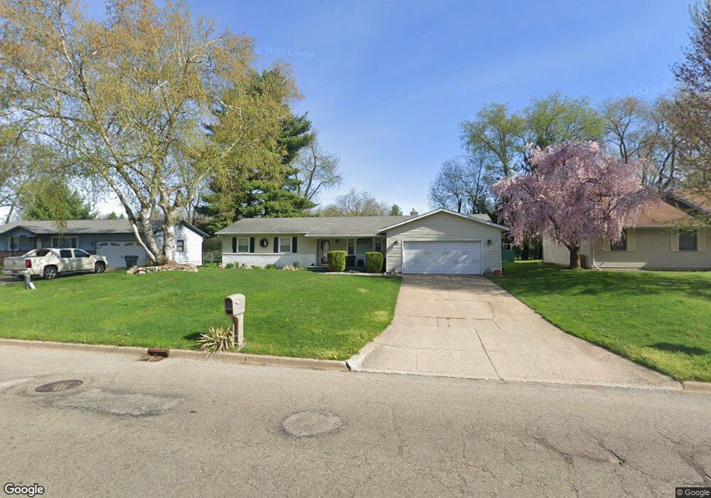
4420 Stonebrook Ave Kalamazoo, MI 49009
Westwood NeighborhoodEstimated Value: $256,000 - $272,000
3
Beds
2
Baths
1,387
Sq Ft
$191/Sq Ft
Est. Value
About This Home
This home is located at 4420 Stonebrook Ave, Kalamazoo, MI 49009 and is currently estimated at $264,880, approximately $190 per square foot. 4420 Stonebrook Ave is a home located in Kalamazoo County with nearby schools including Northglade Montessori School, Linden Grove Middle School, and Kalamazoo Central High School.
Ownership History
Date
Name
Owned For
Owner Type
Purchase Details
Closed on
Sep 30, 2015
Sold by
Batterson Michael Scott
Bought by
Rodocker Carlson Keyle Jo
Current Estimated Value
Home Financials for this Owner
Home Financials are based on the most recent Mortgage that was taken out on this home.
Original Mortgage
$55,000
Interest Rate
3.88%
Mortgage Type
New Conventional
Create a Home Valuation Report for This Property
The Home Valuation Report is an in-depth analysis detailing your home's value as well as a comparison with similar homes in the area
Home Values in the Area
Average Home Value in this Area
Purchase History
| Date | Buyer | Sale Price | Title Company |
|---|---|---|---|
| Rodocker Carlson Keyle Jo | $130,000 | Attorneys Title Agency |
Source: Public Records
Mortgage History
| Date | Status | Borrower | Loan Amount |
|---|---|---|---|
| Previous Owner | Rodocker Carlson Keyle Jo | $55,000 |
Source: Public Records
Tax History Compared to Growth
Tax History
| Year | Tax Paid | Tax Assessment Tax Assessment Total Assessment is a certain percentage of the fair market value that is determined by local assessors to be the total taxable value of land and additions on the property. | Land | Improvement |
|---|---|---|---|---|
| 2025 | $4,067 | $120,200 | $0 | $0 |
| 2024 | $2,271 | $112,800 | $0 | $0 |
| 2023 | $2,165 | $97,300 | $0 | $0 |
| 2022 | $3,689 | $85,500 | $0 | $0 |
| 2021 | $3,567 | $81,700 | $0 | $0 |
| 2020 | $3,493 | $77,900 | $0 | $0 |
| 2019 | $3,330 | $71,400 | $0 | $0 |
| 2018 | $3,252 | $66,600 | $0 | $0 |
| 2017 | $2,860 | $66,500 | $0 | $0 |
| 2016 | $2,860 | $63,800 | $0 | $0 |
| 2015 | $2,860 | $61,200 | $0 | $0 |
| 2014 | $2,860 | $54,800 | $0 | $0 |
Source: Public Records
Map
Nearby Homes
- 124 Merriweather Ln Unit 3
- 4625 Green Acres Dr
- 213 Raintree Cir Unit 55
- 4164 Corvo Trace
- 4135 Corvo Trace
- 4007 Corvo Trace
- 4047 Enclave Way Unit 1
- 4065 Enclave Way
- 4021 Londonderry Ave
- 4163 Corvo Trace
- 806 Northampton Rd
- 82 Mandalay Dr
- Emerald Plan at Walden Woods - The Enclave
- Diamond Plan at Walden Woods - The Enclave
- Carbon Plan at Walden Woods - The Enclave
- Basalt Plan at Walden Woods - The Enclave
- Anthracite Plan at Walden Woods - The Enclave
- 3526 Alianca Terrace
- 5160 Green Meadow Rd
- 636 Wynding Oaks
- 4420 Stonebrook Ave
- 4502 Stonebrooke Ave
- 4502 Stonebrook Ave
- 4410 Stonebrook Ave
- 4419 Stonebrooke Ave
- 4413 Stonebrooke Ave
- 4410 Stonebrooke Cs
- 4501 Stonebrook Ave
- 4510 Stonebrook Ave
- 4400 Stonebrook Ave
- 4510 Stonebrooke Ave
- 4400 Stonebrooke Ave
- 4501 Stonebrooke Ave
- 4419 Stonebrook Ave
- 4413 Stonebrook Ave
- 4509 Stonebrooke Cs
- 4518 Stonebrook Ave
- 4509 Stonebrook Ave
- 4401 Stonebrook Ave
- 122 S Sage St