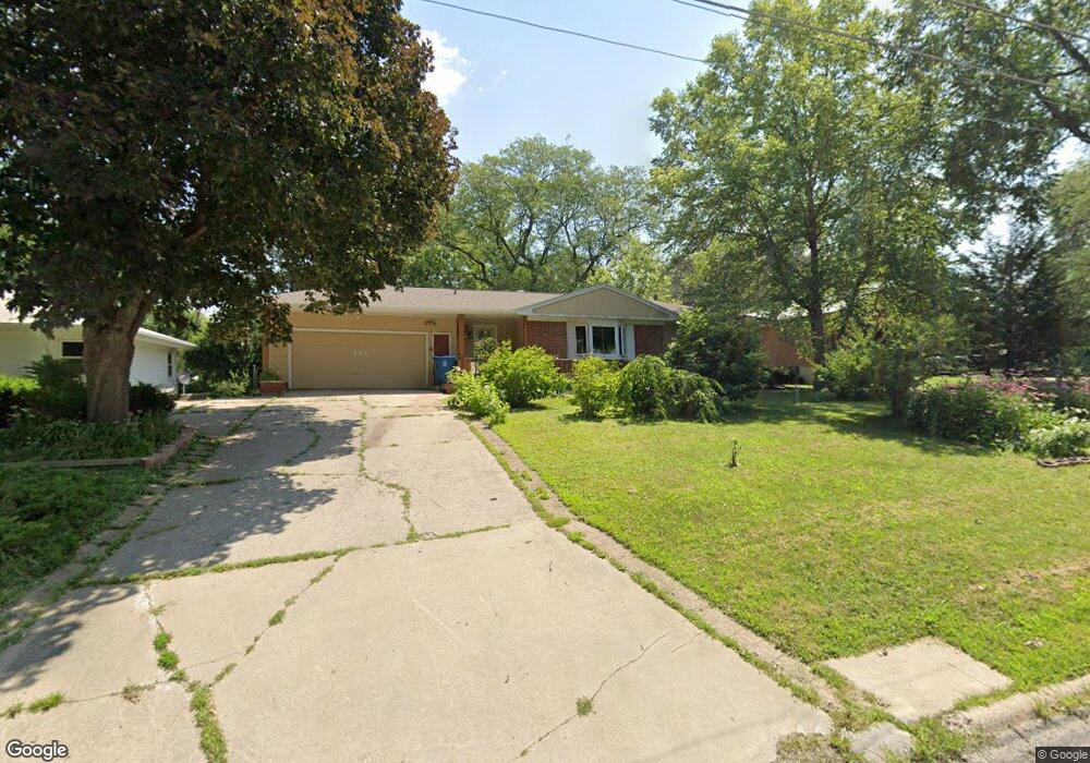
443 S Hackett Rd Waterloo, IA 50701
Estimated Value: $187,000 - $210,000
2
Beds
2
Baths
1,080
Sq Ft
$181/Sq Ft
Est. Value
About This Home
This home is located at 443 S Hackett Rd, Waterloo, IA 50701 and is currently estimated at $195,883, approximately $181 per square foot. 443 S Hackett Rd is a home located in Black Hawk County with nearby schools including Becker Elementary School, Central Middle School, and East High School.
Ownership History
Date
Name
Owned For
Owner Type
Purchase Details
Closed on
May 21, 2007
Sold by
Broadway Cheryl V and Boesen Brian H
Bought by
Williams Michael L and Williams Tselha N
Current Estimated Value
Home Financials for this Owner
Home Financials are based on the most recent Mortgage that was taken out on this home.
Original Mortgage
$101,600
Outstanding Balance
$62,137
Interest Rate
6.27%
Mortgage Type
New Conventional
Estimated Equity
$133,746
Purchase Details
Closed on
Dec 15, 2005
Sold by
Geopfert Travis J and Geopfert Nicole B
Bought by
Broadway Cheryl V and Boesen Brian H
Home Financials for this Owner
Home Financials are based on the most recent Mortgage that was taken out on this home.
Original Mortgage
$134,900
Interest Rate
6.48%
Mortgage Type
New Conventional
Create a Home Valuation Report for This Property
The Home Valuation Report is an in-depth analysis detailing your home's value as well as a comparison with similar homes in the area
Purchase History
| Date | Buyer | Sale Price | Title Company |
|---|---|---|---|
| Williams Michael L | $127,000 | None Available | |
| Broadway Cheryl V | $135,000 | None Available |
Source: Public Records
Mortgage History
| Date | Status | Borrower | Loan Amount |
|---|---|---|---|
| Open | Williams Michael L | $101,600 | |
| Previous Owner | Broadway Cheryl V | $134,900 |
Source: Public Records
Tax History
| Year | Tax Paid | Tax Assessment Tax Assessment Total Assessment is a certain percentage of the fair market value that is determined by local assessors to be the total taxable value of land and additions on the property. | Land | Improvement |
|---|---|---|---|---|
| 2025 | $3,344 | $195,800 | $32,430 | $163,370 |
| 2024 | $3,344 | $178,100 | $32,430 | $145,670 |
| 2023 | $3,168 | $178,100 | $32,430 | $145,670 |
| 2022 | $3,084 | $153,160 | $32,430 | $120,730 |
| 2021 | $2,904 | $153,160 | $32,430 | $120,730 |
| 2020 | $2,854 | $136,840 | $25,480 | $111,360 |
| 2019 | $2,854 | $136,840 | $25,480 | $111,360 |
| 2018 | $2,800 | $136,840 | $25,480 | $111,360 |
| 2017 | $2,888 | $134,310 | $25,480 | $108,830 |
| 2016 | $2,850 | $134,310 | $25,480 | $108,830 |
| 2015 | $2,850 | $134,310 | $25,480 | $108,830 |
| 2014 | $2,772 | $128,580 | $25,480 | $103,100 |
Source: Public Records
Map
Nearby Homes
- 0 Bergen Dr
- 301 S Hackett Rd
- 2009 Wembley Rd
- 2117 Tilbury Rd
- 412 Hughes Dr
- 320 Valley Rd
- 456 Loma St
- 1712 Rainbow Dr
- 1434 Rainbow Dr
- 1214 Pleasant Valley Dr
- 1906 Coachman Dr
- 328 Drynan Dr
- 600 Beverly Hills St
- 108 Helen Rd
- 3314 Scenic Dr
- 425 Auburn St
- 3230 Terrace Dr
- 2151 Grand Blvd
- 1811 Sager Ave
- 4009 Sager Ave
- 451 S Hackett Rd
- 435 S Hackett Rd
- 430 Norris Ct
- 422 Norris Ct
- 434 Norris Ct
- 459 S Hackett Rd
- 427 S Hackett Rd
- 440 S Hackett Rd
- 419 S Hackett Rd
- 430 S Hackett Rd
- 450 S Hackett Rd
- 410 Norris Ct
- 416 Norris Ct
- 467 S Hackett Rd
- 438 Norris Ct
- 404 Norris Ct
- 2450 Maynard Ave
- 415 Norris Ct
- 427 Norris Ct
- 437 Norris Ct
Your Personal Tour Guide
Ask me questions while you tour the home.