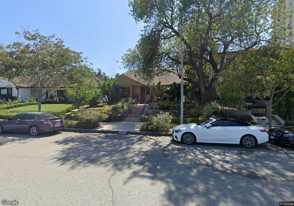
443 S Spalding Dr Beverly Hills, CA 90212
Estimated Value: $3,773,000 - $4,487,000
4
Beds
4
Baths
3,126
Sq Ft
$1,316/Sq Ft
Est. Value
About This Home
This home is located at 443 S Spalding Dr, Beverly Hills, CA 90212 and is currently estimated at $4,113,462, approximately $1,315 per square foot. 443 S Spalding Dr is a home located in Los Angeles County with nearby schools including El Rodeo Elementary School, Beverly Hills High School, and Good Shepherd Catholic School.
Ownership History
Date
Name
Owned For
Owner Type
Purchase Details
Closed on
Sep 8, 2003
Sold by
Hirschfeld Michael and Hirschfeld Sheri
Bought by
Hirschfeld Michael
Current Estimated Value
Purchase Details
Closed on
Dec 18, 2002
Sold by
Hirschfeld Michael and Hirschfeld Sheri
Bought by
Hirschfeld Michael
Home Financials for this Owner
Home Financials are based on the most recent Mortgage that was taken out on this home.
Original Mortgage
$360,000
Interest Rate
5.86%
Purchase Details
Closed on
Apr 4, 2002
Sold by
Hirschfeld Michael Alan and Hirschfeld Sheri Surell
Bought by
Hirschfeld Michael
Purchase Details
Closed on
Mar 2, 1998
Sold by
Greenfield 1971 Trust and Ruth
Bought by
Hirschfeld Michael Alan
Home Financials for this Owner
Home Financials are based on the most recent Mortgage that was taken out on this home.
Original Mortgage
$365,000
Interest Rate
7.02%
Create a Home Valuation Report for This Property
The Home Valuation Report is an in-depth analysis detailing your home's value as well as a comparison with similar homes in the area
Home Values in the Area
Average Home Value in this Area
Purchase History
| Date | Buyer | Sale Price | Title Company |
|---|---|---|---|
| Hirschfeld Michael | -- | -- | |
| Hirschfeld Michael | -- | American Title | |
| Hirschfeld Michael | -- | -- | |
| Hirschfeld Michael Alan | -- | Provident Title |
Source: Public Records
Mortgage History
| Date | Status | Borrower | Loan Amount |
|---|---|---|---|
| Closed | Hirschfeld Michael | $360,000 | |
| Closed | Hirschfeld Michael Alan | $365,000 |
Source: Public Records
Tax History Compared to Growth
Tax History
| Year | Tax Paid | Tax Assessment Tax Assessment Total Assessment is a certain percentage of the fair market value that is determined by local assessors to be the total taxable value of land and additions on the property. | Land | Improvement |
|---|---|---|---|---|
| 2025 | $19,725 | $1,652,635 | $1,228,069 | $424,566 |
| 2024 | $19,725 | $1,620,232 | $1,203,990 | $416,242 |
| 2023 | $19,374 | $1,588,464 | $1,180,383 | $408,081 |
| 2022 | $18,823 | $1,557,319 | $1,157,239 | $400,080 |
| 2021 | $18,265 | $1,526,785 | $1,134,549 | $392,236 |
| 2019 | $17,740 | $1,481,502 | $1,100,899 | $380,603 |
| 2018 | $16,976 | $1,452,454 | $1,079,313 | $373,141 |
| 2016 | $16,274 | $1,396,054 | $1,037,402 | $358,652 |
| 2015 | $15,581 | $1,375,085 | $1,021,820 | $353,265 |
| 2014 | $15,068 | $1,348,150 | $1,001,804 | $346,346 |
Source: Public Records
Map
Nearby Homes
- 405 Shirley Place
- 2160 Century Park E Unit 1911
- 2170 Century Park E Unit 1507
- 2160 Century Park E Unit 1503
- 2170 Century Park E Unit 1807
- 2160 Century Park E Unit 910
- 2160 Century Park E Unit 2101N
- 2160 Century Park E Unit 602
- 2160 Century Park E Unit 902
- 2170 Century Park E Unit 203
- 2170 Century Park E Unit 1611
- 2170 Century Park E Unit 1902
- 2160 Century Park E Unit 1112
- 2160 Century Park E Unit 1903
- 2170 Century Park E Unit 204S
- 2160 Century Park E Unit 103N
- 2160 Century Park E Unit 411
- 2170 Century Park E Unit 910
- 2160 Century Park E Unit 104N
- 2160 Century Park E Unit 1804
- 439 S Spalding Dr
- 447 S Spalding Dr
- 451 S Spalding Dr
- 437 Shirley Place
- 437 Shirley Place Unit C
- 437 Shirley Place Unit D
- 437 Shirley Place Unit C
- 437 Shirley Place Unit A
- 437 Shirley Place Unit B
- 2180 Century Hill
- 459 S Spalding Dr
- 431 Shirley Place Unit C
- 431 Shirley Place Unit A
- 431 Shirley Place
- 431 Shirley Place Unit B
- 429 Shirley Place Unit A
- 429 Shirley Place
- 429 Shirley Place Unit B
- 429 Shirley Place Unit 431B
- 436 S Spalding Dr