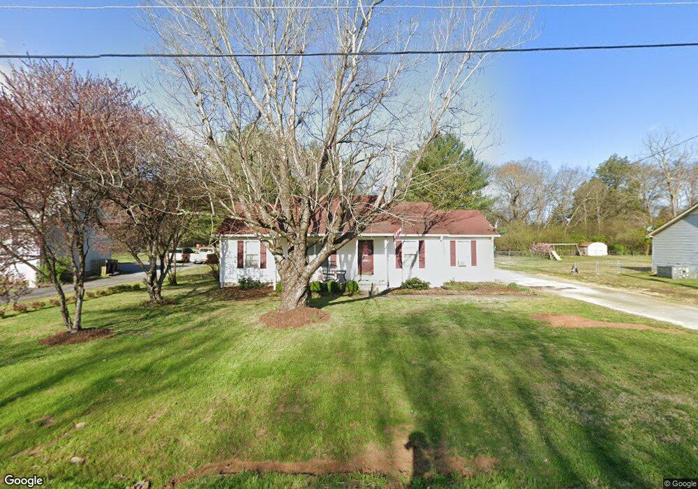
4433 Bingham St Murfreesboro, TN 37129
Estimated Value: $325,000 - $424,619
--
Bed
--
Bath
--
Sq Ft
6.65
Acres
About This Home
This home is located at 4433 Bingham St, Murfreesboro, TN 37129 and is currently estimated at $365,655. 4433 Bingham St is a home with nearby schools including Brown's Chapel Elementary School, Blackman Middle School, and Blackman High School.
Ownership History
Date
Name
Owned For
Owner Type
Purchase Details
Closed on
Jan 15, 2013
Sold by
Vanderbilt Mortgage & Fina
Bought by
Doyle John P
Current Estimated Value
Purchase Details
Closed on
Mar 20, 2012
Sold by
Wilkins James S
Bought by
Vanderbilt Mortgage & Finance
Purchase Details
Closed on
Feb 2, 2006
Sold by
Keith Hopkins Brian
Bought by
Wilkins James S and Wilkins Elizabeth K
Home Financials for this Owner
Home Financials are based on the most recent Mortgage that was taken out on this home.
Original Mortgage
$158,795
Interest Rate
6.14%
Create a Home Valuation Report for This Property
The Home Valuation Report is an in-depth analysis detailing your home's value as well as a comparison with similar homes in the area
Home Values in the Area
Average Home Value in this Area
Purchase History
| Date | Buyer | Sale Price | Title Company |
|---|---|---|---|
| Doyle John P | $150,000 | -- | |
| Vanderbilt Mortgage & Finance | $172,987 | -- | |
| Wilkins James S | $60,000 | -- |
Source: Public Records
Mortgage History
| Date | Status | Borrower | Loan Amount |
|---|---|---|---|
| Previous Owner | Wilkins James S | $158,795 |
Source: Public Records
Tax History Compared to Growth
Tax History
| Year | Tax Paid | Tax Assessment Tax Assessment Total Assessment is a certain percentage of the fair market value that is determined by local assessors to be the total taxable value of land and additions on the property. | Land | Improvement |
|---|---|---|---|---|
| 2025 | $994 | $53,000 | $26,175 | $26,825 |
| 2024 | $994 | $53,000 | $26,175 | $26,825 |
| 2023 | $994 | $53,000 | $26,175 | $26,825 |
| 2022 | $857 | $53,000 | $26,175 | $26,825 |
| 2021 | $715 | $32,200 | $16,425 | $15,775 |
| 2020 | $715 | $32,200 | $16,425 | $15,775 |
| 2019 | $715 | $32,200 | $16,425 | $15,775 |
| 2018 | $676 | $32,200 | $0 | $0 |
| 2017 | $806 | $30,075 | $0 | $0 |
| 2016 | $806 | $30,075 | $0 | $0 |
| 2015 | $806 | $30,075 | $0 | $0 |
| 2014 | $748 | $30,075 | $0 | $0 |
| 2013 | -- | $34,125 | $0 | $0 |
Source: Public Records
Map
Nearby Homes
- 4343 Banks St
- 5342 Keystone Ct
- 5302 Grassland Dr
- 507 Heatherwood Dr
- 5132 Prickly Pine Place
- 4606 Turquoise Ln
- 416 Heatherwood Dr
- 4700 Turquoise Ln
- 5064 Tricia Place
- 2816 Lightning Bug Dr
- 4944 Kai Dr
- 4936 Kai Dr
- 4920 Kai Dr
- 4912 Kai Dr
- 4365 Blackman Rd
- 4947 Kai Dr
- 4940 Kai Dr
- 4932 Kai Dr
- 2853 Elijah Dr
- 3514 Howard T Smith Dr
- 4417 Bingham St
- 4411 Bingham St
- 4423 Bingham St
- 5341 Sallee Dr
- 5340 Sallee Dr
- 5295 Asbury Rd
- 5335 Sallee Dr
- 5334 Sallee Dr
- 5331 Sallee Dr
- 5410 Grassland Dr
- 5321 Sallee Dr
- 5322 Sallee Dr
- 5404 Grassland Dr
- 4331 Banks St
- 4325 Banks St
- 4337 Banks St
- 5316 Sallee Dr
- 4319 Banks St
- 5313 Sallee Dr
- 5358 Grassland Dr