
Seller's Agent in 2025
Jason Beard
Keller Williams Greater Metropolitan
(216) 659-5520
1 in this area
187 Total Sales
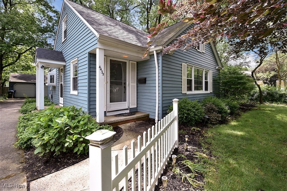
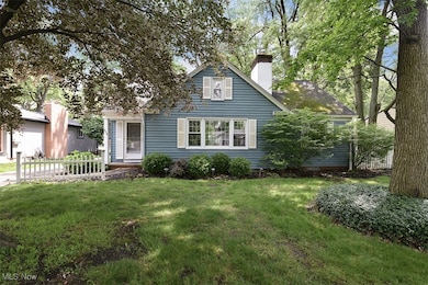
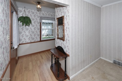
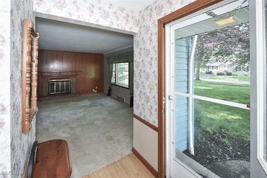
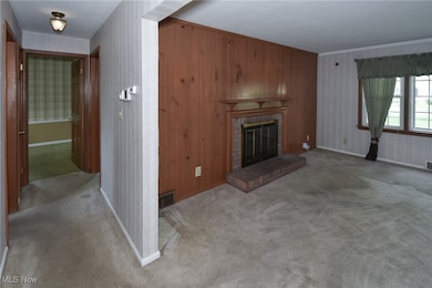
Offered for the first time in over 50 years, this well-maintained 3-bedroom, 2-bath Cape Cod is full of potential and located on one of the area's most sought-after streets. Thoughtfully designed with flexibility in mind, the home features two spacious bedrooms and a full bath on the first floor—ideal for guests, multi-generational living, or a convenient home office setup.
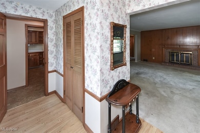
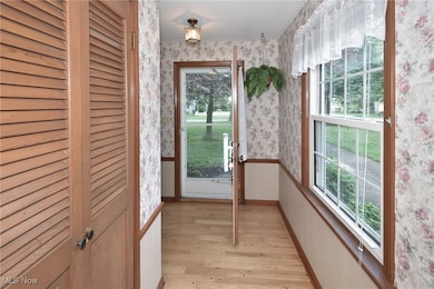
Upstairs, you'll find one additional bedroom plus sitting room and a second full bath, offering privacy and space for growing households. The spacious family room off the kitchen provides options for a media, sitting or playroom, or can serve as a bright office space.
Note the following improvements and updates: H2O tank 2021, roof 2016, waterproofing 2014, attic insulation 2015, sump pump 2017.
Set on a quiet, tree-lined street with well-kept homes and a strong community feel, this is a rare opportunity to create your next chapter in a location that simply can’t be replicated. Whether you envision updating to suit your style or preserving its timeless character, this home offers a solid foundation and unbeatable setting to make it your own.
Last Agent to Sell the Property
Keller Williams Greater Metropolitan Brokerage Email: JasonBeardRealtor@gmail.com, 216-659-5520 License #2014002646 Listed on: 06/25/2025
Co-Listed By
Keller Williams Greater Metropolitan Brokerage Email: JasonBeardRealtor@gmail.com, 216-659-5520 License #2004003117
| Date | Type | Sale Price | Title Company |
|---|---|---|---|
| Warranty Deed | $282,500 | Infinity Title | |
| Interfamily Deed Transfer | -- | -- | |
| Deed | -- | -- |
| Date | Status | Loan Amount | Loan Type |
|---|---|---|---|
| Open | $268,375 | New Conventional |
| Date | Event | Price | List to Sale | Price per Sq Ft |
|---|---|---|---|---|
| 08/15/2025 08/15/25 | Sold | $282,500 | -4.2% | $135 / Sq Ft |
| 07/16/2025 07/16/25 | Pending | -- | -- | -- |
| 06/25/2025 06/25/25 | For Sale | $295,000 | -- | $141 / Sq Ft |
| Year | Tax Paid | Tax Assessment Tax Assessment Total Assessment is a certain percentage of the fair market value that is determined by local assessors to be the total taxable value of land and additions on the property. | Land | Improvement |
|---|---|---|---|---|
| 2024 | $4,833 | $80,325 | $12,600 | $67,725 |
| 2023 | $4,883 | $68,960 | $12,920 | $56,040 |
| 2022 | $4,892 | $68,950 | $12,915 | $56,035 |
| 2021 | $4,427 | $68,950 | $12,920 | $56,040 |
| 2020 | $3,928 | $56,070 | $10,500 | $45,570 |
| 2019 | $3,822 | $160,200 | $30,000 | $130,200 |
| 2018 | $3,649 | $56,070 | $10,500 | $45,570 |
| 2017 | $3,480 | $47,850 | $8,160 | $39,690 |
| 2016 | $3,449 | $47,850 | $8,160 | $39,690 |
| 2015 | $3,385 | $47,850 | $8,160 | $39,690 |
| 2014 | $3,385 | $46,900 | $7,980 | $38,920 |
Seller's Agent in 2025
Jason Beard
Keller Williams Greater Metropolitan
(216) 659-5520
1 in this area
187 Total Sales
Seller Co-Listing Agent in 2025
Sionann Monroe
Keller Williams Greater Metropolitan
(216) 406-3933
1 in this area
65 Total Sales
Buyer's Agent in 2025
Jill Renee Hill
HomeSmart Real Estate Momentum LLC
(330) 310-5781
6 in this area
169 Total Sales
Source: MLS Now
MLS Number: 5134821
APN: 237-03-037
Disclaimer: Certain information contained herein is derived from information provided by parties other than Homes.com. All information provided is deemed reliable, but is not guaranteed to be accurate and should be independently verified.
![]() IDX information is provided exclusively for personal, non-commercial use, and may not be used for any purpose other than to identify prospective properties consumers may be interested in purchasing. Information is deemed reliable but not guaranteed.
IDX information is provided exclusively for personal, non-commercial use, and may not be used for any purpose other than to identify prospective properties consumers may be interested in purchasing. Information is deemed reliable but not guaranteed.