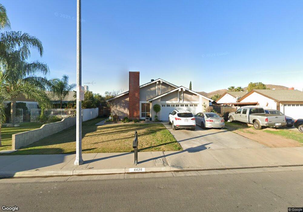
4438 Blueridge Dr Riverside, CA 92505
La Sierra NeighborhoodEstimated Value: $601,123 - $642,000
3
Beds
2
Baths
1,418
Sq Ft
$442/Sq Ft
Est. Value
About This Home
This home is located at 4438 Blueridge Dr, Riverside, CA 92505 and is currently estimated at $627,281, approximately $442 per square foot. 4438 Blueridge Dr is a home located in Riverside County with nearby schools including S. Christa Mcauliffe Elementary School, Ysmael Villegas Middle School, and La Sierra High School.
Ownership History
Date
Name
Owned For
Owner Type
Purchase Details
Closed on
Sep 23, 1997
Sold by
Petrovsky John A
Bought by
Lange Michael James and Lange Eileen
Current Estimated Value
Home Financials for this Owner
Home Financials are based on the most recent Mortgage that was taken out on this home.
Original Mortgage
$104,616
Outstanding Balance
$16,241
Interest Rate
7.49%
Mortgage Type
FHA
Estimated Equity
$611,040
Purchase Details
Closed on
Dec 3, 1996
Sold by
Petrovsky Mary A
Bought by
Petrovsky John A
Create a Home Valuation Report for This Property
The Home Valuation Report is an in-depth analysis detailing your home's value as well as a comparison with similar homes in the area
Home Values in the Area
Average Home Value in this Area
Purchase History
| Date | Buyer | Sale Price | Title Company |
|---|---|---|---|
| Lange Michael James | $105,000 | First American Title Ins Co | |
| Petrovsky John A | -- | -- |
Source: Public Records
Mortgage History
| Date | Status | Borrower | Loan Amount |
|---|---|---|---|
| Open | Lange Michael James | $104,616 |
Source: Public Records
Tax History
| Year | Tax Paid | Tax Assessment Tax Assessment Total Assessment is a certain percentage of the fair market value that is determined by local assessors to be the total taxable value of land and additions on the property. | Land | Improvement |
|---|---|---|---|---|
| 2025 | $2,052 | $167,622 | $63,847 | $103,775 |
| 2023 | $2,052 | $161,116 | $61,369 | $99,747 |
| 2022 | $1,901 | $157,958 | $60,166 | $97,792 |
| 2021 | $1,881 | $154,862 | $58,987 | $95,875 |
| 2020 | $1,852 | $153,275 | $58,383 | $94,892 |
| 2019 | $1,828 | $150,271 | $57,239 | $93,032 |
| 2018 | $1,804 | $147,325 | $56,118 | $91,207 |
| 2017 | $1,771 | $144,437 | $55,018 | $89,419 |
| 2016 | $1,743 | $141,606 | $53,940 | $87,666 |
| 2015 | $1,717 | $139,481 | $53,131 | $86,350 |
| 2014 | $1,711 | $136,751 | $52,092 | $84,659 |
Source: Public Records
Map
Nearby Homes
- 4539 Rivergate Ct
- 11372 Riverpass Ct
- 11356 Pondhurst Way
- 4674 Trailmore Ct
- 4459 Clarksdale Dr
- 11306 Trailstone Ct
- 11141 Gardenhurst Ct
- 4161 Stonewall Dr
- 4389 Drexel Ave
- 4878 Streambay Ct
- 11390 Parkfield Ct
- 11587 Trailway Dr
- 4201 Ferguson Ct
- 0 Bushnell Ave
- 11230 Reliance Dr
- 11499 Bridgeway Dr
- 11517 Anacapa Place
- 11116 Wayfield Rd
- 0 Rancho Corto Dr
- 0 Sunnyslope Ave
- 4428 Blueridge Dr
- 4448 Blueridge Dr
- 4431 Morristown Dr
- 4441 Morristown Dr
- 4418 Blueridge Dr
- 4421 Morristown Dr
- 4458 Blueridge Dr
- 4451 Morristown Dr
- 11231 Peachtree Place
- 4556 Lyon Ave
- 4411 Morristown Dr
- 4408 Blueridge Dr
- 4461 Morristown Riverside
- 4461 Morristown Dr
- 4461 Morristown Riverside
- 11221 Peachtree Place
- 4546 Lyon Ave
- 4575 Lyon Ave
- 4403 Morristown Dr
- 4565 Lyon Ave