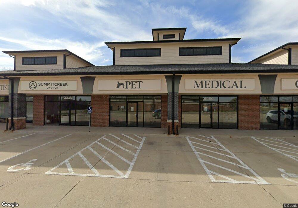
4446 128th St Urbandale, IA 50323
--
Bed
--
Bath
9,600
Sq Ft
1.93
Acres
About This Home
This home is located at 4446 128th St, Urbandale, IA 50323. 4446 128th St is a home located in Polk County with nearby schools including Webster Elementary School, Urbandale Middle School, and Urbandale High School.
Ownership History
Date
Name
Owned For
Owner Type
Purchase Details
Closed on
Apr 9, 2025
Sold by
Sanav Meredith Holdings Llc
Bought by
Lawson Family Dentistry Llc
Purchase Details
Closed on
Jan 4, 2021
Sold by
The Square At Days Run I Llc
Bought by
Sanav Meredith Holdings Llc
Home Financials for this Owner
Home Financials are based on the most recent Mortgage that was taken out on this home.
Original Mortgage
$1,890,000
Interest Rate
2.7%
Mortgage Type
Future Advance Clause Open End Mortgage
Purchase Details
Closed on
May 20, 2008
Sold by
Hubbell Properties I Lc Series C
Bought by
The Square At Days Run I Llc
Home Financials for this Owner
Home Financials are based on the most recent Mortgage that was taken out on this home.
Original Mortgage
$1,312,500
Interest Rate
5.87%
Mortgage Type
Construction
Create a Home Valuation Report for This Property
The Home Valuation Report is an in-depth analysis detailing your home's value as well as a comparison with similar homes in the area
Home Values in the Area
Average Home Value in this Area
Purchase History
| Date | Buyer | Sale Price | Title Company |
|---|---|---|---|
| Lawson Family Dentistry Llc | $758,500 | None Listed On Document | |
| Lawson Family Dentistry Llc | $758,500 | None Listed On Document | |
| Sanav Meredith Holdings Llc | $1,877,500 | None Available | |
| The Square At Days Run I Llc | $356,000 | None Available |
Source: Public Records
Mortgage History
| Date | Status | Borrower | Loan Amount |
|---|---|---|---|
| Previous Owner | Sanav Meredith Holdings Llc | $1,890,000 | |
| Previous Owner | The Square At Days Run I Llc | $1,312,500 |
Source: Public Records
Tax History Compared to Growth
Tax History
| Year | Tax Paid | Tax Assessment Tax Assessment Total Assessment is a certain percentage of the fair market value that is determined by local assessors to be the total taxable value of land and additions on the property. | Land | Improvement |
|---|---|---|---|---|
| 2025 | $43,982 | -- | -- | -- |
| 2024 | $43,982 | $1,330,000 | $441,000 | $889,000 |
| 2023 | $36,938 | $1,330,000 | $441,000 | $889,000 |
| 2022 | $36,032 | $1,110,000 | $369,000 | $741,000 |
| 2021 | $35,190 | $1,110,000 | $369,000 | $741,000 |
| 2020 | $35,558 | $1,080,000 | $335,000 | $745,000 |
| 2019 | $34,850 | $1,080,000 | $335,000 | $745,000 |
| 2018 | $34,136 | $1,040,000 | $503,000 | $537,000 |
| 2017 | $30,704 | $1,030,000 | $503,200 | $526,800 |
| 2016 | $30,702 | $945,000 | $419,000 | $526,000 |
| 2015 | $30,702 | $945,000 | $419,000 | $526,000 |
| 2014 | $29,816 | $886,000 | $419,000 | $467,000 |
Source: Public Records
Map
Nearby Homes
- 4309 129th St
- 13114 Iltis Dr
- 12912 Hammontree Dr
- 4412 125th St
- 12335 Tanglewood Dr
- 12510 Prairie Dr
- 4016 127th St
- 4143 122nd St
- 12527 Airline Ave
- 12515 Airline Ave
- 4111 140th St
- 12723 Sunflower Dr
- 15217 Springbrook Trail
- 15015 Springbrook Trail
- 15019 Springbrook Trail
- 14509 Persimmon Dr
- 14627 Persimmon Dr
- 3935 122nd St
- 12220 Horton Ave
- 12324 Sunflower Dr
- 4440 128th St
- 13000 Greenbelt Dr
- 13001 Greenbelt Dr
- 13005 Greenbelt Dr
- 12909 Westbrook Dr
- 12915 Westbrook Dr
- 13004 Greenbelt Dr
- 12919 Westbrook Dr
- 12901 Westbrook Dr
- 13002 Alpine Dr
- 12905 Westbrook Dr
- 13006 Alpine Dr
- 13008 Greenbelt Dr
- 13009 Greenbelt Dr
- 4500 128th St
- 13003 Westbrook Dr
- 13007 Westbrook Dr
- 4335 129th St
- 13010 Alpine Dr
- 13003 Alpine Dr