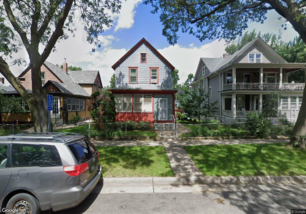
445 Edmund Ave Saint Paul, MN 55103
Frogtown NeighborhoodEstimated Value: $220,217 - $241,000
3
Beds
1
Bath
1,354
Sq Ft
$168/Sq Ft
Est. Value
About This Home
This home is located at 445 Edmund Ave, Saint Paul, MN 55103 and is currently estimated at $227,304, approximately $167 per square foot. 445 Edmund Ave is a home located in Ramsey County with nearby schools including Jackson Elementary, Hidden River Middle School, and Central Senior High School.
Ownership History
Date
Name
Owned For
Owner Type
Purchase Details
Closed on
Jan 14, 2021
Sold by
Vo Linh Ba
Bought by
Vo Linh Ba and Vo Diep Ba
Current Estimated Value
Purchase Details
Closed on
Oct 28, 2004
Sold by
Nguyen Tri Qui
Bought by
Vo Linh Ba and Nguyen Hoa
Purchase Details
Closed on
Nov 24, 2003
Sold by
Nguyen Wellstone and Nguyen Nhoung
Bought by
Tri Qui Nguyen
Purchase Details
Closed on
Nov 28, 2000
Sold by
Raschick Mary L
Bought by
Nguyen Wellstone and Thi Nhuong
Purchase Details
Closed on
Nov 25, 1997
Sold by
Estate Of Frank Raschick
Bought by
Raschick Mary
Create a Home Valuation Report for This Property
The Home Valuation Report is an in-depth analysis detailing your home's value as well as a comparison with similar homes in the area
Home Values in the Area
Average Home Value in this Area
Purchase History
| Date | Buyer | Sale Price | Title Company |
|---|---|---|---|
| Vo Linh Ba | -- | None Listed On Document | |
| Vo Linh Ba | $151,000 | -- | |
| Tri Qui Nguyen | $120,000 | -- | |
| Nguyen Wellstone | $86,800 | -- | |
| Raschick Mary | $58,000 | -- |
Source: Public Records
Tax History Compared to Growth
Tax History
| Year | Tax Paid | Tax Assessment Tax Assessment Total Assessment is a certain percentage of the fair market value that is determined by local assessors to be the total taxable value of land and additions on the property. | Land | Improvement |
|---|---|---|---|---|
| 2025 | $2,680 | $198,500 | $25,000 | $173,500 |
| 2023 | $2,680 | $185,300 | $20,000 | $165,300 |
| 2022 | $2,194 | $172,600 | $20,000 | $152,600 |
| 2021 | $1,746 | $152,600 | $20,000 | $132,600 |
| 2020 | $1,554 | $127,600 | $11,200 | $116,400 |
| 2019 | $1,248 | $112,800 | $11,200 | $101,600 |
| 2018 | $976 | $94,500 | $11,200 | $83,300 |
| 2017 | $802 | $82,100 | $11,200 | $70,900 |
| 2016 | $772 | $0 | $0 | $0 |
| 2015 | $638 | $68,800 | $11,200 | $57,600 |
| 2014 | $688 | $0 | $0 | $0 |
Source: Public Records
Map
Nearby Homes
- 465 Edmund Ave
- 481 Edmund Ave
- 482 Edmund Ave
- 395 Thomas Ave
- 601 Western Ave N
- 429 Sherburne Ave
- 534 Thomas Ave
- 597 Virginia St
- 538 Charles Ave
- 553 Charles Ave
- 627 Virginia St
- 371 Sherburne Ave
- 566 Edmund Ave
- 547 Blair Ave
- 511 Van Buren Ave
- 553 Blair Ave
- 313 Edmund Ave
- 697 Virginia St
- 594 Charles Ave
- 694 Virginia St
- 443 Edmund Ave W
- 451 Edmund Ave
- 441 Edmund Ave
- 453 Edmund Ave
- 589 Arundel St
- 595 Arundel St
- 461 Edmund Ave
- 569 Arundel St
- 448 Thomas Ave
- 452 Thomas Ave
- 452 452 Thomas-Avenue-
- 463 Edmund Ave
- 450 Edmund Ave
- 440 Thomas Ave
- 452 Edmund Ave
- 458 Thomas Ave
- 462 Thomas Ave
- 436 Edmund Ave
- 557 Arundel St
- 456 Edmund Ave