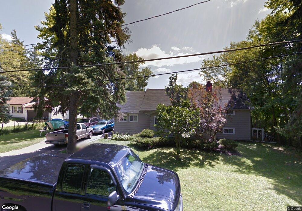
445 Forest Ave Youngstown, OH 44514
Estimated Value: $135,178 - $195,000
4
Beds
1
Bath
1,619
Sq Ft
$105/Sq Ft
Est. Value
About This Home
This home is located at 445 Forest Ave, Youngstown, OH 44514 and is currently estimated at $170,295, approximately $105 per square foot. 445 Forest Ave is a home located in Mahoning County with nearby schools including Stadium Drive Elementary School, Boardman Glenwood Junior High School, and Boardman High School.
Ownership History
Date
Name
Owned For
Owner Type
Purchase Details
Closed on
Oct 31, 2019
Sold by
Toth Gabriel M
Bought by
Toth Michelle E
Current Estimated Value
Purchase Details
Closed on
Apr 17, 2018
Sold by
Toth Gabriel M
Bought by
Toth Gabriel M
Purchase Details
Closed on
Nov 6, 2000
Sold by
Heater Alberta and Tokich Joseph James
Bought by
Toth Gabriel M
Purchase Details
Closed on
Dec 18, 1990
Bought by
Adams Alberta Jean
Create a Home Valuation Report for This Property
The Home Valuation Report is an in-depth analysis detailing your home's value as well as a comparison with similar homes in the area
Purchase History
| Date | Buyer | Sale Price | Title Company |
|---|---|---|---|
| Toth Michelle E | -- | None Available | |
| Toth Gabriel M | -- | None Available | |
| Toth Gabriel M | $14,000 | -- | |
| Adams Alberta Jean | $14,000 | -- |
Source: Public Records
Tax History
| Year | Tax Paid | Tax Assessment Tax Assessment Total Assessment is a certain percentage of the fair market value that is determined by local assessors to be the total taxable value of land and additions on the property. | Land | Improvement |
|---|---|---|---|---|
| 2025 | $822 | $26,460 | $2,520 | $23,940 |
| 2024 | $840 | $26,460 | $2,520 | $23,940 |
| 2023 | $861 | $26,460 | $2,520 | $23,940 |
| 2022 | $912 | $23,090 | $2,500 | $20,590 |
| 2021 | $913 | $23,090 | $2,500 | $20,590 |
| 2020 | $918 | $23,090 | $2,500 | $20,590 |
| 2019 | $831 | $20,980 | $2,270 | $18,710 |
| 2018 | $742 | $20,980 | $2,270 | $18,710 |
| 2017 | $739 | $20,980 | $2,270 | $18,710 |
| 2016 | $832 | $22,360 | $1,860 | $20,500 |
| 2015 | $815 | $22,360 | $1,860 | $20,500 |
| 2014 | -- | $22,360 | $1,860 | $20,500 |
| 2013 | $811 | $22,360 | $1,860 | $20,500 |
Source: Public Records
Map
Nearby Homes
- 363 Maple Dr
- 0 W Harvard Blvd
- 0 Harvard Rd Unit 5038029
- 331 Warren Ave
- 601 E Western Reserve Rd Unit 1401
- 601 E Western Reserve Rd Unit 701
- 695 E Western Reserve Rd Unit 1903
- 9140 Woodworth Rd
- 717 Calla Rd E
- 42 E Western Reserve Rd
- 62 E Western Reserve Rd Unit 3
- 0 W Western Reserve Rd Unit 5188999
- 1008 E Calla Rd
- 327 Calla Rd W
- 50 Carter Cir
- 1070 Calla Rd E
- 9264 Sharrott Rd Unit 1001
- 9264 Sharrott Rd Unit 801
- 9264 Sharrott Rd Unit 104
- 1275 E Western Reserve Rd
Your Personal Tour Guide
Ask me questions while you tour the home.