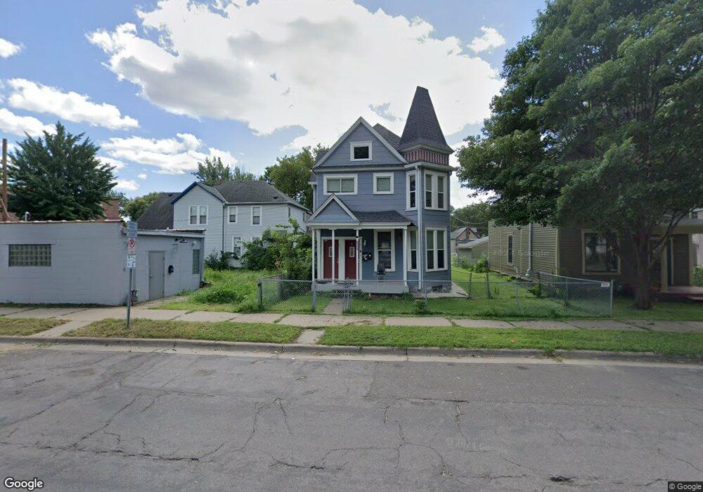
448 Thomas Ave Saint Paul, MN 55103
Frogtown NeighborhoodEstimated Value: $258,000 - $310,000
4
Beds
2
Baths
1,918
Sq Ft
$149/Sq Ft
Est. Value
About This Home
This home is located at 448 Thomas Ave, Saint Paul, MN 55103 and is currently estimated at $286,298, approximately $149 per square foot. 448 Thomas Ave is a home located in Ramsey County with nearby schools including Jackson Elementary, Hidden River Middle School, and Central Senior High School.
Ownership History
Date
Name
Owned For
Owner Type
Purchase Details
Closed on
Jun 18, 2020
Sold by
Pham Anthony X and Pham Van Hong
Bought by
Malone Deidre
Current Estimated Value
Home Financials for this Owner
Home Financials are based on the most recent Mortgage that was taken out on this home.
Original Mortgage
$230,743
Outstanding Balance
$204,536
Interest Rate
3.2%
Mortgage Type
FHA
Estimated Equity
$81,762
Purchase Details
Closed on
Jun 2, 2014
Sold by
Bank Of The West
Bought by
Pham Anthony X
Purchase Details
Closed on
Jun 27, 2013
Sold by
Marrone Stephen and Marrone Marci E
Bought by
Bank Of The West
Create a Home Valuation Report for This Property
The Home Valuation Report is an in-depth analysis detailing your home's value as well as a comparison with similar homes in the area
Home Values in the Area
Average Home Value in this Area
Purchase History
| Date | Buyer | Sale Price | Title Company |
|---|---|---|---|
| Malone Deidre | $235,000 | Stewart Title Company | |
| Pham Anthony X | $74,181 | Burnet Title | |
| Bank Of The West | $158,632 | None Available |
Source: Public Records
Mortgage History
| Date | Status | Borrower | Loan Amount |
|---|---|---|---|
| Open | Malone Deidre | $230,743 |
Source: Public Records
Tax History Compared to Growth
Tax History
| Year | Tax Paid | Tax Assessment Tax Assessment Total Assessment is a certain percentage of the fair market value that is determined by local assessors to be the total taxable value of land and additions on the property. | Land | Improvement |
|---|---|---|---|---|
| 2025 | $3,932 | $247,300 | $25,000 | $222,300 |
| 2023 | $3,932 | $222,800 | $20,000 | $202,800 |
| 2022 | $2,970 | $207,200 | $20,000 | $187,200 |
| 2021 | $2,554 | $173,800 | $20,000 | $153,800 |
| 2020 | $3,412 | $169,300 | $8,100 | $161,200 |
| 2019 | $3,074 | $151,200 | $8,100 | $143,100 |
| 2018 | $2,904 | $133,800 | $8,100 | $125,700 |
| 2017 | $2,690 | $129,500 | $8,100 | $121,400 |
| 2016 | $2,558 | $0 | $0 | $0 |
| 2015 | $2,810 | $106,800 | $9,000 | $97,800 |
| 2014 | $2,698 | $0 | $0 | $0 |
Source: Public Records
Map
Nearby Homes
- 465 Edmund Ave
- 481 Edmund Ave
- 482 Edmund Ave
- 395 Thomas Ave
- 601 Western Ave N
- 429 Sherburne Ave
- 534 Thomas Ave
- 597 Virginia St
- 538 Charles Ave
- 553 Charles Ave
- 627 Virginia St
- 371 Sherburne Ave
- 566 Edmund Ave
- 547 Blair Ave
- 511 Van Buren Ave
- 553 Blair Ave
- 313 Edmund Ave
- 697 Virginia St
- 594 Charles Ave
- 694 Virginia St
- 452 Thomas Ave
- 452 452 Thomas-Avenue-
- 595 Arundel St
- 589 Arundel St
- 440 Thomas Ave
- 458 Thomas Ave
- 462 Thomas Ave
- 451 Edmund Ave
- 445 Edmund Ave
- 453 Edmund Ave
- 464 Thomas Ave
- 443 Edmund Ave W
- 441 Edmund Ave
- 463 Edmund Ave
- 455 Thomas Ave
- 461 Edmund Ave
- 466 Thomas Ave W
- 451 Thomas Ave
- 468 Thomas Ave
- 607 Arundel St