Estimated Value: $182,213 - $197,000
3
Beds
1
Bath
1,312
Sq Ft
$144/Sq Ft
Est. Value
About This Home
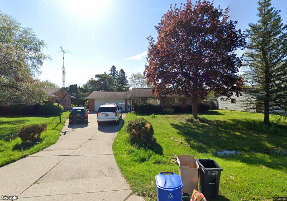
This home is located at 4483 Old Colony Dr, Flint, MI 48507 and is currently estimated at $188,553, approximately $143 per square foot. 4483 Old Colony Dr is a home located in Genesee County with nearby schools including Carman-Ainsworth High School and Madison Academy - Elementary School.
Ownership History
Date
Name
Owned For
Owner Type
Purchase Details
Closed on
Dec 16, 2005
Sold by
Allison Joyce Andrew and Allison Joyce
Bought by
Graves Tony M and Graves Joanna
Current Estimated Value
Purchase Details
Closed on
Aug 8, 2003
Sold by
Joyce Andrew
Bought by
Allison Joyce Andrew and Allison Joyce
Purchase Details
Closed on
Aug 8, 2002
Sold by
Kondel Joseph A and Kondel Christina S
Bought by
Joyce Andrew
Purchase Details
Closed on
Aug 31, 1999
Sold by
Brunske Cheryl
Bought by
Kondel Joseph A and Kondel Christina S
Home Financials for this Owner
Home Financials are based on the most recent Mortgage that was taken out on this home.
Original Mortgage
$85,600
Interest Rate
7.77%
Mortgage Type
Balloon
Create a Home Valuation Report for This Property
The Home Valuation Report is an in-depth analysis detailing your home's value as well as a comparison with similar homes in the area
Home Values in the Area
Average Home Value in this Area
Purchase History
| Date | Buyer | Sale Price | Title Company |
|---|---|---|---|
| Graves Tony M | $132,900 | Metropolitan Title Company | |
| Allison Joyce Andrew | -- | First American Title Ins Co | |
| Joyce Andrew | $120,000 | First American Title | |
| Kondel Joseph A | $107,000 | First American Title Ins Co |
Source: Public Records
Mortgage History
| Date | Status | Borrower | Loan Amount |
|---|---|---|---|
| Previous Owner | Kondel Joseph A | $85,600 |
Source: Public Records
Tax History Compared to Growth
Tax History
| Year | Tax Paid | Tax Assessment Tax Assessment Total Assessment is a certain percentage of the fair market value that is determined by local assessors to be the total taxable value of land and additions on the property. | Land | Improvement |
|---|---|---|---|---|
| 2025 | $1,943 | $79,600 | $0 | $0 |
| 2024 | $996 | $78,600 | $0 | $0 |
| 2023 | $950 | $72,100 | $0 | $0 |
| 2022 | $847 | $62,900 | $0 | $0 |
| 2021 | $1,715 | $54,900 | $0 | $0 |
| 2020 | $854 | $50,800 | $0 | $0 |
| 2019 | $842 | $45,800 | $0 | $0 |
| 2018 | $1,604 | $43,200 | $0 | $0 |
| 2017 | $1,532 | $43,200 | $0 | $0 |
| 2016 | $1,597 | $39,800 | $0 | $0 |
| 2015 | $1,414 | $37,000 | $0 | $0 |
| 2014 | $839 | $35,500 | $0 | $0 |
| 2012 | -- | $35,800 | $35,800 | $0 |
Source: Public Records
Map
Nearby Homes
- 4505 Old Carriage Rd
- 4480 Cherrytree Ln
- 1256 W Rowland St
- 1203 Pickwick Place
- 4460 Torrey Rd
- 1136 W Rowland St
- 1144 Pickwick Place
- 5131 Gateway Centre Blvd
- 4460 Saint Martins Dr
- 1508 W Bristol Rd
- 1380 Sunset Blvd
- 2144 W Hill Rd
- 1108 Trotwood Ln
- 1044 W Rowland St
- 1111 W Mclean Ave
- 5374 Torrey Rd
- 6042 Birch Dr
- 1130 Leisure Dr Unit 21
- 1072 W Williamson Ave
- 1097 W Buder Ave
- 4477 Old Colony Dr
- 4471 Old Colony Dr
- 2089 Forest Heights Dr
- 4474 Westmont Dr
- 4480 Old Colony Dr
- 4494 Old Colony Dr
- 4486 Old Colony Dr
- 2108 W Maple Ave
- 4462 Westmont Dr
- 4465 Old Colony Dr
- 4468 Westmont Dr
- 2120 W Maple Ave
- 00 Taylor Dr
- 13044 N. Fenton Rd. Leisure Dr
- 00 van Slyke Rd
- 00A van Slyke Rd
- 262 Hunters Rill Ogema Ave
- 2094 W Maple Ave
- 4500 Old Colony Dr
- 2081 Forest Heights Dr