Estimated Value: $249,000 - $310,000
3
Beds
1
Bath
1,437
Sq Ft
$191/Sq Ft
Est. Value
About This Home
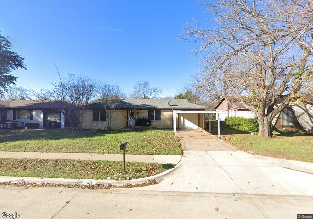
This home is located at 449 Michael Blvd, Hurst, TX 76053 and is currently estimated at $273,782, approximately $190 per square foot. 449 Michael Blvd is a home located in Tarrant County with nearby schools including Bellaire Elementary School, Hurst J High School, and L.D. Bell High School.
Ownership History
Date
Name
Owned For
Owner Type
Purchase Details
Closed on
Dec 14, 2020
Sold by
Weeks Leah M and Weeks Brian
Bought by
Bryant Jasmine Michelle
Current Estimated Value
Home Financials for this Owner
Home Financials are based on the most recent Mortgage that was taken out on this home.
Original Mortgage
$195,886
Outstanding Balance
$174,708
Interest Rate
2.8%
Mortgage Type
FHA
Estimated Equity
$99,074
Purchase Details
Closed on
Aug 31, 2016
Sold by
Raider Property Investments Llc
Bought by
Weeks Leah M
Home Financials for this Owner
Home Financials are based on the most recent Mortgage that was taken out on this home.
Original Mortgage
$133,200
Interest Rate
3.45%
Mortgage Type
New Conventional
Purchase Details
Closed on
May 3, 2016
Sold by
Newberry Kenneth and Newberry Sandy
Bought by
Raider Property Investments Llc
Purchase Details
Closed on
Jun 22, 2001
Sold by
Smith Timothy J and Smith Lisa Ann
Bought by
Newberry Kenneth and Newberry Sandy
Home Financials for this Owner
Home Financials are based on the most recent Mortgage that was taken out on this home.
Original Mortgage
$84,829
Interest Rate
7.16%
Mortgage Type
FHA
Purchase Details
Closed on
Jun 1, 1998
Sold by
Strange Jeanne R and Strange Bills Jeanne R
Bought by
Smith Timothy J and Smith Lisa Ann
Home Financials for this Owner
Home Financials are based on the most recent Mortgage that was taken out on this home.
Original Mortgage
$64,724
Interest Rate
7.27%
Mortgage Type
FHA
Create a Home Valuation Report for This Property
The Home Valuation Report is an in-depth analysis detailing your home's value as well as a comparison with similar homes in the area
Home Values in the Area
Average Home Value in this Area
Purchase History
| Date | Buyer | Sale Price | Title Company |
|---|---|---|---|
| Bryant Jasmine Michelle | -- | Rattikin Title Company | |
| Weeks Leah M | -- | Freedom Title Company | |
| Raider Property Investments Llc | $77,000 | None Available | |
| Newberry Kenneth | -- | First American Title Co | |
| Smith Timothy J | -- | Safeco Land Title |
Source: Public Records
Mortgage History
| Date | Status | Borrower | Loan Amount |
|---|---|---|---|
| Open | Bryant Jasmine Michelle | $195,886 | |
| Previous Owner | Weeks Leah M | $133,200 | |
| Previous Owner | Newberry Kenneth | $84,829 | |
| Previous Owner | Smith Timothy J | $64,724 |
Source: Public Records
Tax History Compared to Growth
Tax History
| Year | Tax Paid | Tax Assessment Tax Assessment Total Assessment is a certain percentage of the fair market value that is determined by local assessors to be the total taxable value of land and additions on the property. | Land | Improvement |
|---|---|---|---|---|
| 2025 | $3,637 | $237,000 | $50,000 | $187,000 |
| 2024 | $3,637 | $251,835 | $50,000 | $201,835 |
| 2023 | $4,921 | $253,497 | $35,000 | $218,497 |
| 2022 | $5,141 | $229,154 | $35,000 | $194,154 |
| 2021 | $4,896 | $203,000 | $35,000 | $168,000 |
| 2020 | $4,670 | $196,554 | $35,000 | $161,554 |
| 2019 | $4,319 | $197,384 | $35,000 | $162,384 |
| 2018 | $3,358 | $160,420 | $15,000 | $145,420 |
| 2017 | $3,690 | $145,836 | $15,000 | $130,836 |
| 2016 | $2,182 | $98,539 | $15,000 | $83,539 |
| 2015 | $1,686 | $78,400 | $15,000 | $63,400 |
| 2014 | $1,686 | $78,400 | $15,000 | $63,400 |
Source: Public Records
Map
Nearby Homes
- 712 Brookfield Dr
- 704 Tanglewood Dr
- 508 Oak Park Dr
- 720 Tanglewood Dr
- 716 E Pecan St Unit 716 - 722
- 212 E Ellen Ave
- 120 Donald Dr
- 260 Corinna Ct
- 1501 Woodridge Cir
- 1407 Woodridge Cir
- 644 Caduceus Ln
- 205 Corinna Ct
- 552 Norwood Dr
- 1302 Woodridge Cir
- 120 Charlene Dr
- 624 Harrison Ln
- 1200 Tanglewood Trail
- 1309 Driftwood Dr
- 812 Forest Hollow Dr
- 127 W Cedar St
- 445 Michael Blvd
- 453 Michael Blvd
- 441 Michael Blvd
- 216 Page Ct
- 448 Michael Blvd
- 437 Michael Blvd
- 452 Michael Blvd
- 436 Michael Blvd
- 212 Page Ct
- 460 Michael Blvd
- 433 Michael Blvd
- 224 Page Ct
- 503 Brookfield Dr
- 208 Page Ct
- 429 Michael Blvd
- 504 Brookfield Dr
- 432 Michael Blvd
- 504 Greenway Dr
- 507 Brookfield Dr
- 516 E Redbud Dr