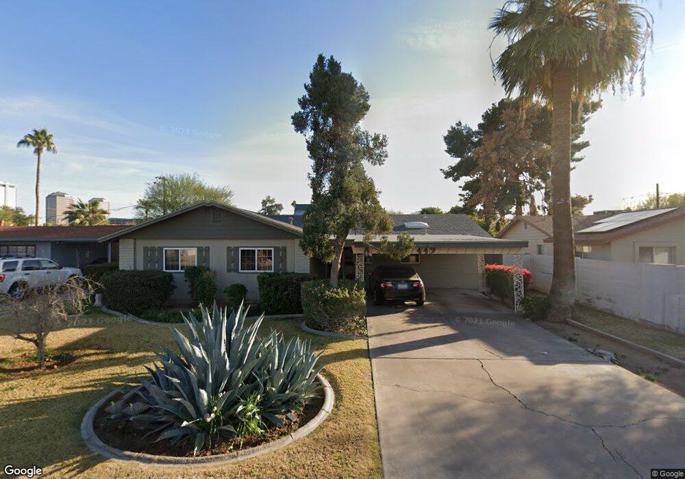
449 W Mulberry Dr Phoenix, AZ 85013
Midtown Phoenix NeighborhoodEstimated Value: $451,927 - $602,000
3
Beds
2
Baths
1,700
Sq Ft
$317/Sq Ft
Est. Value
About This Home
This home is located at 449 W Mulberry Dr, Phoenix, AZ 85013 and is currently estimated at $538,482, approximately $316 per square foot. 449 W Mulberry Dr is a home located in Maricopa County with nearby schools including Clarendon Elementary School, Encanto Elementary School, and Osborn Middle School.
Ownership History
Date
Name
Owned For
Owner Type
Purchase Details
Closed on
Nov 17, 2009
Sold by
Torphy John William
Bought by
Hallum Erica and Leyba Gabriel
Current Estimated Value
Home Financials for this Owner
Home Financials are based on the most recent Mortgage that was taken out on this home.
Original Mortgage
$220,924
Outstanding Balance
$141,818
Interest Rate
4.83%
Mortgage Type
FHA
Estimated Equity
$396,664
Create a Home Valuation Report for This Property
The Home Valuation Report is an in-depth analysis detailing your home's value as well as a comparison with similar homes in the area
Home Values in the Area
Average Home Value in this Area
Purchase History
| Date | Buyer | Sale Price | Title Company |
|---|---|---|---|
| Hallum Erica | $225,000 | Equity Title Agency Inc |
Source: Public Records
Mortgage History
| Date | Status | Borrower | Loan Amount |
|---|---|---|---|
| Open | Hallum Erica | $220,924 |
Source: Public Records
Tax History Compared to Growth
Tax History
| Year | Tax Paid | Tax Assessment Tax Assessment Total Assessment is a certain percentage of the fair market value that is determined by local assessors to be the total taxable value of land and additions on the property. | Land | Improvement |
|---|---|---|---|---|
| 2025 | $2,034 | $17,800 | -- | -- |
| 2024 | $1,891 | $16,953 | -- | -- |
| 2023 | $1,891 | $40,780 | $8,150 | $32,630 |
| 2022 | $1,882 | $30,960 | $6,190 | $24,770 |
| 2021 | $1,938 | $27,100 | $5,420 | $21,680 |
| 2020 | $1,885 | $23,930 | $4,780 | $19,150 |
| 2019 | $1,797 | $23,200 | $4,640 | $18,560 |
| 2018 | $1,733 | $26,260 | $5,250 | $21,010 |
| 2017 | $1,576 | $20,030 | $4,000 | $16,030 |
| 2016 | $1,517 | $18,450 | $3,690 | $14,760 |
| 2015 | $1,414 | $16,130 | $3,220 | $12,910 |
Source: Public Records
Map
Nearby Homes
- 457 W Mulberry Dr
- 3343 N 6th Ave
- 3308 N 6th Ave
- 3126 N 6th Ave Unit 1
- 3600 N 5th Ave Unit 302
- 3018 N 7th Ave
- 834 W Osborn Rd
- 829 W Mitchell Dr
- 3655 N 5th Ave Unit 105
- 3633 N 3rd Ave Unit 2091
- 3633 N 3rd Ave Unit 2051
- 3633 N 3rd Ave Unit 1059
- 3633 N 3rd Ave Unit 2009
- 3633 N 3rd Ave Unit 2084
- 3633 N 3rd Ave Unit 2083
- 3633 N 3rd Ave Unit 2012
- 2931 N 8th Ave
- 500 W Clarendon Ave Unit F-6
- 500 W Clarendon Ave Unit D6
- 207 W Clarendon Ave Unit 2A
- 453 W Mulberry Dr
- 436 W Flower St
- 430 W Flower St
- 457 W Mulberry Dr
- 437 W Mulberry Dr
- 444 W Flower St
- 450 W Mulberry Dr
- 426 W Flower St
- 444 W Mulberry Dr
- 454 W Mulberry Dr
- 452 W Flower St
- 461 W Mulberry Dr
- 433 W Mulberry Dr
- 420 W Flower St
- 438 W Mulberry Dr
- 458 W Flower St
- 458 W Mulberry Dr Unit 1
- 465 W Mulberry Dr
- 434 W Mulberry Dr Unit 1
- 427 W Mulberry Dr