45 Edwards Farm Dr Rock Spring, GA 30739
Rock Spring NeighborhoodEstimated Value: $213,000 - $272,170
--
Bed
1
Bath
1,456
Sq Ft
$165/Sq Ft
Est. Value
About This Home
This home is located at 45 Edwards Farm Dr, Rock Spring, GA 30739 and is currently estimated at $239,793, approximately $164 per square foot. 45 Edwards Farm Dr is a home located in Walker County with nearby schools including Rock Spring Elementary School, Lafayette High School, and Alice M Daley Adventist School.
Ownership History
Date
Name
Owned For
Owner Type
Purchase Details
Closed on
Dec 10, 2021
Sold by
Michael Nehrt
Bought by
Raines Brandon E and Raines Jennifer D
Current Estimated Value
Purchase Details
Closed on
Feb 15, 2019
Sold by
Nehrt Michael L
Bought by
Nehrt Neal E
Home Financials for this Owner
Home Financials are based on the most recent Mortgage that was taken out on this home.
Original Mortgage
$111,655
Interest Rate
4.4%
Mortgage Type
New Conventional
Purchase Details
Closed on
Apr 21, 1994
Sold by
Johnston William T
Bought by
Nehrt Michael L and Nehrt Debra
Purchase Details
Closed on
May 20, 1983
Sold by
Johnston William T
Bought by
Johnston William T
Purchase Details
Closed on
Dec 16, 1965
Bought by
Johnston William T
Create a Home Valuation Report for This Property
The Home Valuation Report is an in-depth analysis detailing your home's value as well as a comparison with similar homes in the area
Home Values in the Area
Average Home Value in this Area
Purchase History
| Date | Buyer | Sale Price | Title Company |
|---|---|---|---|
| Raines Brandon E | $55,000 | -- | |
| Nehrt Neal E | $111,655 | -- | |
| Nehrt Michael L | $88,500 | -- | |
| Johnston William T | -- | -- | |
| Johnston William T | -- | -- |
Source: Public Records
Mortgage History
| Date | Status | Borrower | Loan Amount |
|---|---|---|---|
| Previous Owner | Nehrt Neal E | $111,655 |
Source: Public Records
Tax History Compared to Growth
Tax History
| Year | Tax Paid | Tax Assessment Tax Assessment Total Assessment is a certain percentage of the fair market value that is determined by local assessors to be the total taxable value of land and additions on the property. | Land | Improvement |
|---|---|---|---|---|
| 2024 | $1,954 | $108,291 | $28,441 | $79,850 |
| 2023 | $1,909 | $96,461 | $22,572 | $73,889 |
| 2022 | $1,798 | $89,538 | $24,766 | $64,772 |
| 2021 | $1,434 | $84,283 | $37,019 | $47,264 |
| 2020 | $1,265 | $76,227 | $37,019 | $39,208 |
| 2019 | $1,284 | $76,227 | $37,019 | $39,208 |
| 2018 | $2,017 | $76,227 | $37,019 | $39,208 |
| 2017 | $1,514 | $76,227 | $37,019 | $39,208 |
| 2016 | $1,143 | $76,227 | $37,019 | $39,208 |
| 2015 | $969 | $65,210 | $35,059 | $30,151 |
| 2014 | $875 | $65,210 | $35,059 | $30,151 |
| 2013 | -- | $65,209 | $35,058 | $30,150 |
Source: Public Records
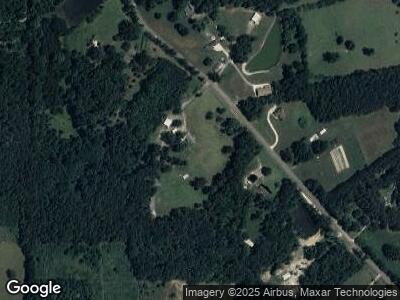
Map
Nearby Homes
- 575 Tarvin Rd
- 445 Pinewood Dr
- 58 Oak Run
- 4 Stonecrest
- 7 Stonecrest Dr
- 0 Tarvin Rd Unit 10336239
- 850 Van Dell Dr
- 6012 Highway 95
- 1585 E Reed Rd
- 90 Lexington Stop Dr
- 0 Millsap Rd Unit 1511978
- 1052 Huffman Rd
- 2565 Ringgold Rd
- 0 Cordell Rd Unit 11456815
- 155 Ash Ln
- 132 Hinton Ln
- 84 Arnold Ln
- 167 Shady Ct
- 101 Golden Oaks Dr
- 524 E Teems Rd
- 45 Edwards Farm Dr
- 4508 Highway 95
- 4533 Highway 95
- 00 Georgia 95 Unit 264
- 4610 Highway 95
- 4531 Highway 95
- 4416 Highway 95
- 4416 Highway 95
- 4619 Highway 95
- 4651 Highway 95
- 4399 Highway 95
- 4535 Highway 95
- 4770 Highway 95
- 4737 Highway 95
- 252 Colbert Hollow Rd
- 4856 Georgia 95
- 4856 Highway 95
- 0 Colbert Hollow Rd
- 0 Colbert Hollow Rd Unit 1157035
- 0 Colbert Hollow Rd Unit 1157036