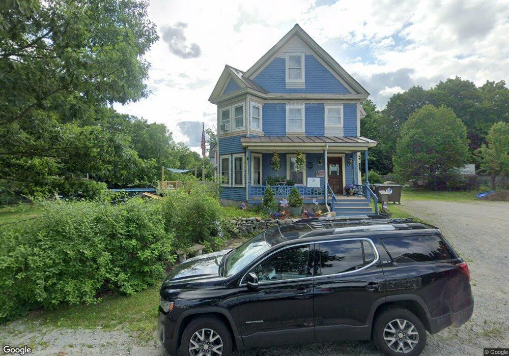
45 Gould St Henniker, NH 03242
Estimated Value: $540,000 - $567,000
4
Beds
2
Baths
3,157
Sq Ft
$176/Sq Ft
Est. Value
About This Home
This home is located at 45 Gould St, Henniker, NH 03242 and is currently estimated at $555,125, approximately $175 per square foot. 45 Gould St is a home with nearby schools including Henniker Community School and John Stark Regional High School.
Ownership History
Date
Name
Owned For
Owner Type
Purchase Details
Closed on
Sep 25, 2024
Sold by
Urbaitis Deborah
Bought by
Amiga-Go Lt and Morneau
Current Estimated Value
Purchase Details
Closed on
Feb 4, 2022
Sold by
Urbaitis Todd
Bought by
Urbaitis Deborah
Create a Home Valuation Report for This Property
The Home Valuation Report is an in-depth analysis detailing your home's value as well as a comparison with similar homes in the area
Home Values in the Area
Average Home Value in this Area
Purchase History
| Date | Buyer | Sale Price | Title Company |
|---|---|---|---|
| Amiga-Go Lt | -- | None Available | |
| Urbaitis Deborah | -- | None Available | |
| Urbaitis Deborah | -- | None Available |
Source: Public Records
Tax History Compared to Growth
Tax History
| Year | Tax Paid | Tax Assessment Tax Assessment Total Assessment is a certain percentage of the fair market value that is determined by local assessors to be the total taxable value of land and additions on the property. | Land | Improvement |
|---|---|---|---|---|
| 2024 | $10,201 | $426,800 | $95,000 | $331,800 |
| 2023 | $9,552 | $426,800 | $95,000 | $331,800 |
| 2022 | $8,469 | $395,000 | $95,000 | $300,000 |
| 2021 | $9,107 | $279,700 | $88,000 | $191,700 |
| 2020 | $8,738 | $279,700 | $88,000 | $191,700 |
| 2019 | $8,319 | $235,400 | $93,300 | $142,100 |
| 2018 | $2,590 | $235,400 | $93,300 | $142,100 |
| 2017 | $7,874 | $232,000 | $93,300 | $138,700 |
| 2016 | $7,733 | $232,000 | $93,300 | $138,700 |
| 2015 | $7,301 | $232,000 | $93,300 | $138,700 |
| 2014 | $7,713 | $251,400 | $97,200 | $154,200 |
Source: Public Records
Map
Nearby Homes
- 388 Western Ave Unit E1
- 2 Hope Rd
- 540-X9-A Route 114
- 540-X9B Route 114
- 143 Tanglewood Dr
- 173 Patterson Hill Rd
- 302 Flanders Rd
- 231 Patterson Hill Rd
- 85 Checkerberry Ln
- 7-351-B Patterson Hill Rd
- 0 Old Concord Rd Unit 551-A 5014211
- 586 C-4 Craney Hill Rd
- 149 Bear Hill Rd
- 11 White Birch Rd
- 430 Highland Dr
- 463 Craney Hill Rd
- 98 Emerald Dr
- 0 Kings Row Unit 151 4855040
- 11 Hillside St
- 0 Spring St Unit 178 4855470