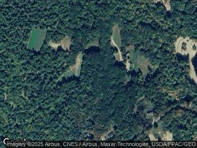
45 Moulton Ridge Rd Porter, ME 04068
Estimated Value: $238,000 - $252,625
--
Bed
--
Bath
682
Sq Ft
$360/Sq Ft
Est. Value
About This Home
This home is located at 45 Moulton Ridge Rd, Porter, ME 04068 and is currently estimated at $245,406, approximately $359 per square foot. 45 Moulton Ridge Rd is a home.
Ownership History
Date
Name
Owned For
Owner Type
Purchase Details
Closed on
Jun 25, 2021
Sold by
Strout Michael J and Strout Susan G
Bought by
Varle Daniel J and Varle Heidi L
Current Estimated Value
Home Financials for this Owner
Home Financials are based on the most recent Mortgage that was taken out on this home.
Original Mortgage
$213,750
Outstanding Balance
$197,277
Interest Rate
2.9%
Mortgage Type
Purchase Money Mortgage
Estimated Equity
$48,408
Purchase Details
Closed on
Jul 17, 2019
Sold by
Livermore Mark
Bought by
Strout Michael J and Strout Susan G
Home Financials for this Owner
Home Financials are based on the most recent Mortgage that was taken out on this home.
Original Mortgage
$187,200
Interest Rate
3.82%
Mortgage Type
New Conventional
Create a Home Valuation Report for This Property
The Home Valuation Report is an in-depth analysis detailing your home's value as well as a comparison with similar homes in the area
Home Values in the Area
Average Home Value in this Area
Purchase History
| Date | Buyer | Sale Price | Title Company |
|---|---|---|---|
| Varle Daniel J | -- | None Available | |
| Strout Michael J | -- | -- |
Source: Public Records
Mortgage History
| Date | Status | Borrower | Loan Amount |
|---|---|---|---|
| Open | Varle Daniel J | $213,750 | |
| Previous Owner | Strout Michael J | $187,200 |
Source: Public Records
Tax History Compared to Growth
Tax History
| Year | Tax Paid | Tax Assessment Tax Assessment Total Assessment is a certain percentage of the fair market value that is determined by local assessors to be the total taxable value of land and additions on the property. | Land | Improvement |
|---|---|---|---|---|
| 2024 | $2,206 | $185,341 | $65,600 | $119,741 |
| 2023 | $1,889 | $107,500 | $36,000 | $71,500 |
| 2022 | $1,785 | $107,539 | $36,000 | $71,539 |
| 2021 | $1,785 | $107,539 | $36,000 | $71,539 |
| 2020 | $1,751 | $107,539 | $36,000 | $71,539 |
| 2019 | $1,812 | $107,539 | $36,000 | $71,539 |
| 2018 | $1,812 | $107,539 | $36,000 | $71,539 |
| 2017 | $1,785 | $107,539 | $36,000 | $71,539 |
| 2016 | $1,624 | $107,539 | $36,000 | $71,539 |
Source: Public Records
Map
Nearby Homes
- Lot 3 Old Meetinghouse Rd
- 538 Colcord Pond Rd
- 48 Town Pound Rd
- 125 Dam Rd
- 193 Spec Pond Rd
- 26 Eastman Hill Rd
- Lot 45 Ossipee Trail
- 219 Sokokis Rd
- TBD North
- 14 Elm St
- 9 Sunnydale Ln
- 118 Federal
- 37 Alpine Dr
- 70AC Ben Gilpatrick Rd
- Lot39 Tripptown Rd
- 31 Tall Pines Ln
- 313 Devereux Rd
- 0 Willis Bean Unit 2,4,6 5006353
- Lot 10 Friedman
- 8-15 Notch Rd
- 5 Moulton Ridge Rd
- 45 Moulton Ridge Rd
- 125 Douglas Mill Rd
- 114 Moulton Ridge Rd
- 393 160
- 0 Giles Moulton Unit 906243
- 0 Giles Moulton Unit 906288
- 0 Durgin Unit 906789
- 0 Durgin Unit 906807
- 806 Spectacle Pond Rd
- 3 Spectacle Pond Rd
- 193 Spectacle Pond Rd
- 567 Spectacle Pond Rd
- 50 Enfield St
- 188 Old Meetinghouse Rd
- 8 Moulton Ridge Rd
- Lot 31A Old Meetinghouse Rd
- Lot 31,31A Old Meetinghouse Rd
- 0 Moulton Ridge
- 154 Old Meetinghouse Rd
