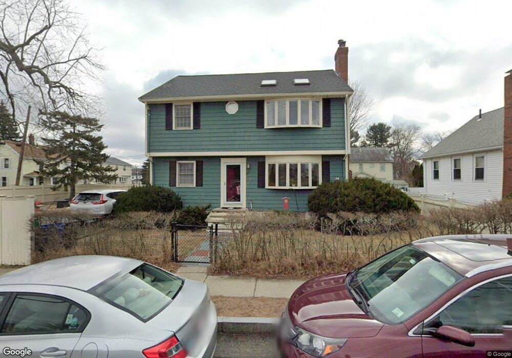
45 N Union St Arlington, MA 02474
East Arlington NeighborhoodEstimated Value: $1,149,000 - $1,175,000
4
Beds
2
Baths
2,048
Sq Ft
$569/Sq Ft
Est. Value
About This Home
This home is located at 45 N Union St, Arlington, MA 02474 and is currently estimated at $1,165,177, approximately $568 per square foot. 45 N Union St is a home located in Middlesex County with nearby schools including Thompson School, Ottoson Middle School, and Arlington High School.
Ownership History
Date
Name
Owned For
Owner Type
Purchase Details
Closed on
Mar 20, 2012
Sold by
Woog Debra A
Bought by
Debra A Woog Ret and Woog
Current Estimated Value
Purchase Details
Closed on
Jun 15, 1998
Sold by
Mccrobie Robert R and Mccrobie Robin M
Bought by
Woog Debra A and Mcginty David W
Home Financials for this Owner
Home Financials are based on the most recent Mortgage that was taken out on this home.
Original Mortgage
$216,000
Interest Rate
7.11%
Mortgage Type
Purchase Money Mortgage
Purchase Details
Closed on
Feb 10, 1988
Sold by
Martin Mary
Bought by
Mccrobie Robert R
Home Financials for this Owner
Home Financials are based on the most recent Mortgage that was taken out on this home.
Original Mortgage
$128,000
Interest Rate
10.59%
Mortgage Type
Purchase Money Mortgage
Create a Home Valuation Report for This Property
The Home Valuation Report is an in-depth analysis detailing your home's value as well as a comparison with similar homes in the area
Home Values in the Area
Average Home Value in this Area
Purchase History
| Date | Buyer | Sale Price | Title Company |
|---|---|---|---|
| Debra A Woog Ret | -- | -- | |
| Woog Debra A | $270,000 | -- | |
| Mccrobie Robert R | $160,000 | -- |
Source: Public Records
Mortgage History
| Date | Status | Borrower | Loan Amount |
|---|---|---|---|
| Previous Owner | Mccrobie Robert R | $248,000 | |
| Previous Owner | Mccrobie Robert R | $216,000 | |
| Previous Owner | Mccrobie Robert R | $128,000 | |
| Closed | Mccrobie Robert R | $40,500 |
Source: Public Records
Tax History Compared to Growth
Tax History
| Year | Tax Paid | Tax Assessment Tax Assessment Total Assessment is a certain percentage of the fair market value that is determined by local assessors to be the total taxable value of land and additions on the property. | Land | Improvement |
|---|---|---|---|---|
| 2025 | $9,969 | $925,600 | $467,300 | $458,300 |
| 2024 | $9,202 | $868,900 | $444,000 | $424,900 |
| 2023 | $8,791 | $784,200 | $397,200 | $387,000 |
| 2022 | $8,404 | $735,900 | $373,900 | $362,000 |
| 2021 | $8,226 | $725,400 | $373,900 | $351,500 |
| 2020 | $5,681 | $725,400 | $373,900 | $351,500 |
| 2019 | $6,676 | $592,900 | $338,800 | $254,100 |
| 2018 | $5,260 | $575,400 | $321,300 | $254,100 |
| 2017 | $6,713 | $534,500 | $280,400 | $254,100 |
| 2016 | $6,318 | $493,600 | $239,500 | $254,100 |
| 2015 | $6,310 | $465,700 | $222,000 | $243,700 |
Source: Public Records
Map
Nearby Homes
- 23 Yale Rd
- 6 Gordon Rd
- 29 Dartmouth St Unit 29
- 12 Arizona Terrace Unit 2
- 42-44 Warren St Unit 42
- 94 Rawson Rd Unit 94
- 132 Rawson Rd Unit 132
- 215 Massachusetts Ave Unit 19 (34)
- 77 Warren St Unit A
- 327 Alewife Brook Pkwy Unit A
- 69 Sterling St
- 166 Arlington St
- 230 Massachusetts Ave Unit 6
- 25-27 Adams St
- 395 Alewife Brook Pkwy Unit 2C
- 395 Alewife Brook Pkwy Unit PH E
- 21 High St
- 16 High St Unit 2
- 44 Woods Ave Unit 44
- 31 Fairfax St
- 54 Norcross St
- 39 N Union St
- 51 Norcross St
- 50 Norcross St
- 52 Norcross St
- 53 N Union St Unit 55
- 55 N Union St
- 55 N Union St Unit 55
- 49 Norcross St
- 35 N Union St
- 45 Norcross St Unit B
- 45 Norcross St Unit A
- 47 Norcross St Unit B
- 59 N Union St
- 6-8 Norcross Cir
- 63 N Union St
- 2 Norcross Cir
- 24 Norcross Cir
- 27 N Union St Unit 8
- 27 N Union St