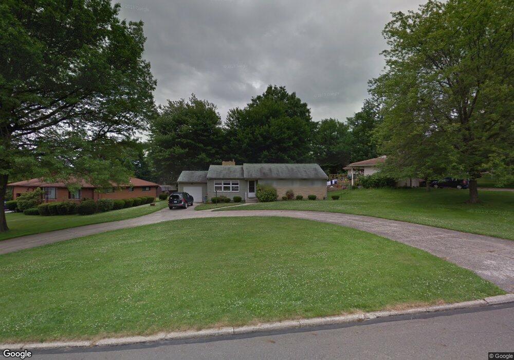
45 S Yorkshire Blvd Youngstown, OH 44515
Austintown NeighborhoodEstimated Value: $149,000 - $166,000
3
Beds
2
Baths
1,460
Sq Ft
$109/Sq Ft
Est. Value
About This Home
This home is located at 45 S Yorkshire Blvd, Youngstown, OH 44515 and is currently estimated at $159,344, approximately $109 per square foot. 45 S Yorkshire Blvd is a home located in Mahoning County with nearby schools including Austintown Elementary School, Austintown Intermediate School, and Austintown Middle School.
Ownership History
Date
Name
Owned For
Owner Type
Purchase Details
Closed on
Nov 8, 2007
Sold by
Dustman Myrtle E and Bordner Patricia H
Bought by
Inglis Steven R
Current Estimated Value
Home Financials for this Owner
Home Financials are based on the most recent Mortgage that was taken out on this home.
Original Mortgage
$69,900
Outstanding Balance
$44,363
Interest Rate
6.44%
Mortgage Type
Purchase Money Mortgage
Estimated Equity
$114,981
Purchase Details
Closed on
May 18, 1992
Bought by
Dustman Myrtle E
Create a Home Valuation Report for This Property
The Home Valuation Report is an in-depth analysis detailing your home's value as well as a comparison with similar homes in the area
Home Values in the Area
Average Home Value in this Area
Purchase History
| Date | Buyer | Sale Price | Title Company |
|---|---|---|---|
| Inglis Steven R | $69,900 | Attorney | |
| Dustman Myrtle E | -- | -- |
Source: Public Records
Mortgage History
| Date | Status | Borrower | Loan Amount |
|---|---|---|---|
| Open | Inglis Steven R | $69,900 |
Source: Public Records
Tax History Compared to Growth
Tax History
| Year | Tax Paid | Tax Assessment Tax Assessment Total Assessment is a certain percentage of the fair market value that is determined by local assessors to be the total taxable value of land and additions on the property. | Land | Improvement |
|---|---|---|---|---|
| 2024 | $1,865 | $40,720 | $5,670 | $35,050 |
| 2023 | $1,836 | $40,720 | $5,670 | $35,050 |
| 2022 | $1,612 | $28,660 | $5,450 | $23,210 |
| 2021 | $1,612 | $28,660 | $5,450 | $23,210 |
| 2020 | $1,619 | $28,660 | $5,450 | $23,210 |
| 2019 | $1,534 | $24,710 | $4,700 | $20,010 |
| 2018 | $1,476 | $24,710 | $4,700 | $20,010 |
| 2017 | $1,573 | $24,710 | $4,700 | $20,010 |
| 2016 | $1,674 | $27,820 | $4,750 | $23,070 |
| 2015 | $1,623 | $27,820 | $4,750 | $23,070 |
| 2014 | $1,630 | $27,820 | $4,750 | $23,070 |
| 2013 | $1,613 | $27,820 | $4,750 | $23,070 |
Source: Public Records
Map
Nearby Homes
- 4258 Mahoning Ave
- 122 S Edgehill Ave
- 126 S Edgehill Ave
- 81 S Edgehill Ave
- 97 Idlewood Rd
- 102 Parkgate Ave
- 209 S Beverly Ave
- 208 S Roanoke Ave
- 225 S Raccoon Rd
- 107 N Roanoke Ave
- 0 S Raccoon Rd Unit 5142489
- 0 Elmwood Ave
- 136 Rosemont Ave
- 161 N Roanoke Ave
- 42 N Navarre Ave
- 169 Westminster Ave
- 263 S Main St
- 98 N Navarre Ave
- 603 S Raccoon Rd Unit 9
- 603 S Raccoon Rd Unit 14
- 39 S Yorkshire Blvd
- 59 S Yorkshire Blvd
- 65 S Yorkshire Blvd
- 35 S Yorkshire Blvd
- 46 S Yorkshire Blvd
- 42 S Yorkshire Blvd
- 38 S Yorkshire Blvd
- 73 S Yorkshire Blvd
- 56 S Yorkshire Blvd
- 50 S Yorkshire Blvd
- 52 S Beverly Ave
- 62 S Yorkshire Blvd
- 34 S Yorkshire Blvd
- 60 S Beverly Ave
- 34 S Beverly Ave
- 68 S Yorkshire Blvd
- 66 S Beverly Ave
- 74 S Beverly Ave
- 72 S Yorkshire Blvd
- 105 S Yorkshire Blvd