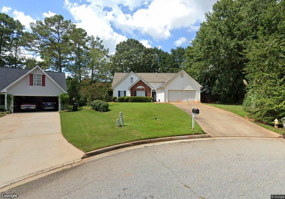
45 Tufts Cir Covington, GA 30016
Estimated Value: $283,202 - $338,000
--
Bed
2
Baths
1,836
Sq Ft
$165/Sq Ft
Est. Value
About This Home
This home is located at 45 Tufts Cir, Covington, GA 30016 and is currently estimated at $302,551, approximately $164 per square foot. 45 Tufts Cir is a home located in Newton County with nearby schools including Live Oak Elementary School, Clements Middle School, and Newton High School.
Ownership History
Date
Name
Owned For
Owner Type
Purchase Details
Closed on
Aug 30, 1999
Sold by
Wilson Carl
Bought by
Jones Jennifer
Current Estimated Value
Home Financials for this Owner
Home Financials are based on the most recent Mortgage that was taken out on this home.
Original Mortgage
$113,900
Outstanding Balance
$33,949
Interest Rate
7.89%
Mortgage Type
FHA
Estimated Equity
$268,602
Purchase Details
Closed on
Mar 24, 1999
Sold by
Manor Dev Inc
Bought by
Wilson Carl
Home Financials for this Owner
Home Financials are based on the most recent Mortgage that was taken out on this home.
Original Mortgage
$86,000
Interest Rate
6.74%
Mortgage Type
New Conventional
Create a Home Valuation Report for This Property
The Home Valuation Report is an in-depth analysis detailing your home's value as well as a comparison with similar homes in the area
Home Values in the Area
Average Home Value in this Area
Purchase History
| Date | Buyer | Sale Price | Title Company |
|---|---|---|---|
| Jones Jennifer | $114,700 | -- | |
| Wilson Carl | $18,000 | -- |
Source: Public Records
Mortgage History
| Date | Status | Borrower | Loan Amount |
|---|---|---|---|
| Open | Jones Jennifer | $113,900 | |
| Previous Owner | Wilson Carl | $86,000 |
Source: Public Records
Tax History Compared to Growth
Tax History
| Year | Tax Paid | Tax Assessment Tax Assessment Total Assessment is a certain percentage of the fair market value that is determined by local assessors to be the total taxable value of land and additions on the property. | Land | Improvement |
|---|---|---|---|---|
| 2024 | $3,141 | $122,440 | $18,000 | $104,440 |
| 2023 | $2,905 | $105,600 | $7,200 | $98,400 |
| 2022 | $2,444 | $88,640 | $7,200 | $81,440 |
| 2021 | $2,257 | $73,120 | $7,200 | $65,920 |
| 2020 | $2,116 | $61,880 | $7,200 | $54,680 |
| 2019 | $2,023 | $58,200 | $7,200 | $51,000 |
| 2018 | $1,891 | $54,000 | $7,200 | $46,800 |
| 2017 | $1,588 | $45,160 | $7,200 | $37,960 |
| 2016 | $1,451 | $41,160 | $5,600 | $35,560 |
| 2015 | $1,399 | $39,640 | $5,600 | $34,040 |
| 2014 | $1,149 | $32,480 | $0 | $0 |
Source: Public Records
Map
Nearby Homes
- 15 Joe Ewing Dr
- 200 Syracuse Ln
- 90 Kirkland Ct
- 105 Queensland Ln
- 814 Jack Neely Rd
- 595 Wisteria Blvd
- 30 Spring Valley Dr
- 30 Capeton Ct
- 185 Stephanie Ln
- 95 Willow Tree Terrace
- 60 Brookstone Ct
- 230 Shiver Blvd
- 280 Hoglen Dr
- 130 Stephanie Ln Unit 5
- 90 Brookstone Ct
- 160 Wisteria Blvd
- 1136 Jack Neely Rd
- 50 Village Walk
- 35 Tufts Cir
- 50 Tufts Cir
- 105 Burdell Dr
- 30 Syracuse Ln
- 95 Burdell Dr
- 20 Syracuse Ln
- 115 Burdell Dr
- 25 Tufts Cir
- 85 Burdell Dr
- 40 Tufts Cir
- 0 Tufts Cir Unit 7341241
- 40 Syracuse Ln
- 65 Princeton Way Unit 2
- 30 Tufts Cir
- 75 Burdell Dr
- 10 Syracuse Ln
- 75 Princeton Way
- 20 Tufts Cir
- 0 Barcelona Dr Unit 48LOTS 7520996
- 0 Barcelona Dr Unit 8952221