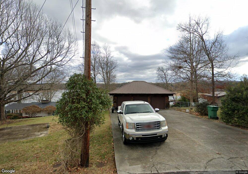
450 Lake Breeze Dr Blountville, TN 37617
Estimated Value: $388,882 - $711,000
3
Beds
3
Baths
2,304
Sq Ft
$243/Sq Ft
Est. Value
About This Home
This home is located at 450 Lake Breeze Dr, Blountville, TN 37617 and is currently estimated at $559,221, approximately $242 per square foot. 450 Lake Breeze Dr is a home located in Sullivan County with nearby schools including Holston Elementary School and Sullivan Central Middle School.
Ownership History
Date
Name
Owned For
Owner Type
Purchase Details
Closed on
Aug 25, 2003
Sold by
David Branson and David Rebecca
Bought by
Guy Eric R
Current Estimated Value
Home Financials for this Owner
Home Financials are based on the most recent Mortgage that was taken out on this home.
Original Mortgage
$120,000
Interest Rate
5.94%
Purchase Details
Closed on
Sep 16, 1994
Sold by
Bissell Michael M
Bought by
Branson David L
Purchase Details
Closed on
Sep 12, 1994
Purchase Details
Closed on
May 21, 1990
Create a Home Valuation Report for This Property
The Home Valuation Report is an in-depth analysis detailing your home's value as well as a comparison with similar homes in the area
Home Values in the Area
Average Home Value in this Area
Purchase History
| Date | Buyer | Sale Price | Title Company |
|---|---|---|---|
| Guy Eric R | $220,000 | -- | |
| Branson David L | -- | -- | |
| -- | $155,000 | -- | |
| -- | $115,000 | -- |
Source: Public Records
Mortgage History
| Date | Status | Borrower | Loan Amount |
|---|---|---|---|
| Closed | -- | $120,000 |
Source: Public Records
Tax History Compared to Growth
Tax History
| Year | Tax Paid | Tax Assessment Tax Assessment Total Assessment is a certain percentage of the fair market value that is determined by local assessors to be the total taxable value of land and additions on the property. | Land | Improvement |
|---|---|---|---|---|
| 2024 | $1,483 | $59,400 | $8,875 | $50,525 |
| 2023 | $1,429 | $59,400 | $8,875 | $50,525 |
| 2022 | $1,429 | $59,400 | $8,875 | $50,525 |
| 2021 | $1,429 | $59,400 | $8,875 | $50,525 |
| 2020 | $1,423 | $59,400 | $8,875 | $50,525 |
| 2019 | $1,423 | $55,375 | $8,875 | $46,500 |
| 2018 | $1,412 | $55,375 | $8,875 | $46,500 |
| 2017 | $1,412 | $55,375 | $8,875 | $46,500 |
| 2016 | $1,377 | $53,450 | $8,875 | $44,575 |
| 2014 | -- | $53,450 | $0 | $0 |
Source: Public Records
Map
Nearby Homes
- 780 Hamilton Rd Unit 6
- 780 Hamilton Rd Unit I-4
- 225 Forest Ln N
- 112 Cardinal Point
- 145 Grande Harbor Way
- 164 Forest Ln N
- 290 Candy Creek Private Dr
- 156 Forest Ln N
- 205 Forest Ct
- 148 Forest Ln S
- 205 Grande Harbor Way
- 191 Grande Harbor Way
- 1033 Haw Ridge Rd
- 341 Haw Ridge Rd E
- 412 Haw Ridge Rd E
- 129 Forest Ln N
- 295 Brown Cir
- 239 Brown Cir
- TBD Haw Ridge Rd
- Tbd Yoakley Rd
- 456 Lake Breeze Dr
- 444 Lake Breeze Dr
- 458 Lake Breeze Dr
- 438 Lake Breeze Dr
- 462 Lake Breeze Dr
- 424 Lake Breeze Dr
- 468 Lake Breeze Dr
- 461 Hamilton Dr
- 418 Lake Breeze Dr
- 418 Lake Breeze Dr
- 474 Lake Breeze Dr
- 482 Lake Breeze Dr
- 408 Lake Breeze Dr
- 428 Hamilton Dr
- 421 Hamilton Dr
- 788 Hamilton Rd
- 404 Hamilton Dr
- 398 Hamilton Dr
- 388 Hamilton Dr
- 245 Forest Ln N