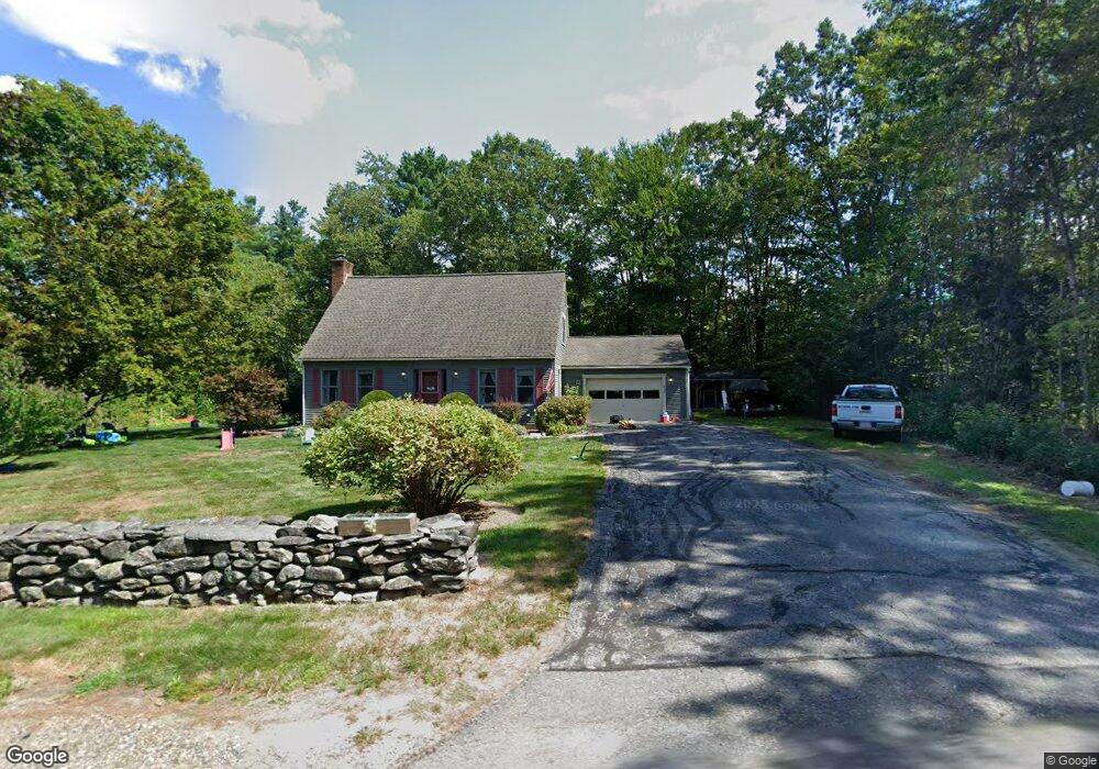
450 River Rd New Ipswich, NH 03071
Estimated Value: $469,467 - $522,000
3
Beds
2
Baths
2,270
Sq Ft
$216/Sq Ft
Est. Value
About This Home
This home is located at 450 River Rd, New Ipswich, NH 03071 and is currently estimated at $491,117, approximately $216 per square foot. 450 River Rd is a home with nearby schools including Highbridge Hill Elementary School, Boynton Middle School, and Mascenic Regional High School.
Ownership History
Date
Name
Owned For
Owner Type
Purchase Details
Closed on
Feb 3, 2022
Sold by
Celia A Koski T A and Celia Jacobson
Bought by
Colameta Joseph G and Koski-Klein Arianne T
Current Estimated Value
Home Financials for this Owner
Home Financials are based on the most recent Mortgage that was taken out on this home.
Original Mortgage
$332,500
Outstanding Balance
$307,180
Interest Rate
3.45%
Mortgage Type
Purchase Money Mortgage
Estimated Equity
$183,937
Create a Home Valuation Report for This Property
The Home Valuation Report is an in-depth analysis detailing your home's value as well as a comparison with similar homes in the area
Home Values in the Area
Average Home Value in this Area
Purchase History
| Date | Buyer | Sale Price | Title Company |
|---|---|---|---|
| Colameta Joseph G | $350,000 | None Available |
Source: Public Records
Mortgage History
| Date | Status | Borrower | Loan Amount |
|---|---|---|---|
| Open | Colameta Joseph G | $332,500 |
Source: Public Records
Tax History Compared to Growth
Tax History
| Year | Tax Paid | Tax Assessment Tax Assessment Total Assessment is a certain percentage of the fair market value that is determined by local assessors to be the total taxable value of land and additions on the property. | Land | Improvement |
|---|---|---|---|---|
| 2024 | $6,651 | $437,000 | $105,700 | $331,300 |
| 2023 | $6,358 | $247,400 | $56,500 | $190,900 |
| 2022 | $5,816 | $247,400 | $56,500 | $190,900 |
| 2021 | $5,497 | $247,400 | $56,500 | $190,900 |
| 2020 | $5,257 | $247,400 | $56,500 | $190,900 |
| 2019 | $5,376 | $247,400 | $56,500 | $190,900 |
| 2018 | $4,922 | $201,200 | $50,500 | $150,700 |
| 2017 | $4,872 | $201,200 | $50,500 | $150,700 |
| 2016 | $5,277 | $201,200 | $50,500 | $150,700 |
| 2015 | $5,615 | $201,200 | $50,500 | $150,700 |
| 2014 | $5,577 | $201,200 | $50,500 | $150,700 |
| 2013 | $4,975 | $222,300 | $75,600 | $146,700 |
Source: Public Records
Map
Nearby Homes
- 31 Cascade Dr Unit 31
- 103 Smithville Rd
- 230 Old Country Rd
- 63 Taylor Rd
- 780 Ashby Rd
- 306 Turnpike Rd
- 27 Westbrook Dr
- 00 Turnpike Rd
- 36 Mill St
- 18 Westbrook Dr
- 545 Turnpike Rd
- 25 Jalen Rd
- 5 Ashby Rd
- 23 Greenbriar Rd
- 811 Turnpike Rd
- 359 Poor Farm Rd
- 00 Greenville Rd
- 74 Wright Rd
- 66 Wellington Rd
- 602 Fitchburg Rd Unit lot 19
- 478 Ashby Rd
- 445 River Rd
- 12 River Rd
- Lot 13-29 Ashburnham Rd
- 29 Ashburnham Rd Unit 13
- 486 Ashby Rd
- 0 Ashburnham Rd
- 0 Ashburnham Rd Unit 13-0-34 4974595
- 0 Ashburnham Rd Unit 4911796
- 0 Ashburnham Rd Unit 4788964
- 0 Ashburnham Rd Unit 4417225
- 9 Ashburnham Rd
- 459 Ashby Rd
- 431 River Rd
- 0 Ashby Rd
- 12-48-1 Ashby Rd
- 00 Ashby Rd
- 0 Mountain View Dr Unit 4473913
- 16 Ashburnham Rd
- 415 River Rd