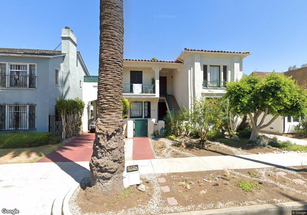
450 S Palm Dr Beverly Hills, CA 90212
Estimated Value: $2,661,000 - $3,739,000
3
Beds
4
Baths
2,958
Sq Ft
$1,053/Sq Ft
Est. Value
About This Home
This home is located at 450 S Palm Dr, Beverly Hills, CA 90212 and is currently estimated at $3,116,116, approximately $1,053 per square foot. 450 S Palm Dr is a home located in Los Angeles County with nearby schools including Beverly Vista Elementary School, Beverly Hills High School, and Harkham Hillel Hebrew Academy.
Ownership History
Date
Name
Owned For
Owner Type
Purchase Details
Closed on
Dec 30, 2014
Sold by
Peskin Gary
Bought by
Peskin Sandra
Current Estimated Value
Purchase Details
Closed on
Dec 19, 2014
Sold by
Peskin Gary
Bought by
Peskin Gary and Joseph Peskin Survivors Trust
Purchase Details
Closed on
Feb 9, 1994
Sold by
Peskin Joseph and Peskin Mildred
Bought by
Peskin Joseph
Purchase Details
Closed on
Oct 1, 1993
Sold by
Peskin Joseph and Peskin Mildred
Bought by
Peskin Joseph
Home Financials for this Owner
Home Financials are based on the most recent Mortgage that was taken out on this home.
Original Mortgage
$386,000
Interest Rate
6.98%
Create a Home Valuation Report for This Property
The Home Valuation Report is an in-depth analysis detailing your home's value as well as a comparison with similar homes in the area
Home Values in the Area
Average Home Value in this Area
Purchase History
| Date | Buyer | Sale Price | Title Company |
|---|---|---|---|
| Peskin Sandra | -- | None Available | |
| Peskin Gary | -- | None Available | |
| Peskin Joseph | -- | -- | |
| Peskin Joseph | -- | Investors Title Company |
Source: Public Records
Mortgage History
| Date | Status | Borrower | Loan Amount |
|---|---|---|---|
| Previous Owner | Peskin Joseph | $386,000 |
Source: Public Records
Tax History Compared to Growth
Tax History
| Year | Tax Paid | Tax Assessment Tax Assessment Total Assessment is a certain percentage of the fair market value that is determined by local assessors to be the total taxable value of land and additions on the property. | Land | Improvement |
|---|---|---|---|---|
| 2025 | $12,416 | $1,018,517 | $887,642 | $130,875 |
| 2024 | $12,416 | $998,547 | $870,238 | $128,309 |
| 2023 | $12,202 | $978,969 | $853,175 | $125,794 |
| 2022 | $11,859 | $959,775 | $836,447 | $123,328 |
| 2021 | $11,495 | $940,957 | $820,047 | $120,910 |
| 2019 | $11,169 | $913,050 | $795,725 | $117,325 |
| 2018 | $10,664 | $895,148 | $780,123 | $115,025 |
| 2016 | $10,195 | $860,390 | $749,831 | $110,559 |
| 2015 | $9,688 | $847,467 | $738,568 | $108,899 |
| 2014 | $9,381 | $830,867 | $724,101 | $106,766 |
Source: Public Records
Map
Nearby Homes
- 462 S Maple Dr Unit 104 PH
- 437 S Doheny Dr
- 423 S Rexford Dr Unit 106
- 423 S Rexford Dr Unit 202
- 361 S Doheny Dr
- 1115 S Elm Dr Unit 401
- 1115 S Elm Dr Unit 207
- 1115 S Elm Dr Unit 301
- 1115 S Elm Dr Unit 417
- 370 S Elm Dr Unit 2
- 9049 Alcott St Unit 204
- 344 S Elm Dr
- 1115 S La Peer Dr
- 324 Rexford Dr
- 1114 S La Peer Dr
- 434 S Canon Dr Unit 202
- 149 -159 S Maple Dr
- 1220 Smithwood Dr
- 272 S Doheny Dr Unit 1
- 1450 S Beverly Dr Unit 105
- 450 S Palm Dr Unit 207
- 450 S Palm Dr Unit 407
- 450 S Palm Dr Unit 306
- 450 S Palm Dr Unit 206
- 450 S Palm Dr Unit 507
- 450 S Palm Dr Unit 406
- 450 S Palm Dr Unit 307
- 450 S Palm Dr Unit 506
- 454 S Palm Dr
- 446 S Palm Dr
- 442 S Palm Dr Unit 442 C
- 458 S Palm Dr
- 451 S Oakhurst Dr Unit 6
- 451 S Oakhurst Dr Unit 3
- 451 S Oakhurst Dr
- 451 S Oakhurst Dr Unit 7
- 443 S Oakhurst Dr Unit 107
- 443 S Oakhurst Dr Unit 206
- 443 S Oakhurst Dr
- 443 S Oakhurst Dr Unit 103