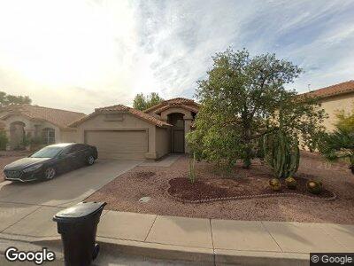
450 S Quail Ln Gilbert, AZ 85233
Downtown Gilbert NeighborhoodEstimated Value: $394,268 - $462,000
--
Bed
2
Baths
1,378
Sq Ft
$313/Sq Ft
Est. Value
About This Home
This home is located at 450 S Quail Ln, Gilbert, AZ 85233 and is currently estimated at $431,567, approximately $313 per square foot. 450 S Quail Ln is a home located in Maricopa County with nearby schools including Gilbert Elementary School, Mesquite Junior High School, and Mesquite High School.
Ownership History
Date
Name
Owned For
Owner Type
Purchase Details
Closed on
Sep 22, 2003
Sold by
Williams Cresson H
Bought by
Madison Michael J
Current Estimated Value
Home Financials for this Owner
Home Financials are based on the most recent Mortgage that was taken out on this home.
Original Mortgage
$113,600
Interest Rate
6.17%
Mortgage Type
New Conventional
Purchase Details
Closed on
Mar 19, 2002
Sold by
Kettler Kurt A and Kettler Lisa A
Bought by
Williams Cresson H
Home Financials for this Owner
Home Financials are based on the most recent Mortgage that was taken out on this home.
Original Mortgage
$99,750
Interest Rate
6.85%
Mortgage Type
New Conventional
Purchase Details
Closed on
Oct 31, 1994
Sold by
Lokerse Linda E
Bought by
Roehrs Don P and Stjohn Kathleen Ann
Create a Home Valuation Report for This Property
The Home Valuation Report is an in-depth analysis detailing your home's value as well as a comparison with similar homes in the area
Home Values in the Area
Average Home Value in this Area
Purchase History
| Date | Buyer | Sale Price | Title Company |
|---|---|---|---|
| Madison Michael J | $142,000 | First American Title Ins Co | |
| Williams Cresson H | $133,000 | Century Title Agency Inc | |
| Roehrs Don P | -- | -- | |
| Lokerse Linda E | -- | -- |
Source: Public Records
Mortgage History
| Date | Status | Borrower | Loan Amount |
|---|---|---|---|
| Open | Madison Michael J | $142,400 | |
| Closed | Madison Michael J | $100,000 | |
| Closed | Madison Michael J | $113,600 | |
| Previous Owner | Williams Cresson H | $99,750 |
Source: Public Records
Tax History Compared to Growth
Tax History
| Year | Tax Paid | Tax Assessment Tax Assessment Total Assessment is a certain percentage of the fair market value that is determined by local assessors to be the total taxable value of land and additions on the property. | Land | Improvement |
|---|---|---|---|---|
| 2025 | $1,387 | $18,964 | -- | -- |
| 2024 | $1,395 | $18,061 | -- | -- |
| 2023 | $1,395 | $31,400 | $6,280 | $25,120 |
| 2022 | $1,354 | $23,530 | $4,700 | $18,830 |
| 2021 | $1,431 | $22,480 | $4,490 | $17,990 |
| 2020 | $1,406 | $21,150 | $4,230 | $16,920 |
| 2019 | $1,293 | $18,470 | $3,690 | $14,780 |
| 2018 | $1,256 | $17,070 | $3,410 | $13,660 |
| 2017 | $1,213 | $15,650 | $3,130 | $12,520 |
| 2016 | $1,248 | $14,980 | $2,990 | $11,990 |
| 2015 | $1,142 | $13,700 | $2,740 | $10,960 |
Source: Public Records
Map
Nearby Homes
- 626 W Catclaw St
- 510 S Saddle St
- 686 W Sereno Dr
- 556 W Sagebrush St
- 515 W Smoke Tree Rd
- 826 W Royal Palms Dr
- 659 S Dodge St
- 662 S Saddle St
- 821 W Sun Coast Dr
- 844 W Emerald Island Dr
- 605 S Monterey St
- 714 W Mesquite St
- 418 W Sagebrush St
- 824 W Mesquite St
- 510 W Amoroso Dr
- 862 W Rawhide Ave
- 854 W Mesquite St
- 1022 W Calypso Ct
- 343 S Cholla St
- 234 S Neely St
- 450 S Quail Ln
- 502 S Quail Ln
- 442 S Quail Ln
- 501 S Abilene Dr
- 510 S Quail Ln
- 509 S Abilene Dr
- 657 W Smoke Tree Rd
- 642 W Sagebrush St
- 708 W Sagebrush St
- 517 S Abilene Dr
- 649 W Smoke Tree Rd
- 518 S Quail Ln
- 665 W Smoke Tree Rd
- 649 W Sagebrush St
- 634 W Sagebrush St
- 717 W Sagebrush St
- 525 S Abilene Dr
- 716 W Sagebrush St
- 641 W Sagebrush St
- 709 W Smoke Tree Rd