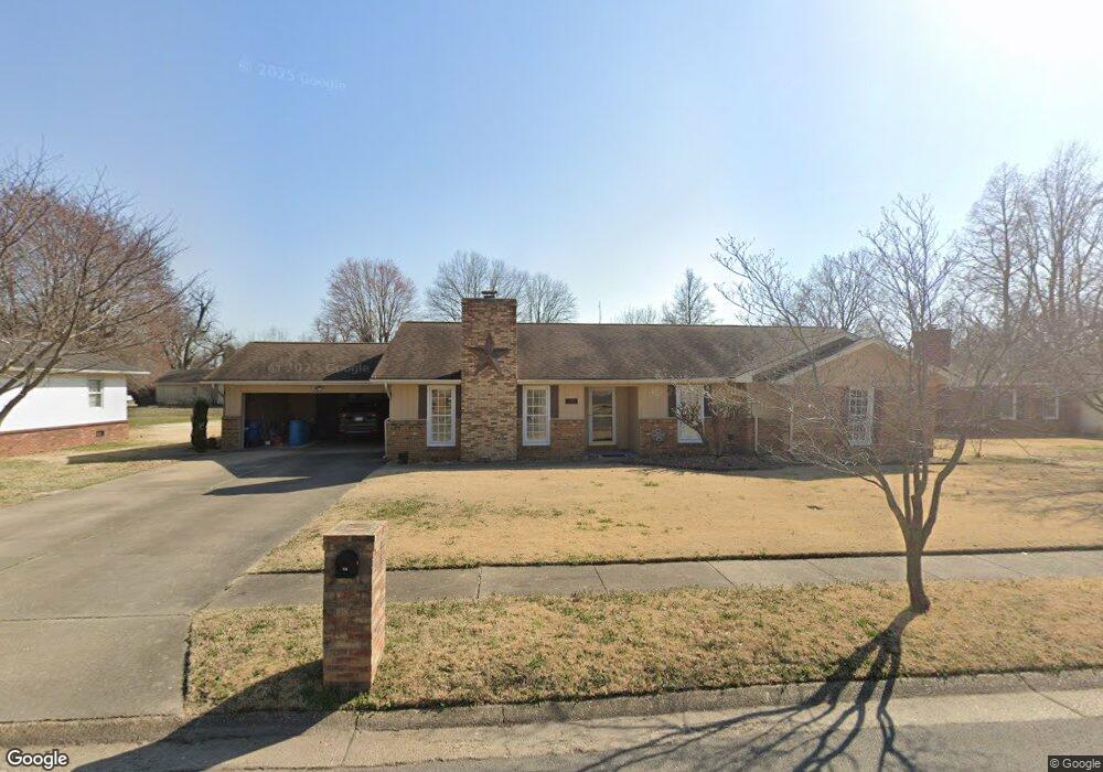
450 Saint Peter Dr New Madrid, MO 63869
Estimated Value: $143,000 - $272,000
3
Beds
1
Bath
2,089
Sq Ft
$100/Sq Ft
Est. Value
About This Home
This home is located at 450 Saint Peter Dr, New Madrid, MO 63869 and is currently estimated at $208,482, approximately $99 per square foot. 450 Saint Peter Dr is a home with nearby schools including Central High School and Immaculate Conception School.
Ownership History
Date
Name
Owned For
Owner Type
Purchase Details
Closed on
Mar 3, 2020
Sold by
Wade Mark Lesley and Wade Sherrie Lynne
Bought by
Roberts Michael L and Roberts Paula G
Current Estimated Value
Home Financials for this Owner
Home Financials are based on the most recent Mortgage that was taken out on this home.
Original Mortgage
$100,000
Outstanding Balance
$49,463
Interest Rate
3.6%
Mortgage Type
New Conventional
Estimated Equity
$159,019
Create a Home Valuation Report for This Property
The Home Valuation Report is an in-depth analysis detailing your home's value as well as a comparison with similar homes in the area
Home Values in the Area
Average Home Value in this Area
Purchase History
| Date | Buyer | Sale Price | Title Company |
|---|---|---|---|
| Roberts Michael L | -- | Semo Title |
Source: Public Records
Mortgage History
| Date | Status | Borrower | Loan Amount |
|---|---|---|---|
| Open | Roberts Michael L | $100,000 |
Source: Public Records
Tax History
| Year | Tax Paid | Tax Assessment Tax Assessment Total Assessment is a certain percentage of the fair market value that is determined by local assessors to be the total taxable value of land and additions on the property. | Land | Improvement |
|---|---|---|---|---|
| 2024 | $1,192 | $23,000 | $1,700 | $21,300 |
| 2023 | $1,195 | $23,000 | $0 | $0 |
| 2022 | $1,117 | $21,600 | $1,700 | $19,900 |
| 2021 | $1,115 | $21,600 | $0 | $0 |
| 2020 | $1,061 | $21,600 | $0 | $0 |
| 2019 | $1,061 | $20,400 | $1,600 | $18,800 |
| 2018 | $1,025 | $19,720 | $0 | $0 |
| 2017 | $1,015 | $19,720 | $0 | $0 |
| 2016 | -- | $19,720 | $0 | $0 |
| 2015 | -- | $19,720 | $0 | $0 |
| 2014 | -- | $19,720 | $0 | $0 |
Source: Public Records
Map
Nearby Homes
- 470 Saint Paul Dr
- 950 2nd St
- 22 Greenbriar Dr
- 101 Saint Matthew Ln
- 340 Semo Dr
- 931 Davis St
- 2 Amanda Dr
- 122 E Lewis St
- 601 State Hwy W
- 601 State Route W
- 0 Highway P Unit MIS25062383
- Island *
- 209 Kell Rd
- 0 Island 8
- 0 County Road 714
- 0 County Road 314
- 103 N Calvin St
- 100 Summit St
- 0 County Road 706
- 226 Sandy Ln
- 430 Saint Peter Dr
- 475 Saint Paul Dr
- 485 Saint Peter Dr
- 485 Saint Paul Dr
- 465 Saint Peter Dr
- 455 Saint Paul Dr
- 420 Saint Peter Dr
- 490 Saint Peter Dr
- 435 Saint Paul Dr
- 495 Saint Paul Dr
- 495 Saint Peter Dr
- 470 Saint Lawrence Dr
- 425 Saint Paul Dr
- 490 Saint Paul Dr
- 450 Saint Lawrence Dr
- 400 Saint Peter Dr
- 490 Saint Lawrence Dr
- 510 Saint Peter Dr
- 501 Saint Paul Dr
- 501 Saint Peter Dr