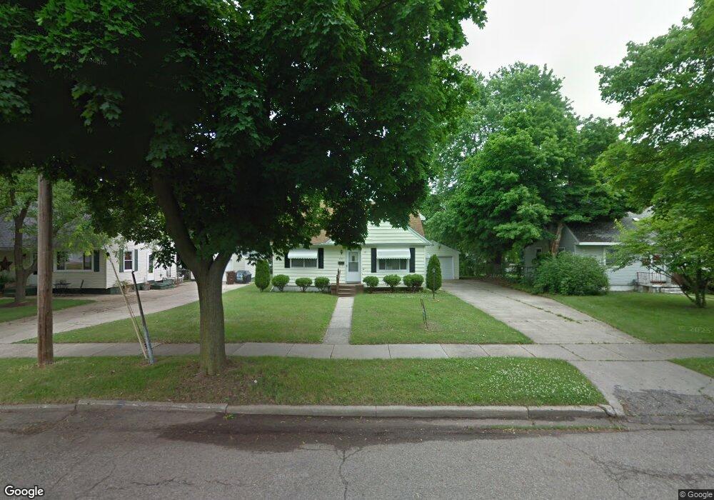
4501 Devonshire Ave Lansing, MI 48910
Old Everett NeighborhoodEstimated Value: $164,103 - $182,000
2
Beds
2
Baths
1,450
Sq Ft
$120/Sq Ft
Est. Value
About This Home
This home is located at 4501 Devonshire Ave, Lansing, MI 48910 and is currently estimated at $174,276, approximately $120 per square foot. 4501 Devonshire Ave is a home located in Ingham County with nearby schools including Kendon School, Attwood School, and Everett High School.
Ownership History
Date
Name
Owned For
Owner Type
Purchase Details
Closed on
Jan 28, 2010
Sold by
Gervais Geraldine
Bought by
Bac Home Loans Servicing Lp
Current Estimated Value
Purchase Details
Closed on
Jul 28, 2004
Sold by
Barnes Leone S
Bought by
Gervais Geraldine
Home Financials for this Owner
Home Financials are based on the most recent Mortgage that was taken out on this home.
Original Mortgage
$96,800
Interest Rate
6.34%
Mortgage Type
New Conventional
Purchase Details
Closed on
Jul 7, 2004
Sold by
Swix Cheryl Darlene
Bought by
Barnes Leone S
Home Financials for this Owner
Home Financials are based on the most recent Mortgage that was taken out on this home.
Original Mortgage
$96,800
Interest Rate
6.34%
Mortgage Type
New Conventional
Create a Home Valuation Report for This Property
The Home Valuation Report is an in-depth analysis detailing your home's value as well as a comparison with similar homes in the area
Home Values in the Area
Average Home Value in this Area
Purchase History
| Date | Buyer | Sale Price | Title Company |
|---|---|---|---|
| Bac Home Loans Servicing Lp | $88,000 | None Available | |
| Gervais Geraldine | $121,000 | Metropolitan Title Company | |
| Barnes Leone S | -- | -- |
Source: Public Records
Mortgage History
| Date | Status | Borrower | Loan Amount |
|---|---|---|---|
| Previous Owner | Gervais Geraldine | $96,800 |
Source: Public Records
Tax History
| Year | Tax Paid | Tax Assessment Tax Assessment Total Assessment is a certain percentage of the fair market value that is determined by local assessors to be the total taxable value of land and additions on the property. | Land | Improvement |
|---|---|---|---|---|
| 2025 | $2,945 | $71,300 | $12,900 | $58,400 |
| 2024 | $23 | $69,000 | $12,900 | $56,100 |
| 2023 | $2,761 | $61,700 | $12,900 | $48,800 |
| 2022 | $2,490 | $56,800 | $12,200 | $44,600 |
| 2021 | $2,438 | $53,000 | $7,600 | $45,400 |
| 2020 | $2,423 | $48,800 | $7,600 | $41,200 |
| 2019 | $2,322 | $47,400 | $7,600 | $39,800 |
| 2018 | $2,177 | $42,900 | $7,600 | $35,300 |
| 2017 | $2,084 | $42,900 | $7,600 | $35,300 |
| 2016 | $1,993 | $38,900 | $7,600 | $31,300 |
| 2015 | $1,993 | $37,200 | $15,276 | $21,924 |
| 2014 | $1,993 | $35,600 | $11,147 | $24,453 |
Source: Public Records
Map
Nearby Homes
- 1101 Kendon Dr
- 4719 S Pennsylvania Ave
- 4815 S Pennsylvania Ave
- 0 Glenwood Ave
- 4806 Lyncott Dr
- 810 Fenton St
- 801 Jessop Ave
- 817 Jessop Ave
- 3907 Glenwood Ave
- 1109 Barr Ave
- 709 Jessop Ave
- 629 Emily Ave
- 600 E Cavanaugh Rd
- 1115 Shirley St
- 705 Hunter Blvd
- 601 Jessop Ave
- 3533 Glenwood Ave
- 3603 Parkway Dr
- 522 E Cavanaugh Rd
- 2018 Worden St
- 4427 Devonshire Ave
- 4507 Devonshire Ave
- 4515 Devonshire Ave
- 4421 Devonshire Ave
- 4500 Devonshire Ave
- 4420 Devonshire Ave
- 1114 Samantha Ave
- 4519 Devonshire Ave
- 4512 Devonshire Ave
- 1115 Samantha Ave
- 4409 Devonshire Ave
- 4518 Devonshire Ave
- 1106 Samantha Ave
- 4525 Devonshire Ave
- 1109 Samantha Ave
- 4524 Devonshire Ave
- 4515 Alpha St
- 4501 Alpha St
- 4401 Devonshire Ave
- 4601 Devonshire Ave
Your Personal Tour Guide
Ask me questions while you tour the home.