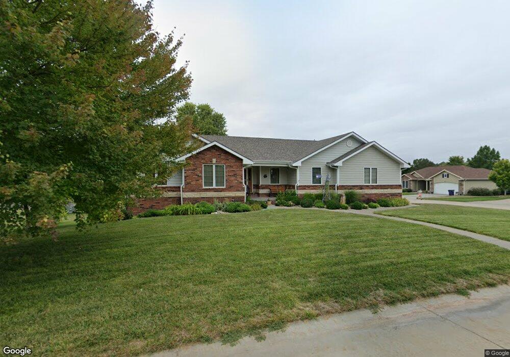
4501 Kelsey Dr Manhattan, KS 66502
Estimated Value: $339,000 - $388,000
5
Beds
3
Baths
1,454
Sq Ft
$247/Sq Ft
Est. Value
About This Home
This home is located at 4501 Kelsey Dr, Manhattan, KS 66502 and is currently estimated at $358,424, approximately $246 per square foot. 4501 Kelsey Dr is a home located in Pottawatomie County with nearby schools including Woodrow Wilson Elementary School, Dwight D. Eisenhower Middle School, and Manhattan High School.
Ownership History
Date
Name
Owned For
Owner Type
Purchase Details
Closed on
Aug 29, 2012
Sold by
Schartz Barry L and Schartz Charlotte K
Bought by
Charlotte K Schartz Revocable Living Tru
Current Estimated Value
Purchase Details
Closed on
Aug 24, 2012
Sold by
Schartz Barry L and Schartz Charlotte K
Bought by
Barry L Schartz Revocable Living Trust
Purchase Details
Closed on
Oct 20, 2011
Sold by
Schartz Barry L and Schartz Charlotte K
Bought by
Charlotte K Schartz Revocable Living Tru
Create a Home Valuation Report for This Property
The Home Valuation Report is an in-depth analysis detailing your home's value as well as a comparison with similar homes in the area
Home Values in the Area
Average Home Value in this Area
Purchase History
| Date | Buyer | Sale Price | Title Company |
|---|---|---|---|
| Charlotte K Schartz Revocable Living Tru | -- | None Available | |
| Barry L Schartz Revocable Living Trust | -- | None Available | |
| Charlotte K Schartz Revocable Living Tru | -- | None Available |
Source: Public Records
Tax History Compared to Growth
Tax History
| Year | Tax Paid | Tax Assessment Tax Assessment Total Assessment is a certain percentage of the fair market value that is determined by local assessors to be the total taxable value of land and additions on the property. | Land | Improvement |
|---|---|---|---|---|
| 2025 | $3,371 | $36,191 | $3,809 | $32,382 |
| 2024 | $34 | $35,113 | $3,874 | $31,239 |
| 2023 | $3,481 | $34,494 | $3,818 | $30,676 |
| 2022 | $2,839 | $30,257 | $3,736 | $26,521 |
| 2021 | $2,839 | $28,016 | $3,598 | $24,418 |
| 2020 | $2,839 | $27,849 | $3,598 | $24,251 |
| 2019 | $2,930 | $28,360 | $3,460 | $24,900 |
| 2018 | $2,847 | $28,332 | $3,181 | $25,151 |
| 2017 | $2,697 | $27,400 | $2,906 | $24,494 |
| 2016 | $2,615 | $27,048 | $2,804 | $24,244 |
| 2015 | -- | $26,853 | $3,059 | $23,794 |
| 2014 | -- | $27,588 | $3,269 | $24,319 |
Source: Public Records
Map
Nearby Homes
- 6100 Tumbleweed Terrace
- 4098 Tyler Ct
- 4658 Pierce Dr
- 4314 Aspen Dr
- 4319 Aspen Dr
- 9168 Dave Dr
- 4105 Tyler Ct
- 9176 Dave Dr
- 4852 Nature Ave
- 4860 Nature Ave
- 4884 Nature Ave
- 4881 Nature Ave
- 4876 Nature Ave
- 4665 Sunflower Slope Dr
- 8739 Eagles Landing Dr
- 4116 Eagle Valley Dr
- 8796 N Kelliann Way
- 8746 S Kelliann Way
- Matthew Plan at Nelson Ridge
- Madeline Plan at Nelson Ridge
- 6126 Brookes Way
- 4505 Kelsey Dr
- 4405 Kelsey Dr
- 4502 Kelsey Dr
- 6130 Brooks Way
- 6130 Brookes Way
- 4509 Kelsey Dr
- 4408 Kelsey Dr
- 4506 Kelsey Dr
- 9070 Tonya Terrace
- 9074 Tonya Terrace
- 6129 Brookes Way
- 4404 Kelsey Dr
- 4513 Kelsey Dr
- 6134 Brookes Way
- 6122 Tumbleweed Terrace
- 6126 Tumbleweed Terrace
- 6135 Brookes Way
- 4510 Kelsey Dr
- 4019 Coachman Rd