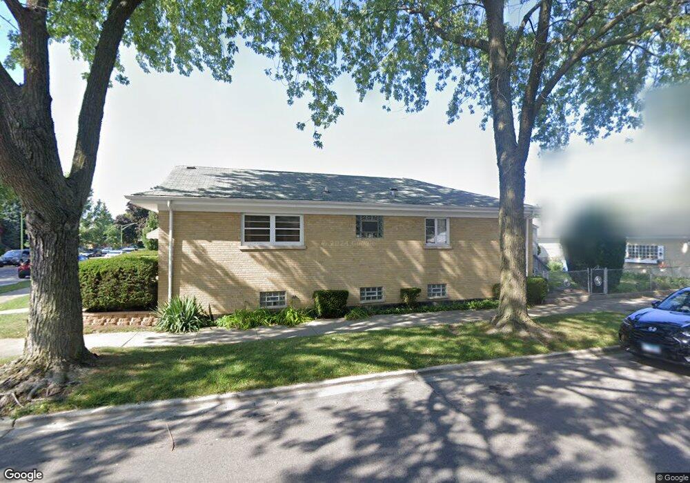
4501 N Mulligan Ave Chicago, IL 60630
Jefferson Park NeighborhoodEstimated Value: $334,000 - $534,000
3
Beds
1
Bath
1,092
Sq Ft
$372/Sq Ft
Est. Value
About This Home
This home is located at 4501 N Mulligan Ave, Chicago, IL 60630 and is currently estimated at $405,678, approximately $371 per square foot. 4501 N Mulligan Ave is a home located in Cook County with nearby schools including Smyser Elementary School, Taft High School, and St. Robert Bellarmine Catholic School.
Ownership History
Date
Name
Owned For
Owner Type
Purchase Details
Closed on
Oct 24, 2018
Sold by
Holda Fleck Marilyn
Bought by
Holda Barbara J
Current Estimated Value
Purchase Details
Closed on
Feb 9, 2015
Sold by
Holda Barbara Jean
Bought by
Holda Thomas M
Purchase Details
Closed on
Jan 20, 2004
Sold by
Holda Theodore J and Holda Dorothy
Bought by
Holda Theodore J and Holda Dorothy
Create a Home Valuation Report for This Property
The Home Valuation Report is an in-depth analysis detailing your home's value as well as a comparison with similar homes in the area
Home Values in the Area
Average Home Value in this Area
Purchase History
| Date | Buyer | Sale Price | Title Company |
|---|---|---|---|
| Holda Barbara J | -- | None Available | |
| Holda Barbara J | -- | Attorney | |
| Holda Thomas M | -- | None Available | |
| Holda Theodore J | -- | Tower City Title Agency Inc |
Source: Public Records
Tax History Compared to Growth
Tax History
| Year | Tax Paid | Tax Assessment Tax Assessment Total Assessment is a certain percentage of the fair market value that is determined by local assessors to be the total taxable value of land and additions on the property. | Land | Improvement |
|---|---|---|---|---|
| 2024 | $5,419 | $30,000 | $15,057 | $14,943 |
| 2023 | $5,261 | $29,000 | $12,046 | $16,954 |
| 2022 | $5,261 | $29,000 | $12,046 | $16,954 |
| 2021 | $5,162 | $28,999 | $12,045 | $16,954 |
| 2020 | $4,527 | $23,425 | $5,377 | $18,048 |
| 2019 | $4,599 | $26,321 | $5,377 | $20,944 |
| 2018 | $4,521 | $26,321 | $5,377 | $20,944 |
| 2017 | $4,113 | $22,480 | $4,732 | $17,748 |
| 2016 | $4,002 | $22,480 | $4,732 | $17,748 |
| 2015 | $3,639 | $22,480 | $4,732 | $17,748 |
| 2014 | $4,328 | $23,325 | $4,302 | $19,023 |
| 2013 | $4,242 | $23,325 | $4,302 | $19,023 |
Source: Public Records
Map
Nearby Homes
- 4526 N Mobile Ave
- 4433 N Narragansett Ave
- 4518 N Merrimac Ave
- 4544 N Mulligan Ave
- 4447 N Merrimac Ave
- 4546 N Merrimac Ave
- 4442 N Melvina Ave
- 4567 N Merrimac Ave
- 6450 W Montrose Ave
- 4305 N Mobile Ave
- 6519 W Forest Preserve Ave
- 6352 W Giddings St
- 6248 W Berteau Ave
- 6137 W Giddings St
- 4533 N Mcvicker Ave
- 6450 W Berteau Ave Unit 201
- 4345 N Mcvicker Ave
- 6316 W Lawrence Ave
- 6228 W Lawrence Ave
- 4517 N Austin Ave
- 4505 N Mulligan Ave
- 4509 N Mulligan Ave
- 4511 N Mulligan Ave
- 4457 N Mulligan Ave
- 4515 N Mulligan Ave
- 4453 N Mulligan Ave
- 4500 N Mobile Ave
- 4504 N Mobile Ave
- 4506 N Mobile Ave
- 4519 N Mulligan Ave
- 4510 N Mobile Ave
- 4449 N Mulligan Ave
- 4456 N Mobile Ave
- 4500 N Mulligan Ave
- 4504 N Mulligan Ave
- 4514 N Mobile Ave
- 4521 N Mulligan Ave
- 4508 N Mulligan Ave
- 4452 N Mobile Ave
- 4510 N Mulligan Ave