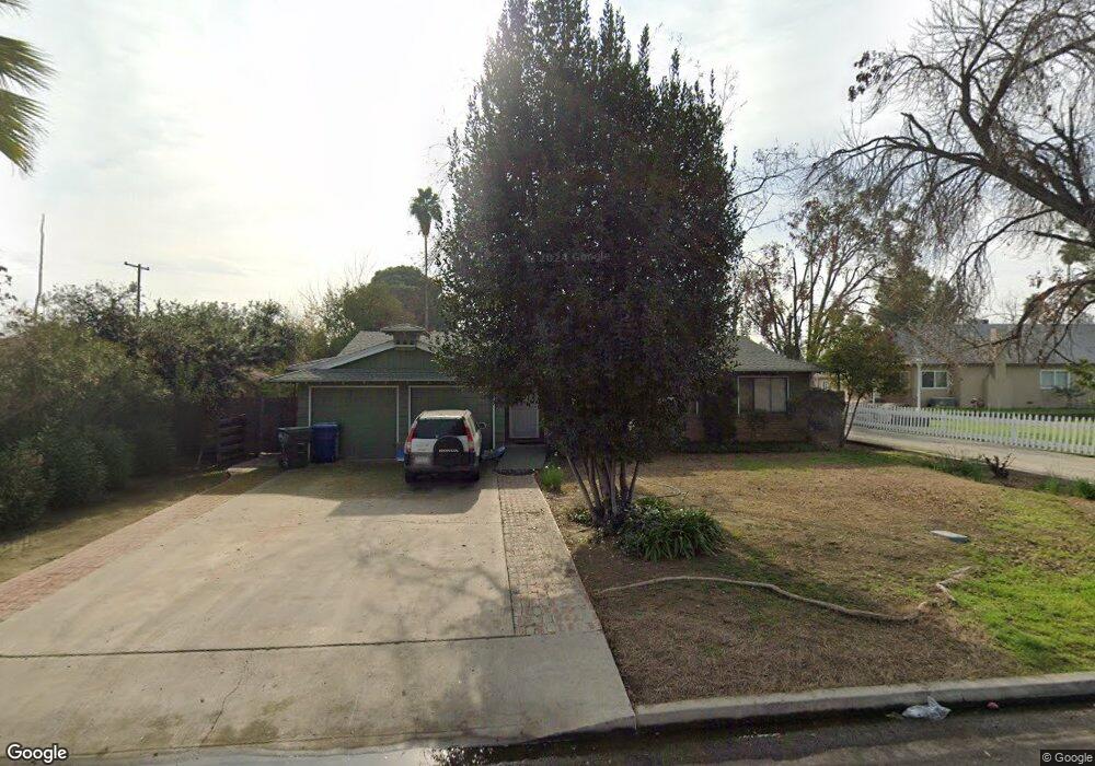
4507 Fishering Dr Bakersfield, CA 93309
Southwest Bakersfield NeighborhoodEstimated Value: $260,301 - $294,000
3
Beds
1
Bath
1,220
Sq Ft
$229/Sq Ft
Est. Value
About This Home
This home is located at 4507 Fishering Dr, Bakersfield, CA 93309 and is currently estimated at $279,575, approximately $229 per square foot. 4507 Fishering Dr is a home located in Kern County with nearby schools including Munsey Elementary School, Curran Middle School, and West High School.
Ownership History
Date
Name
Owned For
Owner Type
Purchase Details
Closed on
Apr 7, 2015
Sold by
Foster Stephanie Suzanne
Bought by
Stephanie Suzanne Foster Irrevocable Hou
Current Estimated Value
Purchase Details
Closed on
Jan 26, 2000
Sold by
Gail Cannon Tyler J and Gail Juanita
Bought by
Foster Stephanie Suzanne
Home Financials for this Owner
Home Financials are based on the most recent Mortgage that was taken out on this home.
Original Mortgage
$76,380
Outstanding Balance
$24,714
Interest Rate
7.87%
Mortgage Type
FHA
Estimated Equity
$254,861
Purchase Details
Closed on
Dec 11, 1994
Sold by
Cannon Armogene
Bought by
Cannon Tyler J and Cannon Juanita Gail
Home Financials for this Owner
Home Financials are based on the most recent Mortgage that was taken out on this home.
Original Mortgage
$45,000
Interest Rate
8.12%
Create a Home Valuation Report for This Property
The Home Valuation Report is an in-depth analysis detailing your home's value as well as a comparison with similar homes in the area
Home Values in the Area
Average Home Value in this Area
Purchase History
| Date | Buyer | Sale Price | Title Company |
|---|---|---|---|
| Stephanie Suzanne Foster Irrevocable Hou | -- | None Available | |
| Foster Stephanie Suzanne | $80,000 | Fidelity National Title Co | |
| Cannon Tyler J | $75,000 | First American Title Ins Co |
Source: Public Records
Mortgage History
| Date | Status | Borrower | Loan Amount |
|---|---|---|---|
| Open | Foster Stephanie Suzanne | $76,380 | |
| Previous Owner | Cannon Tyler J | $45,000 | |
| Closed | Foster Stephanie Suzanne | $4,491 |
Source: Public Records
Tax History Compared to Growth
Tax History
| Year | Tax Paid | Tax Assessment Tax Assessment Total Assessment is a certain percentage of the fair market value that is determined by local assessors to be the total taxable value of land and additions on the property. | Land | Improvement |
|---|---|---|---|---|
| 2025 | $1,909 | $122,933 | $38,413 | $84,520 |
| 2024 | $1,852 | $120,523 | $37,660 | $82,863 |
| 2023 | $1,852 | $118,161 | $36,922 | $81,239 |
| 2022 | $1,775 | $115,846 | $36,199 | $79,647 |
| 2021 | $1,686 | $113,576 | $35,490 | $78,086 |
| 2020 | $1,642 | $112,413 | $35,127 | $77,286 |
| 2019 | $1,608 | $112,413 | $35,127 | $77,286 |
| 2018 | $1,556 | $108,050 | $33,764 | $74,286 |
| 2017 | $1,542 | $105,932 | $33,102 | $72,830 |
| 2016 | $1,418 | $103,855 | $32,453 | $71,402 |
| 2015 | $1,415 | $102,296 | $31,966 | $70,330 |
| 2014 | $1,373 | $100,293 | $31,340 | $68,953 |
Source: Public Records
Map
Nearby Homes
- 4408 Fishering Dr
- 613 Middlefield St
- 507 McDonald Way
- 4700 Nordic Dr Unit I
- 4801 Belle Terrace Unit C
- 1040 McDonald Way
- 4900 Nordic Dr Unit 6
- 5101 Hunter Ave Unit 2
- 4317 Parkwood Ct
- 113 Griffiths St
- 4428 Belle Terrace
- 615 Cherokee Dr
- 3917 Stockdale Hwy
- 3920 Navajo Ave
- 7 Candy St
- 1413 Libra Ct
- 924 Bermuda St
- 1455 Gemini Ct
- 4501 Fishering Dr
- 4515 Fishering Dr
- 4500 Bloomquist Dr
- 4419 Fishering Dr
- 4424 Blomquist Dr
- 4506 Blomquist Dr
- 4424 Bloomquist Dr
- 4500 Blomquist Dr
- 4506 Bloomquist Dr
- 4510 Blomquist Dr
- 4523 Fishering Dr
- 4418 Bloomquist Dr
- 4510 Bloomquist Dr
- 4508 Fishering Dr
- 4413 Fishering Dr
- 4514 Fishering Dr
- 4502 Fishering Dr
- 4514 Bloomquist Dr
- 4520 Fishering Dr
- 4412 Blomquist Dr