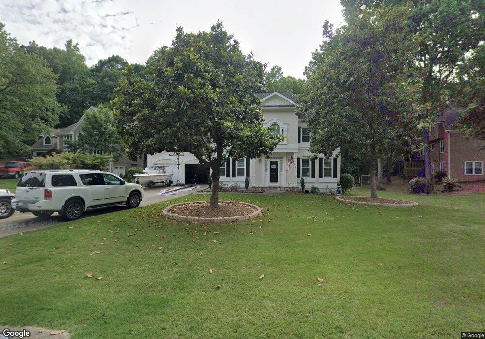
4507 Forest Peak Cir Unit 2 Marietta, GA 30066
Sandy Plains NeighborhoodEstimated Value: $686,000
4
Beds
4
Baths
2,875
Sq Ft
$239/Sq Ft
Est. Value
About This Home
This home is located at 4507 Forest Peak Cir Unit 2, Marietta, GA 30066 and is currently estimated at $686,000, approximately $238 per square foot. 4507 Forest Peak Cir Unit 2 is a home located in Cobb County with nearby schools including Davis Elementary School, Mabry Middle School, and Lassiter High School.
Ownership History
Date
Name
Owned For
Owner Type
Purchase Details
Closed on
Apr 18, 2003
Sold by
Ashtiani Parvin
Bought by
Williams Wayne H and Williams Kerry
Current Estimated Value
Home Financials for this Owner
Home Financials are based on the most recent Mortgage that was taken out on this home.
Original Mortgage
$205,600
Outstanding Balance
$87,612
Interest Rate
5.76%
Mortgage Type
New Conventional
Estimated Equity
$598,388
Purchase Details
Closed on
Jun 24, 1994
Sold by
Otero Antonio Lesley Y
Bought by
Holcomb Parvin
Home Financials for this Owner
Home Financials are based on the most recent Mortgage that was taken out on this home.
Original Mortgage
$120,000
Interest Rate
8.39%
Create a Home Valuation Report for This Property
The Home Valuation Report is an in-depth analysis detailing your home's value as well as a comparison with similar homes in the area
Home Values in the Area
Average Home Value in this Area
Purchase History
| Date | Buyer | Sale Price | Title Company |
|---|---|---|---|
| Williams Wayne H | $257,000 | -- | |
| Holcomb Parvin | $175,000 | -- |
Source: Public Records
Mortgage History
| Date | Status | Borrower | Loan Amount |
|---|---|---|---|
| Open | Williams Wayne H | $205,600 | |
| Previous Owner | Holcomb Parvin | $120,000 |
Source: Public Records
Tax History Compared to Growth
Tax History
| Year | Tax Paid | Tax Assessment Tax Assessment Total Assessment is a certain percentage of the fair market value that is determined by local assessors to be the total taxable value of land and additions on the property. | Land | Improvement |
|---|---|---|---|---|
| 2025 | $4,799 | $222,148 | $60,000 | $162,148 |
| 2024 | $4,799 | $222,148 | $60,000 | $162,148 |
| 2023 | $4,799 | $222,148 | $60,000 | $162,148 |
| 2022 | $4,490 | $181,280 | $40,000 | $141,280 |
| 2021 | $3,899 | $154,284 | $40,000 | $114,284 |
| 2020 | $3,899 | $154,284 | $40,000 | $114,284 |
| 2019 | $3,899 | $154,284 | $40,000 | $114,284 |
| 2018 | $3,396 | $131,324 | $36,800 | $94,524 |
| 2017 | $3,266 | $131,324 | $36,800 | $94,524 |
| 2016 | $3,040 | $120,852 | $31,600 | $89,252 |
| 2015 | $3,109 | $120,852 | $31,600 | $89,252 |
| 2014 | $3,131 | $120,852 | $0 | $0 |
Source: Public Records
Map
Nearby Homes
- 4243 N Mountain Rd NE
- 4219 N Mountain Rd NE
- 4302 Highborne Dr NE Unit 3
- 3333 Devaughn Dr NE
- 4563 Ashmore Cir NE
- 4397 Windsor Oaks Cir
- 4734 Outlook Way NE
- 4380 Wood Creek Dr
- 3043 Sawyer Trace NE
- 4589 Wigley Estates Rd
- 3350 Brookhill Cir
- 2855 Lamer Trace
- 3465 Township Ridge Point
- 2842 Forest Chase Dr NE
- 3870 Sweat Creek Run
- 3480 Pebble Hill Dr
- 3130 Maley Ct
- 130 Cherecobb Dr
- 4032 Ashmont Ct
- 4505 Forest Peak Cir
- 4532 N Slope Cir Unit 2
- 4530 N Slope Cir Unit 2
- 4514 Forest Peak Cir
- 4504 N Slope Cir Unit 1
- 4499 Forest Peak Cir
- 4512 Forest Peak Cir Unit 2
- 4500 N Slope Cir Unit 1
- 4249 N Mountain Rd NE Unit I
- 4531 N Slope Cir
- 4506 N Slope Cir
- 4516 Forest Peak Cir
- 4528 N Slope Cir
- 4245 N Mountain Rd NE Unit 1
- 4251 N Mountain Rd NE
- 4529 N Slope Cir
- 4492 N Slope Cir
- N N Slope Cir Unit 85
- N N Slope Cir
- 0 N Slope Cir