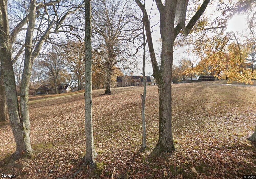
451 S Circle Rd Memphis, TN 38127
Frayser NeighborhoodEstimated Value: $269,000 - $461,000
6
Beds
4
Baths
4,469
Sq Ft
$72/Sq Ft
Est. Value
About This Home
This home is located at 451 S Circle Rd, Memphis, TN 38127 and is currently estimated at $320,998, approximately $71 per square foot. 451 S Circle Rd is a home located in Shelby County with nearby schools including Westside Elementary School, Compass Community School Frayser Campus, and Pathways In Education - Tn.
Ownership History
Date
Name
Owned For
Owner Type
Purchase Details
Closed on
Aug 18, 2010
Sold by
Deutsche Bank National Trust Company
Bought by
Smith David and Smith Angela
Current Estimated Value
Home Financials for this Owner
Home Financials are based on the most recent Mortgage that was taken out on this home.
Original Mortgage
$172,323
Interest Rate
4.87%
Mortgage Type
FHA
Purchase Details
Closed on
Feb 11, 2010
Sold by
Pugh Barry A and Pugh Carol
Bought by
Deutsche Bank National Trust Company
Purchase Details
Closed on
Sep 9, 2003
Sold by
Affordable Management
Bought by
Pugh Barry A
Home Financials for this Owner
Home Financials are based on the most recent Mortgage that was taken out on this home.
Original Mortgage
$185,185
Interest Rate
6.24%
Mortgage Type
Purchase Money Mortgage
Purchase Details
Closed on
May 28, 1997
Sold by
Rutledge Denny Morris and Rutledge Sharon
Bought by
Affordable Management
Create a Home Valuation Report for This Property
The Home Valuation Report is an in-depth analysis detailing your home's value as well as a comparison with similar homes in the area
Home Values in the Area
Average Home Value in this Area
Purchase History
| Date | Buyer | Sale Price | Title Company |
|---|---|---|---|
| Smith David | $149,900 | Preferred Title & Escrow Llc | |
| Deutsche Bank National Trust Company | $168,000 | None Available | |
| Pugh Barry A | $195,000 | -- | |
| Affordable Management | -- | -- |
Source: Public Records
Mortgage History
| Date | Status | Borrower | Loan Amount |
|---|---|---|---|
| Previous Owner | Smith David | $172,323 | |
| Previous Owner | Pugh Barry A | $185,185 |
Source: Public Records
Tax History Compared to Growth
Tax History
| Year | Tax Paid | Tax Assessment Tax Assessment Total Assessment is a certain percentage of the fair market value that is determined by local assessors to be the total taxable value of land and additions on the property. | Land | Improvement |
|---|---|---|---|---|
| 2025 | $2,118 | $69,100 | $10,700 | $58,400 |
| 2024 | $2,118 | $62,475 | $10,175 | $52,300 |
| 2023 | $2,118 | $62,475 | $10,175 | $52,300 |
| 2022 | $2,118 | $62,475 | $10,175 | $52,300 |
| 2021 | $2,155 | $62,475 | $10,175 | $52,300 |
| 2020 | $2,008 | $49,575 | $10,175 | $39,400 |
| 2019 | $2,008 | $49,575 | $10,175 | $39,400 |
| 2018 | $2,008 | $49,575 | $10,175 | $39,400 |
| 2017 | $2,038 | $49,575 | $10,175 | $39,400 |
| 2016 | $2,082 | $47,650 | $0 | $0 |
| 2014 | $2,082 | $47,650 | $0 | $0 |
Source: Public Records
Map
Nearby Homes
- 518 Burlington Cir
- 598 Orchard Ave
- 3230 Markley St
- 607 Burlington Cir
- 603 Burlington Cir
- 3097 Harvester Ln
- 3058 Harvester Ln
- 646 Semple Ave
- 596 Burdette Ave
- 613 Burdette Ave
- 597 Frayser Dr
- 3245 Sinclair St
- 3176 Benjestown Rd
- 3053 Sunrise St
- 3021 Sunrise St
- 3005 Sunrise St
- 3263 Sunrise St
- 3294 Benjestown Rd
- 3067 Morningside St
- 3189 Morningside St
- 449 Burlington Cir
- 455 Burlington Cir
- 450 Burlington Cir
- 458 Orchard Ave
- 459 Burlington Cir
- 467 Orchard Ave
- 470 Burlington Cir
- 477 Orchard Ave
- 478 Burlington Cir
- 485 Orchard Ave
- 489 Orchard Ave
- 490 Burlington Cir
- 484 Orchard Ave
- 495 Orchard Ave
- 496 Burlington Cir
- 488 Orchard Ave
- 503 Orchard Ave
- 504 Burlington Cir
- 494 Orchard Ave
- 511 Orchard Ave
