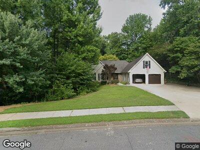
4512 Forest Peak Cir Unit 2 Marietta, GA 30066
Sandy Plains NeighborhoodEstimated Value: $675,000 - $714,000
4
Beds
4
Baths
2,816
Sq Ft
$249/Sq Ft
Est. Value
About This Home
This home is located at 4512 Forest Peak Cir Unit 2, Marietta, GA 30066 and is currently estimated at $701,808, approximately $249 per square foot. 4512 Forest Peak Cir Unit 2 is a home located in Cobb County with nearby schools including Davis Elementary School, Mabry Middle School, and Lassiter High School.
Ownership History
Date
Name
Owned For
Owner Type
Purchase Details
Closed on
Nov 19, 2020
Sold by
Hager Robert E and Estate Of Beverly F Hager
Bought by
Hager Robert B
Current Estimated Value
Home Financials for this Owner
Home Financials are based on the most recent Mortgage that was taken out on this home.
Original Mortgage
$228,600
Outstanding Balance
$206,517
Interest Rate
2.9%
Mortgage Type
New Conventional
Estimated Equity
$480,440
Purchase Details
Closed on
Jun 16, 1994
Sold by
Mitchell Alice L
Bought by
Hager Robert E Beverl
Home Financials for this Owner
Home Financials are based on the most recent Mortgage that was taken out on this home.
Original Mortgage
$159,000
Interest Rate
5.75%
Create a Home Valuation Report for This Property
The Home Valuation Report is an in-depth analysis detailing your home's value as well as a comparison with similar homes in the area
Home Values in the Area
Average Home Value in this Area
Purchase History
| Date | Buyer | Sale Price | Title Company |
|---|---|---|---|
| Hager Robert B | -- | None Available | |
| Hager Robert E Beverl | $199,200 | -- |
Source: Public Records
Mortgage History
| Date | Status | Borrower | Loan Amount |
|---|---|---|---|
| Open | Hager Robert | $228,600 | |
| Closed | Hager Robert F | $236,000 | |
| Closed | Hager Robert E | $250,860 | |
| Closed | Hager Robert E | $260,000 | |
| Closed | Hager Beverly F | $260,000 | |
| Closed | Hager Robert E | $80,000 | |
| Closed | Hager Robert E | $214,000 | |
| Closed | Hager Robert E | $238,000 | |
| Closed | Hager Robert E | $80,000 | |
| Closed | Hager Robert E Beverl | $159,000 |
Source: Public Records
Tax History Compared to Growth
Tax History
| Year | Tax Paid | Tax Assessment Tax Assessment Total Assessment is a certain percentage of the fair market value that is determined by local assessors to be the total taxable value of land and additions on the property. | Land | Improvement |
|---|---|---|---|---|
| 2024 | $1,785 | $242,308 | $60,000 | $182,308 |
| 2023 | $1,579 | $242,308 | $60,000 | $182,308 |
| 2022 | $1,657 | $199,588 | $40,000 | $159,588 |
| 2021 | $1,569 | $170,104 | $40,000 | $130,104 |
| 2020 | $1,569 | $170,104 | $40,000 | $130,104 |
| 2019 | $1,569 | $170,104 | $40,000 | $130,104 |
| 2018 | $1,490 | $143,732 | $36,800 | $106,932 |
| 2017 | $1,291 | $143,732 | $36,800 | $106,932 |
| 2016 | $1,253 | $133,940 | $31,600 | $102,340 |
| 2015 | $1,343 | $133,940 | $31,600 | $102,340 |
| 2014 | $1,374 | $133,940 | $0 | $0 |
Source: Public Records
Map
Nearby Homes
- 3626 Lone Indian Trail Unit 2
- 4515 N Slope Cir
- 4730 W Forest Peak
- 4349 Highborne Dr NE
- 4223 N Mountain Rd NE
- 4371 Wigley Preserve Dr
- 4508 Bankside Ct NE
- 4388 Cades Pointe
- 4391 Sandy Plains Rd
- 4753 Outlook Way NE Unit 1
- 4270 Parnell Rd
- 4231 Shamans Dr
- 4551 Ashmore Cir NE
- 3337 Devaughn Dr NE
- 3333 Devaughn Dr NE
- 4563 Ashmore Cir NE
- 4404 Wigley Rd
- 4397 Windsor Oaks Cir
- 2949 Summitop Ct NE
- 4512 Forest Peak Cir Unit 2
- 4514 Forest Peak Cir
- 4251 N Mountain Rd NE
- 4249 N Mountain Rd NE Unit I
- 3624 Lone Indian Trail Unit 2
- 4516 Forest Peak Cir
- 4507 Forest Peak Cir Unit 2
- 4253 N Mountain Rd NE
- 3628 Lone Indian Trail
- 4505 Forest Peak Cir
- 4532 N Slope Cir Unit 2
- 4518 Forest Peak Cir
- 4499 Forest Peak Cir
- 4246 N Mountain Rd NE Unit 1
- 4531 N Slope Cir
- 3630 Lone Indian Trail
- 4530 N Slope Cir Unit 2
- 4520 Forest Peak Cir Unit 2
- 4248 N Mountain Rd NE
- 4245 N Mountain Rd NE Unit 1