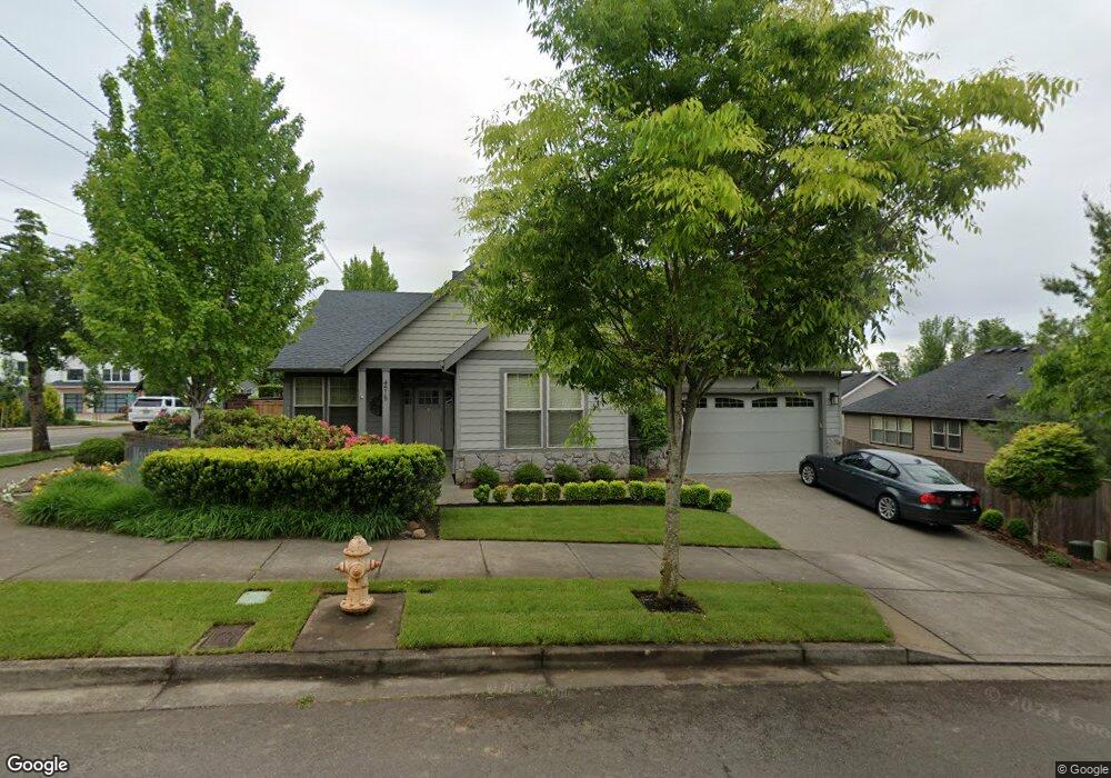
4515 Maxfield Dr West Linn, OR 97068
Parker Crest NeighborhoodEstimated Value: $794,499 - $950,000
3
Beds
2
Baths
2,000
Sq Ft
$436/Sq Ft
Est. Value
About This Home
This home is located at 4515 Maxfield Dr, West Linn, OR 97068 and is currently estimated at $872,125, approximately $436 per square foot. 4515 Maxfield Dr is a home located in Clackamas County with nearby schools including Sunset Primary School, Rosemont Ridge Middle School, and West Linn High School.
Ownership History
Date
Name
Owned For
Owner Type
Purchase Details
Closed on
Sep 7, 2022
Sold by
Milliron James C
Bought by
Milliron Living Trust
Current Estimated Value
Purchase Details
Closed on
Apr 6, 2011
Sold by
Chesapeake Holding Mac Llc
Bought by
Milliron James C and Milliron Susan J
Home Financials for this Owner
Home Financials are based on the most recent Mortgage that was taken out on this home.
Original Mortgage
$352,012
Interest Rate
4.83%
Mortgage Type
VA
Create a Home Valuation Report for This Property
The Home Valuation Report is an in-depth analysis detailing your home's value as well as a comparison with similar homes in the area
Home Values in the Area
Average Home Value in this Area
Purchase History
| Date | Buyer | Sale Price | Title Company |
|---|---|---|---|
| Milliron Living Trust | -- | -- | |
| Milliron James C | $382,500 | Pacific Northwest Title Of O |
Source: Public Records
Mortgage History
| Date | Status | Borrower | Loan Amount |
|---|---|---|---|
| Previous Owner | Milliron James C | $352,012 |
Source: Public Records
Tax History Compared to Growth
Tax History
| Year | Tax Paid | Tax Assessment Tax Assessment Total Assessment is a certain percentage of the fair market value that is determined by local assessors to be the total taxable value of land and additions on the property. | Land | Improvement |
|---|---|---|---|---|
| 2025 | $9,229 | $478,884 | -- | -- |
| 2024 | $8,883 | $464,936 | -- | -- |
| 2023 | $8,883 | $451,395 | $0 | $0 |
| 2022 | $8,385 | $438,248 | $0 | $0 |
| 2021 | $7,959 | $425,484 | $0 | $0 |
| 2020 | $8,014 | $413,092 | $0 | $0 |
| 2019 | $7,642 | $401,061 | $0 | $0 |
| 2018 | $7,301 | $389,380 | $0 | $0 |
| 2017 | $7,017 | $378,039 | $0 | $0 |
| 2016 | $6,836 | $367,028 | $0 | $0 |
| 2015 | $6,529 | $356,338 | $0 | $0 |
| 2014 | $6,166 | $345,959 | $0 | $0 |
Source: Public Records
Map
Nearby Homes
- 3933 Parker Rd
- 3115 Sabo Ln
- 3296 Nomie Way
- 2625 Beacon Hill Dr
- 1470 Rosemont Rd
- 3249 Wild Rose Loop
- 4425 Cornwall St Unit 7
- 4194 Cornwall St
- 4192 Cornwall St
- 4190 Cornwall St
- 4973 Summit St
- 2650 Lorinda Ln
- 4110 Cornwall St
- 4057 Heron Dr
- 4147 Cornwall St
- 3776 Landis St
- 5062 Prospect St
- 3496 Chaparrel Loop
- 2530 Cambridge St
- 2525 Sunset Ave
- 3041 Winkel Way
- 3037 Winkel Way
- 3029 Winkel Way
- 3025 Winkel Way
- 2104 Deerhill Ln Unit 1
- 3027 Winkel Way
- 4512 Maxfield Dr
- 4524 Maxfield Dr
- 3103 Winkel Way
- 3036 Winkel Way
- 2101 Deerhill Ln Unit L12
- 2110 Deerhill Ln Unit L2
- 3032 Winkel Way
- 3040 Winkel Way
- 3109 Winkel Way
- 3021 Winkel Way
- 3945 Parker Rd
- 3024 Winkel Way
- 3019 Winkel Way
- 3102 Winkel Way