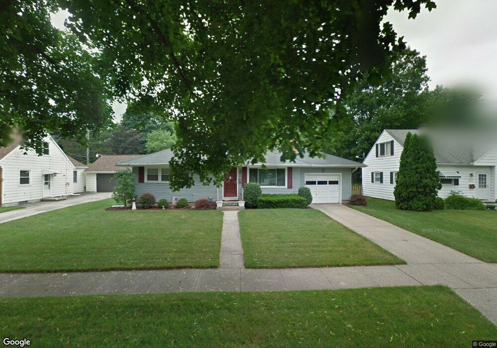
4518 Devonshire Ave Lansing, MI 48910
Old Everett NeighborhoodEstimated Value: $151,619 - $195,000
--
Bed
--
Bath
912
Sq Ft
$193/Sq Ft
Est. Value
About This Home
This home is located at 4518 Devonshire Ave, Lansing, MI 48910 and is currently estimated at $175,655, approximately $192 per square foot. 4518 Devonshire Ave is a home located in Ingham County with nearby schools including Kendon School, Attwood School, and Everett High School.
Ownership History
Date
Name
Owned For
Owner Type
Purchase Details
Closed on
Mar 19, 2004
Sold by
Porter Tonya L
Bought by
Porter Donald L
Current Estimated Value
Home Financials for this Owner
Home Financials are based on the most recent Mortgage that was taken out on this home.
Original Mortgage
$108,700
Outstanding Balance
$51,937
Interest Rate
5.99%
Mortgage Type
Stand Alone Refi Refinance Of Original Loan
Estimated Equity
$123,718
Purchase Details
Closed on
Nov 15, 2001
Sold by
Tellez Jose L and Tellez Tina L
Bought by
Porter Donald L and Porter Tonya L
Home Financials for this Owner
Home Financials are based on the most recent Mortgage that was taken out on this home.
Original Mortgage
$104,500
Interest Rate
6.68%
Mortgage Type
Purchase Money Mortgage
Purchase Details
Closed on
Apr 1, 1994
Create a Home Valuation Report for This Property
The Home Valuation Report is an in-depth analysis detailing your home's value as well as a comparison with similar homes in the area
Home Values in the Area
Average Home Value in this Area
Purchase History
| Date | Buyer | Sale Price | Title Company |
|---|---|---|---|
| Porter Donald L | -- | Standard Insurance Services | |
| Porter Donald L | $110,000 | Midstate Title Company | |
| -- | $64,000 | -- |
Source: Public Records
Mortgage History
| Date | Status | Borrower | Loan Amount |
|---|---|---|---|
| Open | Porter Donald L | $108,700 | |
| Closed | Porter Donald L | $104,500 |
Source: Public Records
Tax History Compared to Growth
Tax History
| Year | Tax Paid | Tax Assessment Tax Assessment Total Assessment is a certain percentage of the fair market value that is determined by local assessors to be the total taxable value of land and additions on the property. | Land | Improvement |
|---|---|---|---|---|
| 2025 | $3,058 | $73,400 | $9,400 | $64,000 |
| 2024 | $24 | $70,800 | $9,400 | $61,400 |
| 2023 | $2,868 | $62,800 | $9,400 | $53,400 |
| 2022 | $2,585 | $57,700 | $8,900 | $48,800 |
| 2021 | $2,531 | $54,300 | $5,600 | $48,700 |
| 2020 | $2,516 | $50,700 | $5,600 | $45,100 |
| 2019 | $2,412 | $49,100 | $5,600 | $43,500 |
| 2018 | $2,260 | $44,400 | $5,600 | $38,800 |
| 2017 | $2,164 | $44,400 | $5,600 | $38,800 |
| 2016 | $2,069 | $39,900 | $5,600 | $34,300 |
| 2015 | $2,069 | $38,200 | $11,131 | $27,069 |
| 2014 | $2,069 | $37,100 | $8,123 | $28,977 |
Source: Public Records
Map
Nearby Homes
- 4412 Devonshire Ave
- 4719 S Pennsylvania Ave
- 713 E Cavanaugh Rd
- 736 Fenton St
- 1101 Barr Ave
- 629 Emily Ave
- 4922 Southgate Ave
- 3716 S Pennsylvania Ave
- 600 E Cavanaugh Rd
- 3725 Parkway Dr
- 639 Maplehill Ave
- 522 E Cavanaugh Rd
- 3611 Homewood Ave
- 4317 S Cedar St
- 3603 Parkway Dr
- 4207 Aurelius Rd
- 2018 Worden St
- 4118 Donald St
- 0 N Aurelius Rd
- 201 E Syringa Dr
- 4524 Devonshire Ave
- 4512 Devonshire Ave
- 4519 Alpha St
- 4600 Devonshire Ave
- 4525 Alpha St
- 4515 Alpha St
- 4500 Devonshire Ave
- 1114 Samantha Ave
- 4515 Devonshire Ave
- 4601 Alpha St
- 1106 Samantha Ave
- 4608 Devonshire Ave
- 4601 Devonshire Ave
- 4501 Alpha St
- 4609 Alpha St
- 4519 Devonshire Ave
- 4525 Devonshire Ave
- 4609 Devonshire Ave
- 4501 Devonshire Ave
- 4507 Devonshire Ave