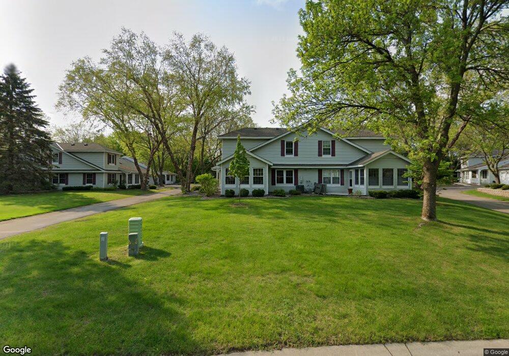
4518 S Mallard Trail Saint Paul, MN 55122
Estimated Value: $354,000 - $399,000
2
Beds
2
Baths
1,739
Sq Ft
$216/Sq Ft
Est. Value
About This Home
This home is located at 4518 S Mallard Trail, Saint Paul, MN 55122 and is currently estimated at $376,133, approximately $216 per square foot. 4518 S Mallard Trail is a home located in Dakota County with nearby schools including Thomas Lake Elementary School, Black Hawk Middle School, and Eastview Senior High School.
Ownership History
Date
Name
Owned For
Owner Type
Purchase Details
Closed on
Jun 27, 2019
Sold by
Sorensen Calvin A and Sorensen Judith L
Bought by
Diehl John Joseph and Schmidt Ellen Marie
Current Estimated Value
Home Financials for this Owner
Home Financials are based on the most recent Mortgage that was taken out on this home.
Original Mortgage
$148,500
Outstanding Balance
$97,951
Interest Rate
4%
Mortgage Type
New Conventional
Estimated Equity
$278,182
Create a Home Valuation Report for This Property
The Home Valuation Report is an in-depth analysis detailing your home's value as well as a comparison with similar homes in the area
Home Values in the Area
Average Home Value in this Area
Purchase History
| Date | Buyer | Sale Price | Title Company |
|---|---|---|---|
| Diehl John Joseph | $290,200 | Results Title |
Source: Public Records
Mortgage History
| Date | Status | Borrower | Loan Amount |
|---|---|---|---|
| Open | Diehl John Joseph | $148,500 |
Source: Public Records
Tax History Compared to Growth
Tax History
| Year | Tax Paid | Tax Assessment Tax Assessment Total Assessment is a certain percentage of the fair market value that is determined by local assessors to be the total taxable value of land and additions on the property. | Land | Improvement |
|---|---|---|---|---|
| 2024 | $3,666 | $350,600 | $66,300 | $284,300 |
| 2023 | $3,666 | $342,200 | $65,900 | $276,300 |
| 2022 | $3,116 | $340,800 | $68,100 | $272,700 |
| 2021 | $2,920 | $285,500 | $59,200 | $226,300 |
| 2020 | $2,862 | $263,100 | $56,400 | $206,700 |
| 2019 | $2,414 | $251,900 | $53,700 | $198,200 |
| 2018 | $2,384 | $227,400 | $49,700 | $177,700 |
| 2017 | $2,406 | $218,400 | $45,200 | $173,200 |
| 2016 | $2,319 | $211,100 | $43,000 | $168,100 |
| 2015 | $2,136 | $184,030 | $37,531 | $146,499 |
| 2014 | -- | $172,040 | $34,766 | $137,274 |
| 2013 | -- | $150,131 | $30,393 | $119,738 |
Source: Public Records
Map
Nearby Homes
- 1655 Walnut Ln
- 1610 Clemson Dr
- 4629 Kingsbury Dr
- 4628 Pinetree Curve
- 4646 1/2 Penkwe Way
- 1719 Nokia Way
- 1778 Walnut Ln
- 4677 Ridge Cliff Dr
- 1612 Summit Hill
- 4681 Ridge Cliff Dr
- 4411 Clover Ln Unit A
- 4401 Clover Ln Unit B
- 4715 Sunne Point
- 4418 Clover Ln Unit B
- 4249 Boulder Ridge Point
- 4679 Sorrel Point
- 1517 Covington Ln
- XXXX Eriks Blvd
- 4676 Marquis Point
- 4168 Arbor Ln
- 4514 S Mallard Trail
- 4522 S Mallard Trail
- 4526 S Mallard Trail
- 4510 S Mallard Trail
- 4516 S Mallard Trail
- 4520 S Mallard Trail
- 4506 S Mallard Trail
- 4530 S Mallard Trail
- 4512 S Mallard Trail
- 4512 4512 Mallard-Trail-s
- 4524 S Mallard Trail
- 4523 S Mallard Trail
- 4508 S Mallard Trail
- 4502 S Mallard Trail
- 4528 S Mallard Trail
- 4534 S Mallard Trail
- 4527 S Mallard Trail
- 4532 S Mallard Trail
- 4519 S Mallard Trail
- 4500 S Mallard Trail