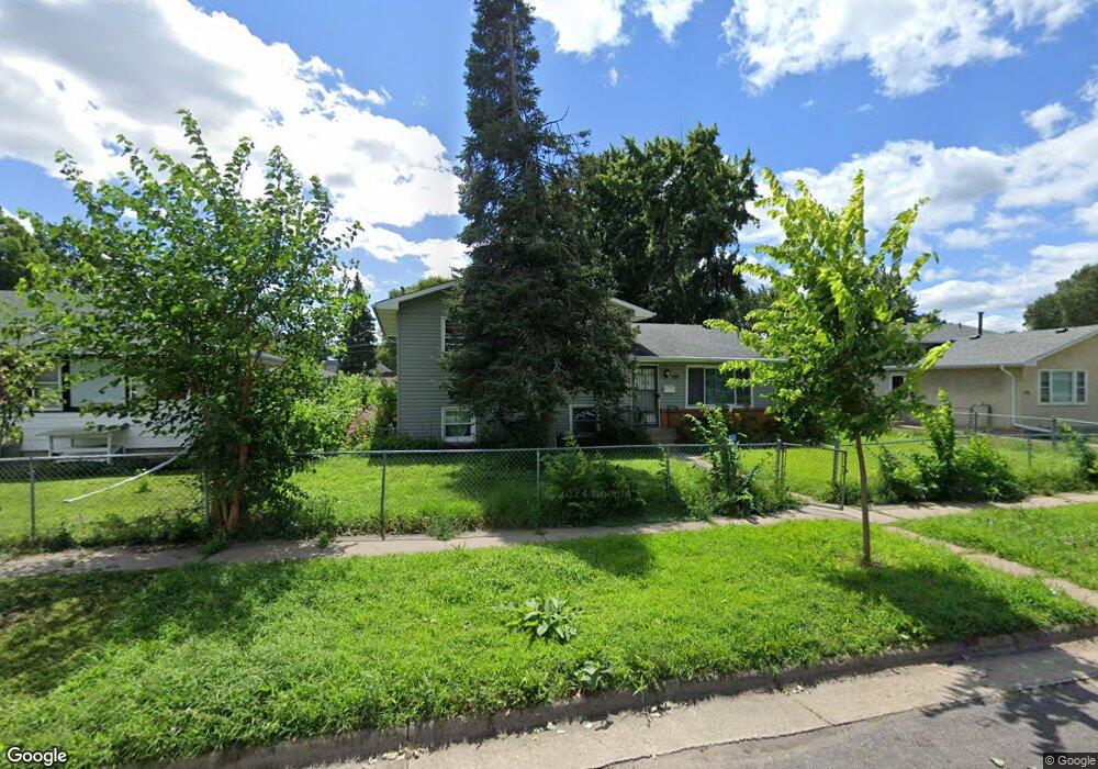
452 Lafond Ave Saint Paul, MN 55103
Frogtown NeighborhoodEstimated Value: $271,000 - $317,000
4
Beds
2
Baths
1,756
Sq Ft
$165/Sq Ft
Est. Value
About This Home
This home is located at 452 Lafond Ave, Saint Paul, MN 55103 and is currently estimated at $289,589, approximately $164 per square foot. 452 Lafond Ave is a home located in Ramsey County with nearby schools including Jackson Elementary, Hidden River Middle School, and Central Senior High School.
Ownership History
Date
Name
Owned For
Owner Type
Purchase Details
Closed on
Feb 16, 2021
Sold by
Yang Chaluenchong B and Yang Dejntxhee M
Bought by
Ali Shamso Hanshi
Current Estimated Value
Home Financials for this Owner
Home Financials are based on the most recent Mortgage that was taken out on this home.
Original Mortgage
$188,800
Outstanding Balance
$168,861
Interest Rate
2.7%
Mortgage Type
Purchase Money Mortgage
Estimated Equity
$120,728
Purchase Details
Closed on
Jan 31, 2020
Sold by
Yang Sia Lue and Yang Mao Lee
Bought by
Yang Chaluenchong B and Yang Dejntxhee M
Home Financials for this Owner
Home Financials are based on the most recent Mortgage that was taken out on this home.
Original Mortgage
$92,000
Interest Rate
3.72%
Mortgage Type
New Conventional
Purchase Details
Closed on
Apr 2, 2001
Sold by
American Housing Trust
Bought by
Yang Sia Lue and Lee Nao
Create a Home Valuation Report for This Property
The Home Valuation Report is an in-depth analysis detailing your home's value as well as a comparison with similar homes in the area
Home Values in the Area
Average Home Value in this Area
Purchase History
| Date | Buyer | Sale Price | Title Company |
|---|---|---|---|
| Ali Shamso Hanshi | $236,000 | Titlesmart Inc | |
| Yang Chaluenchong B | $152,000 | Titlesmart Inc | |
| Yang Sia Lue | $70,275 | -- | |
| Ali Shamso Shamso | $236,000 | -- |
Source: Public Records
Mortgage History
| Date | Status | Borrower | Loan Amount |
|---|---|---|---|
| Open | Ali Shamso Hanshi | $188,800 | |
| Previous Owner | Yang Chaluenchong B | $92,000 | |
| Closed | Ali Shamso Shamso | $234,000 |
Source: Public Records
Tax History Compared to Growth
Tax History
| Year | Tax Paid | Tax Assessment Tax Assessment Total Assessment is a certain percentage of the fair market value that is determined by local assessors to be the total taxable value of land and additions on the property. | Land | Improvement |
|---|---|---|---|---|
| 2025 | $3,952 | $269,000 | $25,000 | $244,000 |
| 2023 | $3,952 | $256,300 | $20,000 | $236,300 |
| 2022 | $3,558 | $242,800 | $20,000 | $222,800 |
| 2021 | $3,396 | $231,700 | $20,000 | $211,700 |
| 2020 | $3,496 | $229,700 | $17,600 | $212,100 |
| 2019 | $3,542 | $221,100 | $17,600 | $203,500 |
| 2018 | $2,790 | $221,000 | $17,600 | $203,400 |
| 2017 | $2,040 | $184,700 | $17,600 | $167,100 |
| 2016 | $2,298 | $0 | $0 | $0 |
| 2015 | $1,684 | $157,500 | $17,600 | $139,900 |
| 2014 | $1,842 | $0 | $0 | $0 |
Source: Public Records
Map
Nearby Homes
- 465 Edmund Ave
- 481 Edmund Ave
- 395 Thomas Ave
- 482 Edmund Ave
- 601 Western Ave N
- 534 Thomas Ave
- 627 Virginia St
- 511 Van Buren Ave
- 597 Virginia St
- 547 Blair Ave
- 429 Sherburne Ave
- 553 Blair Ave
- 553 Charles Ave
- 538 Charles Ave
- 697 Virginia St
- 566 Edmund Ave
- 371 Sherburne Ave
- 694 Virginia St
- 324 Van Buren Ave
- 727 Virginia St
- 458 Lafond Ave
- 444 Lafond Ave
- 464 Lafond Ave
- 451 Thomas Ave
- 455 Thomas Ave
- 607 Arundel St
- 461 Thomas Ave
- 468 Lafond Ave
- 449 Lafond Ave
- 459 Lafond Ave
- 637 Arundel St
- 463 Thomas Ave
- 434 Lafond Ave
- 463 Lafond Ave
- 439 Thomas Ave
- 439 439 Thomas Ave
- 472 Lafond Ave
- 469 Thomas Ave
- 469 Lafond Ave
- 638 Arundel St