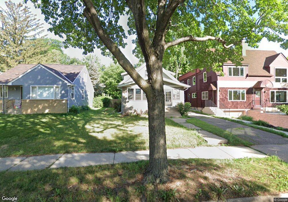
452 Morgan Ave S Minneapolis, MN 55405
Bryn Mawr NeighborhoodEstimated Value: $334,000 - $544,805
2
Beds
2
Baths
1,536
Sq Ft
$298/Sq Ft
Est. Value
About This Home
This home is located at 452 Morgan Ave S, Minneapolis, MN 55405 and is currently estimated at $457,701, approximately $297 per square foot. 452 Morgan Ave S is a home located in Hennepin County with nearby schools including Bryn Mawr Elementary School, Anwatin Middle School, and North Community High School.
Ownership History
Date
Name
Owned For
Owner Type
Purchase Details
Closed on
Jan 14, 2020
Sold by
Schultz Jeremy and Stroup Katie
Bought by
Benyo Matthew and Sherman Katharine
Current Estimated Value
Home Financials for this Owner
Home Financials are based on the most recent Mortgage that was taken out on this home.
Original Mortgage
$260,480
Outstanding Balance
$231,330
Interest Rate
3.87%
Mortgage Type
FHA
Estimated Equity
$226,371
Purchase Details
Closed on
Apr 4, 2006
Sold by
Johnson Judith D
Bought by
Stroup Katie and Schultz Jeremy
Create a Home Valuation Report for This Property
The Home Valuation Report is an in-depth analysis detailing your home's value as well as a comparison with similar homes in the area
Home Values in the Area
Average Home Value in this Area
Purchase History
| Date | Buyer | Sale Price | Title Company |
|---|---|---|---|
| Benyo Matthew | $386,000 | Dca Title | |
| Stroup Katie | $286,000 | -- |
Source: Public Records
Mortgage History
| Date | Status | Borrower | Loan Amount |
|---|---|---|---|
| Open | Benyo Matthew | $260,480 |
Source: Public Records
Tax History Compared to Growth
Tax History
| Year | Tax Paid | Tax Assessment Tax Assessment Total Assessment is a certain percentage of the fair market value that is determined by local assessors to be the total taxable value of land and additions on the property. | Land | Improvement |
|---|---|---|---|---|
| 2024 | $7,012 | $477,000 | $296,000 | $181,000 |
| 2023 | $6,019 | $463,000 | $261,000 | $202,000 |
| 2022 | $7,123 | $421,000 | $235,000 | $186,000 |
| 2021 | $5,927 | $421,000 | $195,000 | $226,000 |
| 2020 | $6,443 | $445,000 | $279,800 | $165,200 |
| 2019 | $6,635 | $436,500 | $238,300 | $198,200 |
| 2018 | $6,120 | $436,500 | $238,300 | $198,200 |
| 2017 | $6,048 | $387,000 | $216,600 | $170,400 |
| 2016 | $6,077 | $387,000 | $216,600 | $170,400 |
| 2015 | $5,790 | $336,500 | $216,600 | $119,900 |
| 2014 | -- | $292,500 | $180,500 | $112,000 |
Source: Public Records
Map
Nearby Homes
- 604 Morgan Ave S
- 40 Penn Ave S
- 1013 Kenwood Pkwy
- 1600 Kenwood Pkwy
- 8 Queen Ave S
- 2423 Mount View Ave
- 2432 Mount View Ave
- 164 Cedar Lake Rd N
- 1527 Waverly Place
- 1721 Mount Curve Ave
- 32 Sheridan Ave S
- 628 Cedar Lake Rd S
- 209 Cedar Lake Rd N
- 226 Gramercy Ave
- 741 Kenwood Pkwy
- 712 Cedar Lake Rd S
- 221 Cedar Lake Rd N
- 1718 3rd Ave N
- 1017 Thomas Ave S
- 1770 Knox Ave S
- 456 Morgan Ave S
- 448 Morgan Ave S
- 450 Morgan Ave S
- 460 Morgan Ave S
- 444 Morgan Ave S
- 602 Morgan Ave S
- 602 602 Morgan-Avenue-s
- 440 Morgan Ave S
- 437 Newton Ave S
- 441 Newton Ave S
- 608 Morgan Ave S
- 433 Newton Ave S
- 436 Morgan Ave S
- 429 Newton Ave S
- 447 Newton Ave S
- 612 Morgan Ave S
- 425 Newton Ave S
- 432 Morgan Ave S
- 457 Newton Ave S
- 618 Morgan Ave S