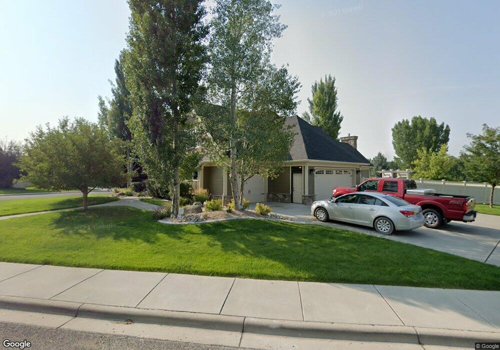
4520 Rangeview Dr Billings, MT 59106
West Shiloh NeighborhoodEstimated Value: $1,213,000 - $1,247,000
6
Beds
4
Baths
6,080
Sq Ft
$202/Sq Ft
Est. Value
About This Home
This home is located at 4520 Rangeview Dr, Billings, MT 59106 and is currently estimated at $1,225,335, approximately $201 per square foot. 4520 Rangeview Dr is a home located in Yellowstone County with nearby schools including Arrowhead School, Ben Steele Middle School, and Billings West High School.
Ownership History
Date
Name
Owned For
Owner Type
Purchase Details
Closed on
Jan 18, 2022
Sold by
Stock Michael D
Bought by
Loos Michael J and Loos Shelley K
Current Estimated Value
Home Financials for this Owner
Home Financials are based on the most recent Mortgage that was taken out on this home.
Original Mortgage
$1,145,000
Outstanding Balance
$1,055,260
Interest Rate
3.11%
Mortgage Type
VA
Estimated Equity
$170,075
Purchase Details
Closed on
Jul 10, 2014
Sold by
Wickhorst Shawn and Wickhorst Julie
Bought by
Stock Michael D and Stock Rochelle A
Home Financials for this Owner
Home Financials are based on the most recent Mortgage that was taken out on this home.
Original Mortgage
$640,000
Interest Rate
4.07%
Mortgage Type
New Conventional
Create a Home Valuation Report for This Property
The Home Valuation Report is an in-depth analysis detailing your home's value as well as a comparison with similar homes in the area
Home Values in the Area
Average Home Value in this Area
Purchase History
| Date | Buyer | Sale Price | Title Company |
|---|---|---|---|
| Loos Michael J | $1,122,100 | Stewart Title | |
| Stock Michael D | -- | None Available |
Source: Public Records
Mortgage History
| Date | Status | Borrower | Loan Amount |
|---|---|---|---|
| Open | Loos Michael J | $1,145,000 | |
| Previous Owner | Stock Michael D | $640,000 |
Source: Public Records
Tax History
| Year | Tax Paid | Tax Assessment Tax Assessment Total Assessment is a certain percentage of the fair market value that is determined by local assessors to be the total taxable value of land and additions on the property. | Land | Improvement |
|---|---|---|---|---|
| 2025 | $9,616 | $1,196,100 | $152,605 | $1,043,495 |
| 2024 | $9,616 | $990,700 | $199,409 | $791,291 |
| 2023 | $9,563 | $990,700 | $199,409 | $791,291 |
| 2022 | $9,891 | $908,500 | $0 | $0 |
| 2021 | $9,344 | $906,100 | $0 | $0 |
| 2020 | $9,229 | $854,600 | $0 | $0 |
| 2019 | $8,806 | $854,600 | $0 | $0 |
| 2018 | $8,708 | $829,200 | $0 | $0 |
| 2017 | $7,676 | $829,200 | $0 | $0 |
| 2016 | $7,776 | $777,600 | $0 | $0 |
| 2015 | $7,642 | $777,600 | $0 | $0 |
| 2014 | $6,479 | $347,839 | $0 | $0 |
Source: Public Records
Map
Nearby Homes
- 4520 Poly Dr
- 2213 Westfield Dr
- 4649 N Hollow Brook Dr
- 2631 Country Ln
- 2301 Elsa Dr
- 4126 Julaura Ln
- 2605 Westfield Dr
- 4816 Silver Creek Trail
- 4902 Silver Creek Trail
- 2514 Silver Pine Ct
- 4044 Backwoods Dr
- 2518 Silver Pine Ct
- 2106 Shiloh Rd
- 5097 Audubon Way
- 5045 Audubon Way
- 4713 Rimrock Rd
- 2529 Buffalo Ridge Trail
- 3940 Fairmeadow Dr
- 4416 Pine Cove Rd
- 1200 Bluegrass Dr W
- 4456 Ridgewood Ln S
- 4483 Ridgewood Ln S
- 4507 Rangeview Dr
- 2115 Park Ridge Ln S
- 4467 Ridgewood Ln S
- 4524 Rangeview Dr
- 4449 Ridgewood Ln S
- 4423 Rangeview Dr
- 2134 Ridgewood Ln S
- 2110 Park Ridge Ln S
- 2137 Park Ridge Ln S
- 4396 Rangeview Dr
- 4527 Rangeview Dr
- 2197 Pheasant Place
- 4435 Ridgewood Ln S
- 2131 Ridgewood Ln S
- 4530 Rangeview Dr
- 2132 Park Ridge Ln S
- 2192 Pheasant Place
- 2196 Ridgewood Ln S
Your Personal Tour Guide
Ask me questions while you tour the home.