Estimated Value: $413,000 - $454,000
4
Beds
3
Baths
2,176
Sq Ft
$197/Sq Ft
Est. Value
About This Home
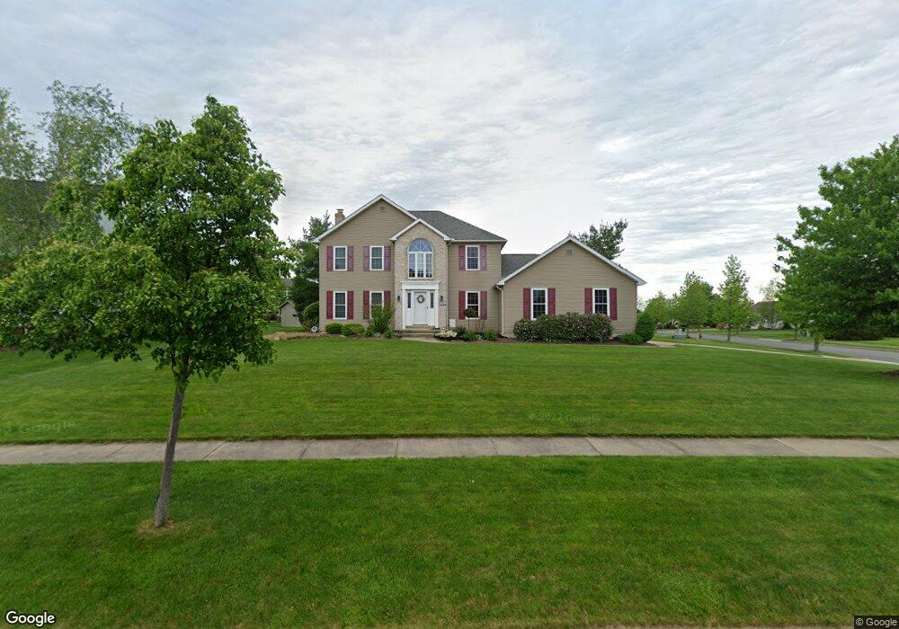
This home is located at 4526 Bunker Ln, Stow, OH 44224 and is currently estimated at $427,592, approximately $196 per square foot. 4526 Bunker Ln is a home located in Summit County with nearby schools including Stow-Munroe Falls High School and St Patrick Elementary School.
Ownership History
Date
Name
Owned For
Owner Type
Purchase Details
Closed on
Jul 14, 2004
Sold by
Coatter Joseph and Coatter Heather
Bought by
Ward Matthew J and Ward Shannon M
Current Estimated Value
Home Financials for this Owner
Home Financials are based on the most recent Mortgage that was taken out on this home.
Original Mortgage
$188,800
Outstanding Balance
$95,246
Interest Rate
6.37%
Mortgage Type
Purchase Money Mortgage
Estimated Equity
$332,346
Purchase Details
Closed on
May 1, 1996
Sold by
Schalmo Homes Inc
Bought by
Coatter Joseph and Coatter Heather
Home Financials for this Owner
Home Financials are based on the most recent Mortgage that was taken out on this home.
Original Mortgage
$87,000
Interest Rate
7.86%
Mortgage Type
New Conventional
Create a Home Valuation Report for This Property
The Home Valuation Report is an in-depth analysis detailing your home's value as well as a comparison with similar homes in the area
Home Values in the Area
Average Home Value in this Area
Purchase History
| Date | Buyer | Sale Price | Title Company |
|---|---|---|---|
| Ward Matthew J | $236,000 | Village Title Agency | |
| Coatter Joseph | $45,900 | -- |
Source: Public Records
Mortgage History
| Date | Status | Borrower | Loan Amount |
|---|---|---|---|
| Open | Ward Matthew J | $188,800 | |
| Closed | Coatter Joseph | $87,000 |
Source: Public Records
Tax History Compared to Growth
Tax History
| Year | Tax Paid | Tax Assessment Tax Assessment Total Assessment is a certain percentage of the fair market value that is determined by local assessors to be the total taxable value of land and additions on the property. | Land | Improvement |
|---|---|---|---|---|
| 2025 | $6,398 | $113,810 | $22,764 | $91,046 |
| 2024 | $6,398 | $113,810 | $22,764 | $91,046 |
| 2023 | $6,398 | $113,810 | $22,764 | $91,046 |
| 2022 | $5,939 | $93,286 | $18,659 | $74,627 |
| 2021 | $5,315 | $93,286 | $18,659 | $74,627 |
| 2020 | $5,224 | $93,290 | $18,660 | $74,630 |
| 2019 | $4,773 | $79,600 | $18,470 | $61,130 |
| 2018 | $4,695 | $79,600 | $18,470 | $61,130 |
| 2017 | $4,339 | $79,600 | $18,470 | $61,130 |
| 2016 | $4,466 | $71,450 | $18,470 | $52,980 |
| 2015 | $4,339 | $71,450 | $18,470 | $52,980 |
| 2014 | $4,343 | $71,450 | $18,470 | $52,980 |
| 2013 | $4,317 | $71,490 | $18,470 | $53,020 |
Source: Public Records
Map
Nearby Homes
- 4451 Newcomer Rd
- 3165 Peterboro Dr
- 2908 Wexford Blvd
- 4233 Smokerise Dr
- 4035 Villas Dr
- 4227 Maribend Dr
- 978 Silver Meadows Blvd
- 4621 Graford Ln
- 4227 Baird Rd
- 3896 Lake Run Blvd
- 4917 Independence Cir Unit B
- 2991 Heatherwood Ct Unit 30B
- 4901 Independence Cir Unit B
- 600 Silver Meadows Blvd
- 4901 Pebblehurst Dr
- 4944 Friar Rd Unit D
- 940 Kevin Dr
- 4131 Burton Dr
- 4048 Burton Dr
- 2410 Liberty Rd
- 4518 Bunker Ln
- 3244 Berwin Dr
- 3249 Berwin Dr
- 4510 Bunker Ln
- 3249 Berwin Dr
- 3168 Evelynton Place W
- 3240 Berwin Dr
- 3264 Berwin Dr
- 3158 Evelynton Place W
- 3200 Evelynton Place E
- 4531 Bunker Ln
- 4502 Bunker Ln
- 4544 Bunker Ln
- 3150 Evelynton Place W
- 3210 Evelynton Place E
- 4541 Bunker Ln
- 4494 Bunker Ln
- 3142 Evelynton Place W
- 4552 Bunker Ln
- 3278 Berwin Dr