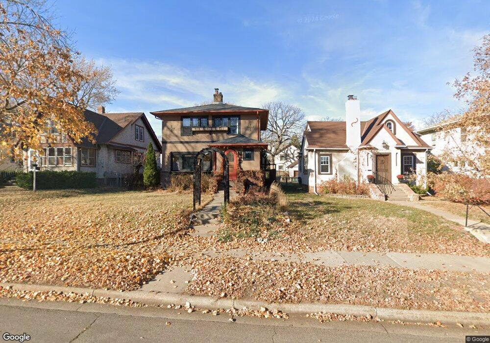
4528 Cedar Ave S Minneapolis, MN 55407
Northrop NeighborhoodEstimated Value: $465,050 - $513,000
3
Beds
2
Baths
2,146
Sq Ft
$225/Sq Ft
Est. Value
About This Home
This home is located at 4528 Cedar Ave S, Minneapolis, MN 55407 and is currently estimated at $483,013, approximately $225 per square foot. 4528 Cedar Ave S is a home located in Hennepin County with nearby schools including Northrop Elementary School, Sanford Middle School, and Roosevelt Senior High School.
Ownership History
Date
Name
Owned For
Owner Type
Purchase Details
Closed on
Jun 10, 2021
Sold by
Cronin Timothy J and Frear Michael S
Bought by
Vann Jake Delwood and Vann Greta Marie
Current Estimated Value
Home Financials for this Owner
Home Financials are based on the most recent Mortgage that was taken out on this home.
Original Mortgage
$427,500
Outstanding Balance
$387,048
Interest Rate
2.9%
Mortgage Type
New Conventional
Estimated Equity
$95,965
Purchase Details
Closed on
Oct 11, 2002
Sold by
Selman William G
Bought by
Cronin Timothy J
Purchase Details
Closed on
May 5, 2000
Sold by
Doroschak Andrew M
Bought by
Selman Lori Jo and Selman William G
Create a Home Valuation Report for This Property
The Home Valuation Report is an in-depth analysis detailing your home's value as well as a comparison with similar homes in the area
Home Values in the Area
Average Home Value in this Area
Purchase History
| Date | Buyer | Sale Price | Title Company |
|---|---|---|---|
| Vann Jake Delwood | $450,000 | Titlesmart Inc | |
| Cronin Timothy J | $229,900 | -- | |
| Selman Lori Jo | $149,000 | -- | |
| Vann Jake Jake | $450,000 | -- |
Source: Public Records
Mortgage History
| Date | Status | Borrower | Loan Amount |
|---|---|---|---|
| Open | Vann Jake Delwood | $427,500 | |
| Closed | Vann Jake Jake | $423,918 |
Source: Public Records
Tax History Compared to Growth
Tax History
| Year | Tax Paid | Tax Assessment Tax Assessment Total Assessment is a certain percentage of the fair market value that is determined by local assessors to be the total taxable value of land and additions on the property. | Land | Improvement |
|---|---|---|---|---|
| 2024 | $5,868 | $405,000 | $107,000 | $298,000 |
| 2023 | $4,999 | $386,000 | $95,000 | $291,000 |
| 2022 | $4,238 | $387,000 | $85,000 | $302,000 |
| 2021 | $3,961 | $314,000 | $56,000 | $258,000 |
| 2020 | $4,291 | $304,500 | $61,300 | $243,200 |
| 2019 | $4,422 | $304,500 | $47,100 | $257,400 |
| 2018 | $3,918 | $304,500 | $47,100 | $257,400 |
| 2017 | $3,560 | $244,500 | $42,800 | $201,700 |
| 2016 | $3,350 | $225,500 | $42,800 | $182,700 |
| 2015 | $3,280 | $212,500 | $42,800 | $169,700 |
| 2014 | -- | $200,000 | $42,800 | $157,200 |
Source: Public Records
Map
Nearby Homes
- 4629 18th Ave S
- 4630 Cedar Ave S
- 4705 17th Ave S
- 4347 15th Ave S
- 4244 Longfellow Ave
- 4628 14th Ave S
- 4736 15th Ave S
- 4700 14th Ave S
- 4348 13th Ave S
- 4236 22nd Ave S
- 4832 Bloomington Ave
- 4107 18th Ave S
- 4848 15th Ave S
- 4106 16th Ave S
- 4100 16th Ave S
- 4204 13th Ave S
- 4128 14th Ave S
- 4105 21st Ave S
- 5015 17th Ave S
- 4004 19th Ave S
- 4532 Cedar Ave S
- 4524 Cedar Ave S
- 4536 Cedar Ave S
- 4520 Cedar Ave S
- 4516 Cedar Ave S
- 4540 Cedar Ave S
- 4525 18th Ave S
- 4531 18th Ave S
- 4537 18th Ave S
- 4521 18th Ave S
- 4544 Cedar Ave S
- 4512 Cedar Ave S
- 4541 18th Ave S
- 4517 18th Ave S
- 4548 Cedar Ave S
- 4529 Cedar Ave S
- 4525 Cedar Ave S
- 4533 Cedar Ave S
- 4508 Cedar Ave S
- 4545 18th Ave S