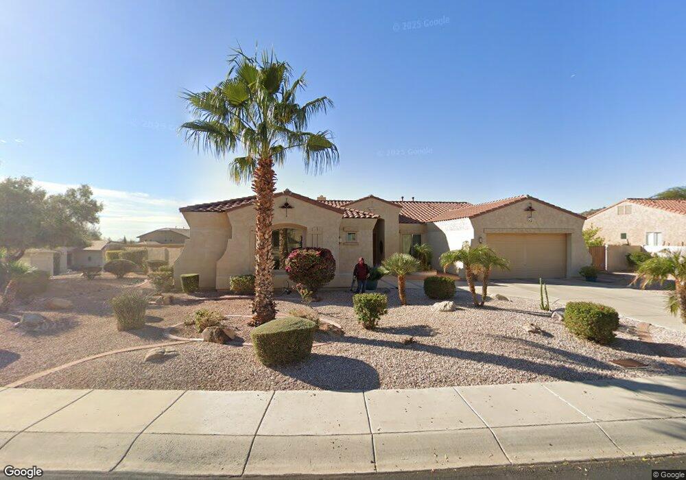
4529 W Rowel Rd Phoenix, AZ 85083
Stetson Valley NeighborhoodEstimated Value: $806,317 - $1,084,000
4
Beds
3
Baths
2,996
Sq Ft
$305/Sq Ft
Est. Value
About This Home
This home is located at 4529 W Rowel Rd, Phoenix, AZ 85083 and is currently estimated at $913,079, approximately $304 per square foot. 4529 W Rowel Rd is a home located in Maricopa County with nearby schools including Stetson Hills Elementary School and Sandra Day O'connor High School.
Ownership History
Date
Name
Owned For
Owner Type
Purchase Details
Closed on
Feb 5, 2004
Sold by
Ley Paul A
Bought by
Lalani Mahedi and Lalani Razia
Current Estimated Value
Home Financials for this Owner
Home Financials are based on the most recent Mortgage that was taken out on this home.
Original Mortgage
$215,000
Outstanding Balance
$100,974
Interest Rate
5.85%
Mortgage Type
New Conventional
Estimated Equity
$812,105
Purchase Details
Closed on
Mar 11, 2003
Sold by
Landers Peter K and Landers Jennifer L
Bought by
Ley Paul A
Purchase Details
Closed on
Feb 20, 2002
Sold by
Pulte Home Corp
Bought by
Landers Peter K and Landers Jennifer L
Home Financials for this Owner
Home Financials are based on the most recent Mortgage that was taken out on this home.
Original Mortgage
$292,615
Interest Rate
7.04%
Mortgage Type
Seller Take Back
Create a Home Valuation Report for This Property
The Home Valuation Report is an in-depth analysis detailing your home's value as well as a comparison with similar homes in the area
Home Values in the Area
Average Home Value in this Area
Purchase History
| Date | Buyer | Sale Price | Title Company |
|---|---|---|---|
| Lalani Mahedi | $465,000 | Transnation Title Ins Co | |
| Ley Paul A | $434,000 | Security Title Agency | |
| Landers Peter K | $365,769 | Transnation Title Insurance |
Source: Public Records
Mortgage History
| Date | Status | Borrower | Loan Amount |
|---|---|---|---|
| Open | Lalani Mahedi | $215,000 | |
| Previous Owner | Landers Peter K | $292,615 | |
| Closed | Landers Peter K | $36,576 |
Source: Public Records
Tax History Compared to Growth
Tax History
| Year | Tax Paid | Tax Assessment Tax Assessment Total Assessment is a certain percentage of the fair market value that is determined by local assessors to be the total taxable value of land and additions on the property. | Land | Improvement |
|---|---|---|---|---|
| 2025 | $4,951 | $54,832 | -- | -- |
| 2024 | $4,863 | $52,220 | -- | -- |
| 2023 | $4,863 | $62,780 | $12,550 | $50,230 |
| 2022 | $4,679 | $48,370 | $9,670 | $38,700 |
| 2021 | $4,820 | $45,110 | $9,020 | $36,090 |
| 2020 | $4,812 | $44,860 | $8,970 | $35,890 |
| 2019 | $4,656 | $43,680 | $8,730 | $34,950 |
| 2018 | $4,491 | $42,830 | $8,560 | $34,270 |
| 2017 | $4,326 | $40,580 | $8,110 | $32,470 |
| 2016 | $4,073 | $39,920 | $7,980 | $31,940 |
| 2015 | $3,588 | $39,820 | $7,960 | $31,860 |
Source: Public Records
Map
Nearby Homes
- 25842 N 44th Ave
- 25417 N 45th Dr
- 4417 W Lawler Loop
- 26412 N 41st Ln
- 25410 N 46th Ln
- 4841 W Avenida Del Rey
- 25417 N 49th Dr
- 25037 N 44th Ave
- 4815 W Saddlehorn Rd
- 5006 W Swayback Pass
- 5121 W Andrea Ln
- 4929 W Marcus Dr
- 4705 W Sweet Iron Pass
- 4723 W Buckskin Trail
- 5026 W Parsons Rd
- 5123 W Redbird Rd
- 3310 W Jomax Rd
- 5237 W Redbird Rd
- 4037 W Hackamore Dr
- 4051 W Buckskin Trail
- 4535 W Rowel Rd
- 4530 W Marcus Dr
- 4530 W Rowel Rd
- 26309 N 45th Dr
- 4526 W Rowel Rd
- 4534 W Marcus Dr
- 4539 W Rowel Rd
- 4538 W Rowel Rd
- 26305 N 45th Dr
- 26313 N 45th Dr
- 4538 W Marcus Dr
- 4542 W Rowel Rd
- 4543 W Rowel Rd
- 26317 N 45th Dr
- 26320 N 45th Dr
- 26251 N 45th Dr
- 4542 W Marcus Dr
- 26250 N 45th Dr
- 4546 W Rowel Rd
- 26321 N 45th Dr