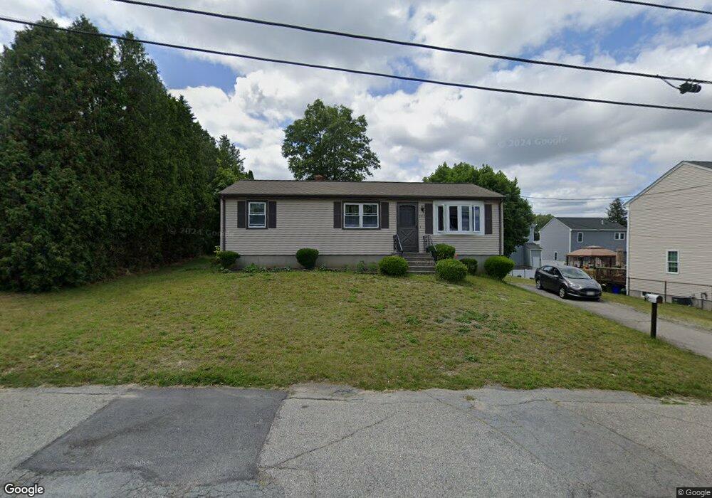
453 Baker St Fall River, MA 02721
Maplewood NeighborhoodEstimated Value: $348,000 - $429,000
3
Beds
1
Bath
1,008
Sq Ft
$379/Sq Ft
Est. Value
About This Home
This home is located at 453 Baker St, Fall River, MA 02721 and is currently estimated at $381,583, approximately $378 per square foot. 453 Baker St is a home located in Bristol County with nearby schools including Letourneau Elementary School, Talbot Innovation School, and B M C Durfee High School.
Ownership History
Date
Name
Owned For
Owner Type
Purchase Details
Closed on
Dec 26, 2012
Sold by
Habib Charles J and Habib Mary L
Bought by
Habib Robert A
Current Estimated Value
Purchase Details
Closed on
Jan 4, 1983
Bought by
Habib Charles J and Habib Mary L
Create a Home Valuation Report for This Property
The Home Valuation Report is an in-depth analysis detailing your home's value as well as a comparison with similar homes in the area
Home Values in the Area
Average Home Value in this Area
Purchase History
| Date | Buyer | Sale Price | Title Company |
|---|---|---|---|
| Habib Robert A | -- | -- | |
| Habib Charles J | $51,500 | -- |
Source: Public Records
Tax History
| Year | Tax Paid | Tax Assessment Tax Assessment Total Assessment is a certain percentage of the fair market value that is determined by local assessors to be the total taxable value of land and additions on the property. | Land | Improvement |
|---|---|---|---|---|
| 2025 | $3,651 | $318,900 | $132,900 | $186,000 |
| 2024 | $3,418 | $297,500 | $127,800 | $169,700 |
| 2023 | $3,346 | $272,700 | $109,600 | $163,100 |
| 2022 | $2,908 | $230,400 | $99,600 | $130,800 |
| 2021 | $2,769 | $200,200 | $92,200 | $108,000 |
| 2020 | $2,665 | $184,400 | $88,200 | $96,200 |
| 2019 | $2,528 | $173,400 | $84,000 | $89,400 |
| 2018 | $2,443 | $167,100 | $82,500 | $84,600 |
| 2017 | $2,339 | $167,100 | $84,100 | $83,000 |
| 2016 | $2,264 | $166,100 | $87,600 | $78,500 |
| 2015 | $2,191 | $167,500 | $84,400 | $83,100 |
| 2014 | $2,163 | $171,900 | $88,800 | $83,100 |
Source: Public Records
Map
Nearby Homes
- 545 Brayton Ave
- 1350 Rodman St
- 21 Boyden St
- 231 Lapham St
- 311 S Oxford St
- 582 Cambridge St
- 59 Denver St
- 10 Aberdeen St
- 304 Cambridge St
- 405 Warren St
- 20 Reeves St
- 248 Jefferson St
- 71 Smith St
- 539 Aetna St
- 59 Wayne St
- 883 Grinnell St
- 118 Jefferson St
- 120 Jefferson St
- 889 Grinnell St Unit 7
- 889 Grinnell St Unit 8
Your Personal Tour Guide
Ask me questions while you tour the home.