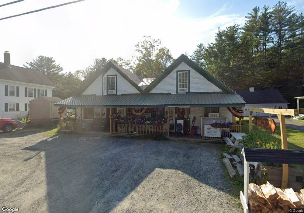
453 Main St Rumney, NH 03266
3
Beds
1
Bath
3,749
Sq Ft
11,326
Sq Ft Lot
About This Home
This home is located at 453 Main St, Rumney, NH 03266. 453 Main St is a home located in Grafton County with nearby schools including Russell Elementary School, Plymouth Regional High School, and Mountain Village Charter School.
Ownership History
Date
Name
Owned For
Owner Type
Purchase Details
Closed on
Sep 17, 2010
Sold by
Northway Bank
Bought by
Savell Kenneth J and Savell Kristie E
Purchase Details
Closed on
Jan 25, 2010
Sold by
453Ms Llc and Northway Bank
Bought by
Northway Bank
Purchase Details
Closed on
Sep 7, 2006
Sold by
Samson Randall R and Samson Rosemarie
Bought by
453Ms Llc
Home Financials for this Owner
Home Financials are based on the most recent Mortgage that was taken out on this home.
Original Mortgage
$220,000
Interest Rate
6.79%
Mortgage Type
Commercial
Purchase Details
Closed on
Jul 22, 2003
Sold by
Hannigan Patrick K and Hannigan Marguerite L
Bought by
Samson Randall R and Samson Rosemarie
Create a Home Valuation Report for This Property
The Home Valuation Report is an in-depth analysis detailing your home's value as well as a comparison with similar homes in the area
Home Values in the Area
Average Home Value in this Area
Purchase History
| Date | Buyer | Sale Price | Title Company |
|---|---|---|---|
| Savell Kenneth J | $60,000 | -- | |
| Savell Kenneth J | $60,000 | -- | |
| Northway Bank | $125,000 | -- | |
| Northway Bank | $125,000 | -- | |
| 453Ms Llc | $275,000 | -- | |
| 453Ms Llc | $275,000 | -- | |
| Samson Randall R | $100,000 | -- | |
| Samson Randall R | $100,000 | -- |
Source: Public Records
Mortgage History
| Date | Status | Borrower | Loan Amount |
|---|---|---|---|
| Previous Owner | Samson Randall R | $220,000 |
Source: Public Records
Tax History
| Year | Tax Paid | Tax Assessment Tax Assessment Total Assessment is a certain percentage of the fair market value that is determined by local assessors to be the total taxable value of land and additions on the property. | Land | Improvement |
|---|---|---|---|---|
| 2024 | $3,455 | $239,300 | $55,400 | $183,900 |
| 2023 | $3,494 | $146,300 | $23,000 | $123,300 |
| 2022 | $3,365 | $146,300 | $23,000 | $123,300 |
| 2020 | $3,502 | $146,300 | $23,000 | $123,300 |
| 2019 | $3,356 | $146,300 | $23,000 | $123,300 |
| 2018 | $3,711 | $153,200 | $15,000 | $138,200 |
| 2016 | $3,780 | $159,100 | $15,000 | $144,100 |
| 2015 | $3,788 | $159,100 | $15,000 | $144,100 |
| 2014 | $3,507 | $159,100 | $15,000 | $144,100 |
| 2013 | $3,805 | $190,900 | $40,200 | $150,700 |
Source: Public Records
Map
Nearby Homes
- 20 Monroe Dr
- 309 Depot St
- 15-12-10-9 Jacob Hall Farm Rd
- 15-12-10-10 Jacob Hall Farm Rd
- 000 Gilford Ave
- 362 Cross Rd
- 15-12-10-04 Jacob Hall Farm Rd
- 12-12-10-8 Jacob Hall Farm Rd
- 15-12-10-06 Jacob Hall Farm Rd
- 213-023-3 Yeaton Rd
- 213-023-1 Yeaton Rd
- 213-023-2 Yeaton Rd
- 286 Lower Beech Hill Rd
- 0 Boulder Point Dr
- 0 Boulder Point Dr Unit 2
- 768 Doetown Rd
- 12 Smith Bridge Rd
- 20 Brock Ln
- 0 Lower Beech Hill Rd Unit 25
- 715 N Groton Rd
Your Personal Tour Guide
Ask me questions while you tour the home.