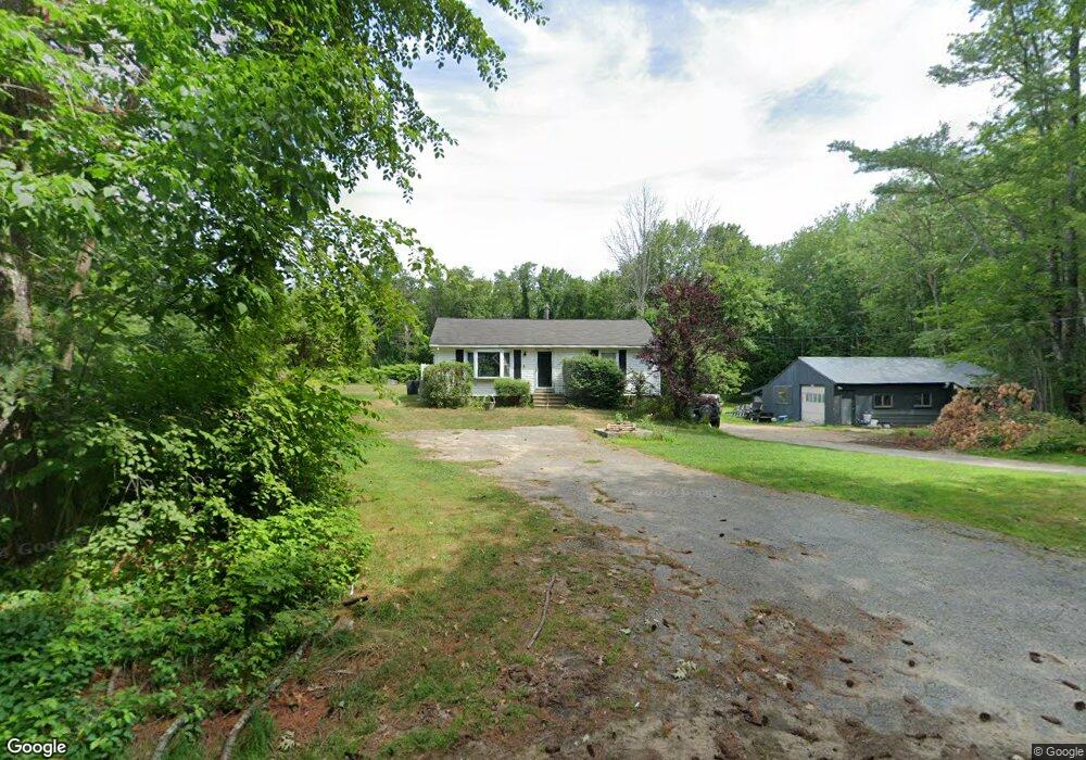
454 Province Rd Strafford, NH 03884
Estimated Value: $326,000 - $426,000
2
Beds
1
Bath
988
Sq Ft
$381/Sq Ft
Est. Value
About This Home
This home is located at 454 Province Rd, Strafford, NH 03884 and is currently estimated at $376,116, approximately $380 per square foot. 454 Province Rd is a home located in Strafford County with nearby schools including Strafford School and Coe-Brown Northwood Academy.
Ownership History
Date
Name
Owned For
Owner Type
Purchase Details
Closed on
Jul 27, 2007
Sold by
Deutsche Bank Natl T C
Bought by
Forbes Bryon J and Forbes Sarah
Current Estimated Value
Home Financials for this Owner
Home Financials are based on the most recent Mortgage that was taken out on this home.
Original Mortgage
$119,200
Interest Rate
6.78%
Mortgage Type
Purchase Money Mortgage
Purchase Details
Closed on
Apr 30, 2007
Sold by
Palmer Katherine V
Bought by
Certificateh Soundview
Create a Home Valuation Report for This Property
The Home Valuation Report is an in-depth analysis detailing your home's value as well as a comparison with similar homes in the area
Home Values in the Area
Average Home Value in this Area
Purchase History
| Date | Buyer | Sale Price | Title Company |
|---|---|---|---|
| Forbes Bryon J | $149,000 | -- | |
| Certificateh Soundview | $131,700 | -- |
Source: Public Records
Mortgage History
| Date | Status | Borrower | Loan Amount |
|---|---|---|---|
| Open | Certificateh Soundview | $113,513 | |
| Closed | Certificateh Soundview | $119,200 |
Source: Public Records
Tax History Compared to Growth
Tax History
| Year | Tax Paid | Tax Assessment Tax Assessment Total Assessment is a certain percentage of the fair market value that is determined by local assessors to be the total taxable value of land and additions on the property. | Land | Improvement |
|---|---|---|---|---|
| 2024 | $4,748 | $240,300 | $71,100 | $169,200 |
| 2023 | $4,479 | $240,300 | $71,100 | $169,200 |
| 2022 | $4,116 | $240,300 | $71,100 | $169,200 |
| 2021 | $4,513 | $244,500 | $71,100 | $173,400 |
| 2020 | $4,186 | $163,200 | $64,500 | $98,700 |
| 2019 | $3,830 | $163,200 | $64,500 | $98,700 |
| 2018 | $3,986 | $168,700 | $64,500 | $104,200 |
| 2016 | $3,585 | $168,700 | $64,500 | $104,200 |
| 2015 | $3,501 | $160,500 | $78,400 | $82,100 |
| 2014 | $3,717 | $160,500 | $78,400 | $82,100 |
| 2013 | $3,640 | $160,500 | $78,400 | $82,100 |
| 2012 | $3,592 | $160,500 | $78,400 | $82,100 |
Source: Public Records
Map
Nearby Homes
- 11 Drake Hill Rd
- M37 L40 Beaver Rd
- 268 Province Rd
- 3 Fire 151 Rd
- Map 3 Lot 18-2b and 18-2c Water St
- 28-1 Range Rd
- 133 & 137 Browns Pasture Rd
- 83 Sloper Rd
- 0 Sloper Rd Unit 6
- 2184 Franklin Pierce Hwy
- 5 Liberty Ln
- 295 1st New Hampshire Turnpike
- 31 Green St
- 249 Cooper Hill Rd
- Map 219 Lot 6-8 Ridge Rd
- 150A 1st New Hampshire Turnpike
- 0 1st New Hampshire Turnpike Unit 5026030
- 0 1st New Hampshire Turnpike Unit 5013320
- 142 Mountain Ave
- 0 Long Shores Dr Unit 5057687
- 446 Province Rd
- 443 Province Rd
- 488 Province Rd
- 437 Province Rd
- 754 Province Rd
- 432 Province Rd
- 427 Province Rd
- 418 Province Rd
- 498 Province Rd
- 408 Province Rd
- 491 Province Rd
- 477 Province Rd
- 449 Roller Coaster Rd
- 395 Province Rd
- 441 Roller Coaster Rd
- 457 Roller Coaster Rd
- 2 Roller Coaster Rd
- 1 Roller Coaster Rd
- 4 Roller Coaster Rd
- 3 Roller Coaster Rd